
West End Surf Guide
West End in Anegada is an exposed point break that has quite reliable surf. Winter and spring are the optimum times of year to visit. Works best in offshore winds from the east southeast. Waves just as likely from local windswells as from distant groundswells and the ideal swell angle is from the north. Even when there are waves, it's not likley to be crowded. Beware of rocks,reef,urchins,jellyfish, and rips.
West End Spot Info
| Type: | Rating: | Reliability: | Todays Sea Temp*: |
|---|---|---|---|
| fairly consistent | 28.1°C*ocean temperature recorded from satellite |
Surfing West End:
The best conditions reported for surf at West End occur when a North swell combines with an offshore wind direction from the East-southeast.

Previsão da Energia de Ondas (Força): 12hrs


West End Surf:
Wednesday, 15 July 2026, 17:08 Local time| Quarta-feira 15 | Quin | |||
| 5PM | 8PM | 11PM | 2AM | |
| Wave (m) | ||||
| Período (s) | 7 | 7 | 7 | 7 |
| Vento (km/h) | ||||
| Estado do Vento | off | cross- off |
cross- off |
off |
- /breaks/West-End_1/forecasts/latest
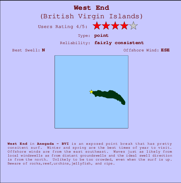
West End Surf Guide
West End in Anegada is an exposed point break that has quite reliable surf. Winter and spring are the optimum times of year to visit. Works best in offshore winds from the east southeast. Waves just as likely from local windswells as from distant groundswells and the ideal swell angle is from the north. Even when there are waves, it's not likley to be crowded. Beware of rocks,reef,urchins,jellyfish, and rips.
West End Spot Info
Type: Rating: Reliability: Todays Sea Temp*:  Point
Point 4
4fairly consistent 28.1°C*ocean temperature recorded from satelliteSurfing West End:
The best conditions reported for surf at West End occur when a North swell combines with an offshore wind direction from the East-southeast.
Previsão da Energia de Ondas (Força): 12hrs
Use a aba navegação acima para ver temperatura do mar em West End, fotografias de West End, previsões detalhadas do swell em West End, previsões do vento e do tempo, webcams em West End , vento atual em Anegada com base em dados ao vivo fornecidos por estações de meteorologia e previsões da maré em West End. O link para os mapas do swell em British Virgin Islands abrirá uma imagem ampliada monstrando British Virgin Islands e os mares próximos. Estes mapas do swell podem ser animados para mostrar diferentes componentes do swell, energia das ondas, período das ondas, altura das ondas, assim como previsões do vento e do tempo, observações em tempo real do estado do tempo e do mar graças às bóias de British Virgin Islands, navios passantes e estações de meteorologia presentes na costa. Cada uma das páginas de previsão para este surf break apresenta as ferramentas do buscador global e regional para localizar as melores condições de surf na área ao redor de West End.
West End Surf:
Wednesday, 15 July 2026, 17:08 Local timeQuarta-feira 15 Quin 5PM 8PM 11PM 2AM Wave (m) Período (s) 7 7 7 7 Vento (km/h) Estado do Vento off cross-
offcross-
offoff - /breaks/West-End_1/forecasts/latest
- /breaks/West-End_1/forecasts/latest/six_day
West End Surf Guide
West End in Anegada is an exposed point break that has quite reliable surf. Winter and spring are the optimum times of year to visit. Works best in offshore winds from the east southeast. Waves just as likely from local windswells as from distant groundswells and the ideal swell angle is from the north. Even when there are waves, it's not likley to be crowded. Beware of rocks,reef,urchins,jellyfish, and rips.
West End Spot Info
Type: Rating: Reliability: Todays Sea Temp*: Point4fairly consistent 28.1°C*ocean temperature recorded from satelliteSurfing West End:
The best conditions reported for surf at West End occur when a North swell combines with an offshore wind direction from the East-southeast.
Previsão da Energia de Ondas (Força): 12hrs
Use a aba navegação acima para ver temperatura do mar em West End, fotografias de West End, previsões detalhadas do swell em West End, previsões do vento e do tempo, webcams em West End , vento atual em Anegada com base em dados ao vivo fornecidos por estações de meteorologia e previsões da maré em West End. O link para os mapas do swell em British Virgin Islands abrirá uma imagem ampliada monstrando British Virgin Islands e os mares próximos. Estes mapas do swell podem ser animados para mostrar diferentes componentes do swell, energia das ondas, período das ondas, altura das ondas, assim como previsões do vento e do tempo, observações em tempo real do estado do tempo e do mar graças às bóias de British Virgin Islands, navios passantes e estações de meteorologia presentes na costa. Cada uma das páginas de previsão para este surf break apresenta as ferramentas do buscador global e regional para localizar as melores condições de surf na área ao redor de West End.
West End Surf:
Wednesday, 15 July 2026, 17:08 Local timeQuarta-feira 15 Quin 5PM 8PM 11PM 2AM Wave (m) Período (s) 7 7 7 7 Vento (km/h) Estado do Vento off cross-
offcross-
offoff - /breaks/West-End_1/forecasts/latest
West End Surf Guide
West End in Anegada is an exposed point break that has quite reliable surf. Winter and spring are the optimum times of year to visit. Works best in offshore winds from the east southeast. Waves just as likely from local windswells as from distant groundswells and the ideal swell angle is from the north. Even when there are waves, it's not likley to be crowded. Beware of rocks,reef,urchins,jellyfish, and rips.
West End Spot Info
Type: Rating: Reliability: Todays Sea Temp*: Point4fairly consistent 28.1°C*ocean temperature recorded from satelliteSurfing West End:
The best conditions reported for surf at West End occur when a North swell combines with an offshore wind direction from the East-southeast.
Previsão da Energia de Ondas (Força): 12hrs
Use a aba navegação acima para ver temperatura do mar em West End, fotografias de West End, previsões detalhadas do swell em West End, previsões do vento e do tempo, webcams em West End , vento atual em Anegada com base em dados ao vivo fornecidos por estações de meteorologia e previsões da maré em West End. O link para os mapas do swell em British Virgin Islands abrirá uma imagem ampliada monstrando British Virgin Islands e os mares próximos. Estes mapas do swell podem ser animados para mostrar diferentes componentes do swell, energia das ondas, período das ondas, altura das ondas, assim como previsões do vento e do tempo, observações em tempo real do estado do tempo e do mar graças às bóias de British Virgin Islands, navios passantes e estações de meteorologia presentes na costa. Cada uma das páginas de previsão para este surf break apresenta as ferramentas do buscador global e regional para localizar as melores condições de surf na área ao redor de West End.
West End Surf:
Wednesday, 15 July 2026, 17:08 Local timeQuarta-feira 15 Quin 5PM 8PM 11PM 2AM Wave (m) Período (s) 7 7 7 7 Vento (km/h) Estado do Vento off cross-
offcross-
offoff Tide Times:
Em West End (0 km).
A PRÓXIMA É ÀS (hora local) faltam maré alta maré baixa West End Tide Times and Tide Chart
Live Weather:
At Beef Island/Roadtown Airport, 36 km from West End.
light winds from the NE
(km/h)
Dry and partly cloudyAir temperature
31°COverall West End Surf Consistency and Wind Distribution in Julho
fotos da galeria
Contornos: Estradas & Rios: Escolha um spot de surf da lista 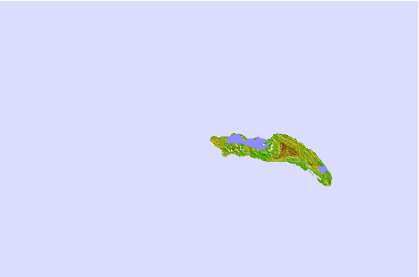


Use este mapa de relevo para navegar até Anegada surf quebras e estações que estão na área de maré West End
Outros Spots de Surf mais próximos de West End:
(Clique no nome do local para maiores detalhes)- Closest spot6 mi
- Second closest spot7 mi
- Third closest spot15 mi
- Fourth closest spot16 mi
- Fifth closest spot20 mi
Bóias ondográficas mais próxima de West End:
- Closest bóia ondográfica41 mi
- Second closest bóia ondográfica76 mi
- Third closest bóia ondográfica112 mi
- Fourth closest bóia ondográfica151 mi
- Fifth closest bóia ondográfica160 mi
Estações de maré mais próximo de West End:
- Closest estação de maréRoad Town24 mi
- Second closest estação de maréCoral Harbor, Saint Johns Island34 mi
- Third closest estação de maréLameshur Bay, Saint Johns35 mi
- Fourth closest estação de maréRedhook Bay, Saint Thomas Island41 mi
- Fifth closest estação de maréBenner Bay, Saint Thomas42 mi
Airports
- The closest passenger airport to West End is Terrance B Lettsome International (Roadtown/beef Island) Airport (EIS) in Virgin Isl., 36 km (22 miles) away (directly).
- The second nearest airport to West End is Cyril E King (St. Thomas) Airport (STT), also in Virgin Isl., 74 km (46 miles) away.
- Third is Henry E Rohlsen (St. Criox Island) Airport (STX) in Virgin Isl., 123 km (76 miles) away.
- Diego Jimenez Torres (Fajardo) Airport (FAJ) in Puerto Rico is 140 km (87 miles) away.
- Roosevelt Roads Ns Airport (NRR), also in Puerto Rico is the fifth nearest airport to West End and is 141 km (88 miles) away.
- /breaks/West-End_1/forecasts/latest


 Nearest