
Previsão:

Previsão de curto prazoChuva intensa (total 30mm), mais intensa durante Terça à tarde. Warm (máx. 28°C na Segunda de manhã, mín 27°C na Seg à noite). o vento será geralmente fraco. | |||||||||||||||||||||||
Segunda-feira 27 | Terça-feira 28 | Quarta-feira 29 | |||||||||||||||||||||
4 AM | 7 AM | 10 AM | 1 PM | 4 PM | 7 PM | 10 PM | 1 AM | 4 AM | 7 AM | 10 AM | 1 PM | 4 PM | 7 PM | 10 PM | 1 AM | 4 AM | 7 AM | 10 AM | 1 PM | 4 PM | 7 PM | 10 PM | |
Mapa da altura do Swell |  |  |  |  | 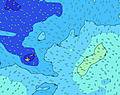 |  |  | 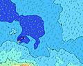 |  | ||||||||||||||
Swell Altura (m) Direção Período (s) | S 13 | S 13 | S 12 | S 12 | S 12 | S 12 | S 12 | SSE 13 | SSE 13 | S 13 | SSW 18 | SSW 18 | SSW 17 | SSW 16 | SSW 16 | SSW 15 | SSW 15 | SSW 15 | SSW 14 | SSW 14 | SSW 14 | SSW 14 | SSW 14 |
Onda Gráfico | |||||||||||||||||||||||
316 | 311 | 309 | 175 | 178 | 235 | 239 | 282 | 282 | 268 | 282 | 390 | 510 | 539 | 512 | 632 | 600 | 568 | 553 | 501 | 447 | 379 | 396 | |
Vento (km/h) | |||||||||||||||||||||||
Estado do Vento maral cruzado-maral Cruzado cruzado-terral terral cristalino | on | cross-on | cross-on | cross-on | on | on | on | on | cross-on | cross-on | cross-on | cross-on | on | on | on | on | on | on | on | on | on | on | on |
Maré Alta | 4:33AM1.14m | 4:55PM1.02m | 5:09AM1.19m | 5:29PM1.07m | 5:42AM1.24m | 6:01PM1.11m | |||||||||||||||||
Maré Baixa | 10:54AM0.25m | 10:51PM0.25m | 11:27AM0.20m | 11:25PM0.20m | 11:59AM0.16m | ||||||||||||||||||
6:43 | — | — | — | — | — | — | — | 6:43 | — | — | — | — | — | — | — | 6:43 | — | — | — | — | — | — | |
— | — | — | — | 6:27 | — | — | — | — | — | — | — | 6:28 | — | — | — | — | — | — | — | 6:28 | — | — | |
mm | — | — | — | — | — | — | — | — | — | 1 | — | 2 | 6 | 4 | 5 | 5 | 2 | 2 | 1 | — | — | — | — |
Temp. °C | 28 | 28 | 28 | 28 | 28 | 28 | 28 | 27 | 27 | 27 | 27 | 28 | 27 | 27 | 27 | 27 | 27 | 27 | 27 | 27 | 27 | 28 | 27 |
Ressent. °C | 30 | 29 | 30 | 31 | 31 | 30 | 30 | 29 | 29 | 28 | 29 | 30 | 29 | 28 | 29 | 29 | 29 | 28 | 28 | 28 | 28 | 29 | 28 |
Swell 1 Altura (m) Direção Período (s) | S 13 | S 13 | S 12 | S 12 | S 12 | S 12 | S 12 | SSE 13 | SSE 13 | S 13 | SSE 13 | SSE 13 | SSW 17 | SSW 16 | SSW 16 | SSW 15 | SSW 15 | SSW 15 | SSW 14 | SSW 14 | SSW 14 | SSW 14 | SSW 14 |
316 | 311 | 309 | 175 | 178 | 235 | 239 | 282 | 282 | 268 | 282 | 277 | 510 | 539 | 512 | 632 | 600 | 568 | 553 | 501 | 447 | 379 | 396 | |
Swell 2 Altura (m) Direção Período (s) | WNW 8 | WNW 8 | ESE 7 | ESE 7 | ENE 6 | ESE 7 | ESE 6 | ESE 7 | E 7 | SSW 18 | SSW 18 | SSW 18 | SSE 13 | SSE 12 | E 8 | E 7 | S 12 | S 12 | S 12 | S 12 | SSE 11 | SSE 14 | SSE 15 |
24 | 23 | 38 | 40 | 21 | 35 | 36 | 35 | 43 | 209 | 276 | 390 | 277 | 208 | 103 | 70 | 141 | 137 | 134 | 69 | 98 | 115 | 123 | |
Swell 3 Altura (m) Direção Período (s) | SSW 14 | SSW 13 | WNW 7 | S 14 | ESE 7 | ENE 6 | NE 6 | ENE 5 | NE 11 | NE 11 | NE 11 | ESE 7 | ESE 7 | ESE 7 | SSE 12 | S 12 | NE 10 | NE 10 | NE 10 | NE 9 | NE 9 | SSE 11 | NE 16 |
71 | 69 | 21 | 97 | 29 | 21 | 15 | 19 | 57 | 56 | 71 | 57 | 47 | 54 | 202 | 187 | 47 | 33 | 32 | 31 | 28 | 39 | 133 | |
Ondas de vento Altura (m) Direção Período (s) | E 6 | E 6 | NE 5 | NE 6 | — | — | — | E 7 | SE 3 | SE 7 | ESE 7 | — | — | ESE 6 | — | — | E 6 | E 7 | E 7 | E 8 | E 8 | E 8 | E 8 |
71 | 71 | 22 | 26 | — | — | — | 56 | 2 | 53 | 59 | — | — | 45 | — | — | 84 | 86 | 111 | 149 | 114 | 130 | 136 | |
Terral ou glassy mais perto | |||||||||||||||||||||||
Distância (km) | 565 | 565 | 565 | 565 | 553 | 565 | 576 | 576 | 593 | 595 | 664 | 664 | 669 | 1963 | 664 | 1963 | 2002 | 1961 | 1961 | 1523 | 1523 | 1523 | 1521 |
Melhor previsões de ondas em Tokelau | |||||||||||||||||||||||
Melhor previsões de ondas em Tokelau | |||||||||||||||||||||||
Buscador de Ondas Global | |||||||||||||||||||||||
- Map Icons:
 Break
Break Live Wave Height (m)
 Live Wind Speed (km/h)
 Surf Rating (10 Max)
 Ocean Swells (m)
- Wind Speed (km/h)
widget de graça do Surf-Forecast.com para o seu site
O relatório de surf / widget do tempo abaixo está disponível para incorporar em sites de terceiros gratuitamente e fornece um resumo das nossas Utua Mamao (Atafu) surf tempo. Simplesmente pegar o trecho de código html que fornecemos e colá-lo em seu próprio site. Você pode escolher seu idioma preferido e unidades métrico/imperial para o surf tempo de alimentação para atender aos usuários do seu site.... Clique aqui para adquirir o código.
 Nearest