
Previsão:

Previsão de curto prazoChuva intensa (total 42mm), mais intensa durante Terça à tarde. Warm (máx. 29°C na Segunda de manhã, mín 28°C na Segunda de manhã). principalmente ventos fortes. | ||||||||||||||||||||||||
Segunda-feira 3 | Terça-feira 4 | Quarta-feira 5 | ||||||||||||||||||||||
1 AM | 4 AM | 7 AM | 10 AM | 1 PM | 4 PM | 7 PM | 10 PM | 1 AM | 4 AM | 7 AM | 10 AM | 1 PM | 4 PM | 7 PM | 10 PM | 1 AM | 4 AM | 7 AM | 10 AM | 1 PM | 4 PM | 7 PM | 10 PM | |
Mapa da altura do Swell |  |  |  |  | 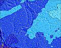 |  | 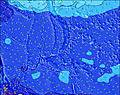 | 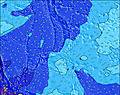 | 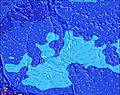 | |||||||||||||||
Swell Altura (m) Direção Período (s) | WSW 8 | WSW 8 | NE 15 | NE 15 | NE 14 | NE 14 | WSW 8 | WSW 8 | WSW 8 | WSW 8 | WSW 8 | WSW 8 | WSW 8 | WSW 8 | WSW 8 | WSW 8 | WSW 9 | WSW 9 | WSW 9 | WSW 9 | WSW 9 | WSW 9 | WSW 9 | NNW 14 |
Onda Gráfico | ||||||||||||||||||||||||
477 | 450 | 993 | 868 | 676 | 590 | 672 | 728 | 691 | 674 | 728 | 728 | 806 | 975 | 1121 | 1302 | 1368 | 1202 | 1312 | 1284 | 1284 | 1202 | 1076 | 1122 | |
Vento (km/h) | ||||||||||||||||||||||||
Estado do Vento maral cruzado-maral Cruzado cruzado-terral terral cristalino | on | cross-on | cross-on | cross-on | cross-on | cross-on | cross-on | cross-on | cross-on | cross-on | cross-on | cross-on | cross-on | cross-on | cross-on | cross-on | cross-on | cross-on | cross-on | cross-on | cross-on | cross-on | cross-on | cross-on |
Maré Alta | 10:39PM0.71m | 10:02AM0.63m | 11:01PM0.71m | 11:05AM0.59m | 11:26PM0.71m | 12:23PM0.56m | ||||||||||||||||||
Maré Baixa | 4:32AM0.30m | 4:24PM0.11m | 5:17AM0.23m | 5:00PM0.21m | 6:09AM0.16m | 5:40PM0.32m | ||||||||||||||||||
— | 6:05 | — | — | — | — | — | — | — | 6:05 | — | — | — | — | — | — | — | 6:07 | — | — | — | — | — | — | |
— | — | — | — | — | 6:47 | — | — | — | — | — | — | — | 6:47 | — | — | — | — | — | — | — | 6:46 | — | — | |
mm | 1 | 1 | 1 | 1 | 2 | 2 | 3 | 1 | 1 | 1 | 2 | 3 | 3 | 4 | 4 | 1 | 1 | 1 | 1 | 2 | 2 | 1 | 1 | 1 |
Temp. °C | 28 | 28 | 28 | 29 | 28 | 28 | 28 | 29 | 28 | 28 | 28 | 28 | 28 | 28 | 28 | 28 | 28 | 28 | 28 | 29 | 29 | 29 | 29 | 29 |
Ressent. °C | 28 | 28 | 27 | 29 | 27 | 27 | 27 | 29 | 27 | 27 | 27 | 27 | 26 | 26 | 26 | 27 | 26 | 27 | 27 | 28 | 28 | 29 | 29 | 29 |
Swell 1 Altura (m) Direção Período (s) | ENE 14 | NE 14 | NE 15 | NE 15 | NE 14 | NE 14 | NE 14 | NE 14 | NE 14 | NE 14 | NNE 14 | NNE 14 | NNE 14 | NNE 13 | NNE 13 | N 13 | N 14 | N 14 | N 13 | N 13 | N 14 | N 14 | N 14 | NNW 14 |
774 | 846 | 993 | 868 | 676 | 590 | 499 | 422 | 463 | 456 | 453 | 553 | 522 | 563 | 617 | 694 | 843 | 932 | 780 | 780 | 932 | 943 | 961 | 1122 | |
Swell 2 Altura (m) Direção Período (s) | SE 10 | SE 9 | SE 9 | SE 9 | SE 9 | SE 9 | SE 9 | SE 9 | SE 9 | SE 9 | SE 9 | SE 8 | SE 8 | SE 8 | SE 8 | SE 8 | SE 9 | SE 8 | ENE 13 | SE 8 | ENE 12 | ENE 12 | ENE 12 | ENE 12 |
14 | 14 | 13 | 13 | 12 | 12 | 12 | 13 | 13 | 13 | 12 | 18 | 18 | 18 | 18 | 18 | 19 | 18 | 33 | 16 | 30 | 27 | 27 | 27 | |
Swell 3 Altura (m) Direção Período (s) | N 8 | N 8 | E 15 | E 15 | E 15 | NNE 20 | ENE 14 | ENE 14 | ENE 14 | ENE 14 | ENE 14 | ENE 13 | ENE 14 | ENE 13 | ENE 13 | ENE 13 | ENE 13 | ENE 13 | SE 13 | ENE 13 | SE 13 | E 18 | ESE 12 | SE 9 |
5 | 1 | 17 | 17 | 17 | 38 | 20 | 19 | 19 | 18 | 18 | 18 | 18 | 17 | 34 | 17 | 33 | 17 | 7 | 32 | 6 | 6 | 14 | 12 | |
Ondas de vento Altura (m) Direção Período (s) | WSW 8 | WSW 8 | WSW 8 | WSW 8 | WSW 7 | WSW 7 | WSW 8 | WSW 8 | WSW 8 | WSW 8 | WSW 8 | WSW 8 | WSW 8 | WSW 8 | WSW 8 | WSW 8 | WSW 9 | WSW 9 | WSW 9 | WSW 9 | WSW 9 | WSW 9 | WSW 9 | WSW 9 |
477 | 450 | 494 | 540 | 542 | 588 | 672 | 728 | 691 | 674 | 728 | 728 | 806 | 975 | 1121 | 1302 | 1368 | 1202 | 1312 | 1284 | 1284 | 1202 | 1076 | 1023 | |
Terral ou glassy mais perto | ||||||||||||||||||||||||
Distância (km) | 1836 | 1813 | 1813 | 1813 | 1888 | 1892 | 1841 | 1816 | 1813 | 1813 | 1813 | 1813 | 1813 | 1841 | 1271 | 1813 | 1813 | 1271 | 1813 | 1813 | 1841 | 1841 | 1813 | 1813 |
Melhor previsões de ondas em Guam | ||||||||||||||||||||||||
Melhor previsões de ondas em Guam | ||||||||||||||||||||||||
Buscador de Ondas Global | ||||||||||||||||||||||||
- Map Icons:
 Break
Break Live Wave Height (m)
 Live Wind Speed (km/h)
 Surf Rating (10 Max)
 Ocean Swells (m)
- Wind Speed (km/h)
widget de graça do Surf-Forecast.com para o seu site
O relatório de surf / widget do tempo abaixo está disponível para incorporar em sites de terceiros gratuitamente e fornece um resumo das nossas Umatac surf tempo. Simplesmente pegar o trecho de código html que fornecemos e colá-lo em seu próprio site. Você pode escolher seu idioma preferido e unidades métrico/imperial para o surf tempo de alimentação para atender aos usuários do seu site.... Clique aqui para adquirir o código.
 Nearest