
Previsão:

Previsão de curto prazoChuva intensa (total 45mm), mais intensa durante Segunda à tarde. Warm (máx. 25°C na Terça à noite, mín 22°C na Seg à noite). Ventos diminuem (ventos fortes de Su-Sudoeste na Segunda de manhã, vento fraco de Su-Sudeste na Terça à tarde). | |||||||||||||||||||||
Dom 2 | Segunda-feira 3 | Terça-feira 4 | |||||||||||||||||||
11 AM | 2 PM | 5 PM | 8 PM | 11 PM | 2 AM | 5 AM | 8 AM | 11 AM | 2 PM | 5 PM | 8 PM | 11 PM | 2 AM | 5 AM | 8 AM | 11 AM | 2 PM | 5 PM | 8 PM | 11 PM | |
Mapa da altura do Swell |  | 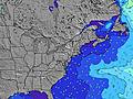 |  | 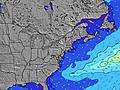 | 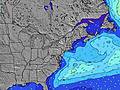 |  | 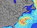 | 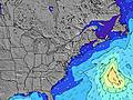 | |||||||||||||
Swell Altura (m) Direção Período (s) | S 7 | S 7 | SSE 4 | SSE 4 | S 5 | S 5 | S 6 | S 7 | S 8 | S 9 | S 9 | S 9 | SSW 8 | S 8 | S 8 | S 8 | S 8 | S 8 | S 8 | S 7 | S 7 |
Onda Gráfico | |||||||||||||||||||||
25 | 58 | 24 | 29 | 53 | 77 | 200 | 419 | 723 | 1026 | 993 | 1017 | 748 | 476 | 368 | 277 | 202 | 191 | 159 | 152 | 124 | |
Vento (km/h) | |||||||||||||||||||||
Estado do Vento maral cruzado-maral Cruzado cruzado-terral terral cristalino | cross | cross | cross-on | cross-on | cross | cross-off | cross-off | cross-off | cross-off | cross-off | cross-off | cross-off | cross | cross | cross-on | cross-on | cross-on | cross-on | cross | cross | cross |
Maré Alta | 10:47AM0.84m | 10:53PM0.80m | 11:24AM0.86m | 11:36PM0.76m | 12:08PM0.87m | ||||||||||||||||
Maré Baixa | 4:38PM0.11m | 4:55AM0.03m | 5:27PM0.13m | 5:36AM0.05m | 6:22PM0.15m | ||||||||||||||||
— | — | — | — | — | — | 5:43 | — | — | — | — | — | — | — | 5:45 | — | — | — | — | — | — | |
— | — | — | 8:02 | — | — | — | — | — | — | — | 8:00 | — | — | — | — | — | — | — | 8:00 | — | |
mm | — | — | — | — | — | 2 | 4 | 3 | 4 | 20 | 3 | 5 | 3 | — | — | — | — | — | — | — | — |
Temp. °C | 24 | 24 | 24 | 24 | 24 | 24 | 24 | 24 | 24 | 23 | 23 | 23 | 24 | 22 | 23 | 22 | 23 | 24 | 24 | 24 | 24 |
Ressent. °C | 24 | 24 | 24 | 25 | 25 | 23 | 25 | 21 | 21 | 22 | 22 | 22 | 25 | 21 | 21 | 20 | 22 | 23 | 22 | 23 | 25 |
Swell 1 Altura (m) Direção Período (s) | S 7 | SE 7 | S 7 | S 7 | SE 6 | SE 9 | — | — | — | — | — | — | SSW 8 | S 8 | S 8 | S 8 | S 8 | S 8 | S 8 | S 7 | S 7 |
25 | 16 | 15 | 14 | 7 | 3 | — | — | — | — | — | — | 748 | 476 | 368 | 277 | 202 | 191 | 159 | 152 | 124 | |
Swell 2 Altura (m) Direção Período (s) | SE 7 | S 9 | S 8 | SE 9 | SE 9 | — | — | — | — | — | — | — | — | — | — | — | — | — | E 9 | E 9 | E 12 |
16 | 6 | 1 | 3 | 3 | — | — | — | — | — | — | — | — | — | — | — | — | — | 2 | 2 | 3 | |
Swell 3 Altura (m) Direção Período (s) | S 9 | SE 9 | SE 9 | — | — | — | — | — | — | — | — | — | — | — | — | — | — | — | — | — | — |
6 | 3 | 3 | — | — | — | — | — | — | — | — | — | — | — | — | — | — | — | — | — | — | |
Ondas de vento Altura (m) Direção Período (s) | S 4 | S 7 | SSE 4 | SSE 4 | S 5 | S 5 | S 6 | S 7 | S 8 | S 9 | S 9 | S 9 | — | — | N 2 | NNE 2 | NE 3 | — | — | — | SE 7 |
13 | 58 | 24 | 29 | 53 | 77 | 200 | 419 | 723 | 1026 | 993 | 1017 | — | — | 1 | 1 | 2 | — | — | — | 54 | |
Terral ou glassy mais perto | |||||||||||||||||||||
Distância (km) | 1699 | 1548 | 1521 | 1475 | 214 | 1202 | 1286 | 192 | 1507 | 1507 | 29 | 93 | 0 | 26 | 24 | 0 | 26 | 2 | 2 | 2 | 2 |
Melhor previsões de ondas em Long Island New York | |||||||||||||||||||||
Melhor previsões de ondas em United States | |||||||||||||||||||||
Buscador de Ondas Global | |||||||||||||||||||||
- Map Icons:
 Break
Break Live Wave Height (m)
 Live Wind Speed (km/h)
 Surf Rating (10 Max)
 Ocean Swells (m)
- Wind Speed (km/h)
widget de graça do Surf-Forecast.com para o seu site
O relatório de surf / widget do tempo abaixo está disponível para incorporar em sites de terceiros gratuitamente e fornece um resumo das nossas Turtle Cove surf tempo. Simplesmente pegar o trecho de código html que fornecemos e colá-lo em seu próprio site. Você pode escolher seu idioma preferido e unidades métrico/imperial para o surf tempo de alimentação para atender aos usuários do seu site.... Clique aqui para adquirir o código.
 Nearest