
Previsão:

Previsão de curto prazoprincipalmente seco. Warm (máx. 25°C na Segunda de manhã, mín 21°C na Terça à noite). o vento será geralmente fraco. | ||||||||||||||||||||||||
Segunda-feira 27 | Terça-feira 28 | Quarta-feira 29 | ||||||||||||||||||||||
2 AM | 5 AM | 8 AM | 11 AM | 2 PM | 5 PM | 8 PM | 11 PM | 2 AM | 5 AM | 8 AM | 11 AM | 2 PM | 5 PM | 8 PM | 11 PM | 2 AM | 5 AM | 8 AM | 11 AM | 2 PM | 5 PM | 8 PM | 11 PM | |
Mapa da altura do Swell |  | 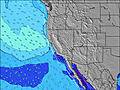 |  |  |  |  |  |  |  | |||||||||||||||
Swell Altura (m) Direção Período (s) | SW 18 | SW 18 | SW 18 | SSW 18 | SW 18 | SSW 18 | SW 16 | SSW 16 | SSW 17 | SSW 17 | SSW 17 | SSW 17 | SSW 17 | SSW 17 | SSW 16 | SSW 16 | SSW 16 | SSW 16 | SSW 16 | SSW 16 | SSW 16 | SSW 16 | SSW 16 | SSW 16 |
Onda Gráfico | ||||||||||||||||||||||||
719 | 915 | 915 | 1056 | 936 | 893 | 625 | 726 | 771 | 921 | 932 | 1009 | 1120 | 1020 | 828 | 700 | 818 | 751 | 612 | 612 | 519 | 724 | 724 | 773 | |
Vento (km/h) | ||||||||||||||||||||||||
Estado do Vento maral cruzado-maral Cruzado cruzado-terral terral cristalino | glassy | cross-on | glassy | on | on | on | glassy | cross | cross | cross | cross | cross-on | on | on | cross-on | cross | cross | cross | cross | cross-on | on | cross-on | cross-on | glassy |
Maré Alta | 9:35AM1.11m | 8:23PM1.76m | 9:59AM1.15m | 8:55PM1.80m | 10:24AM1.19m | 9:27PM1.80m | ||||||||||||||||||
Maré Baixa | 3:13AM-0.08m | 2:10PM0.72m | 3:42AM-0.12m | 2:46PM0.66m | 4:09AM-0.14m | 3:21PM0.61m | ||||||||||||||||||
— | 5:58 | — | — | — | — | — | — | — | 6:00 | — | — | — | — | — | — | — | 6:00 | — | — | — | — | — | — | |
— | — | — | — | — | 7:53 | — | — | — | — | — | — | — | 7:52 | — | — | — | — | — | — | — | 7:52 | — | — | |
mm | — | — | — | — | — | — | — | — | — | — | — | — | — | — | — | — | — | — | — | — | — | — | — | — |
Temp. °C | 21 | 22 | 23 | 25 | 25 | 25 | 22 | 22 | 22 | 22 | 23 | 24 | 24 | 23 | 22 | 22 | 22 | 21 | 22 | 25 | 24 | 23 | 21 | 22 |
Ressent. °C | 24 | 24 | 26 | 27 | 26 | 27 | 24 | 24 | 23 | 23 | 24 | 24 | 24 | 23 | 23 | 23 | 23 | 22 | 23 | 26 | 24 | 23 | 23 | 24 |
Swell 1 Altura (m) Direção Período (s) | SW 18 | SW 18 | SW 18 | SSW 18 | SW 18 | SSW 18 | SW 16 | SSW 16 | SSW 17 | SSW 17 | SSW 17 | SSW 17 | SSW 17 | SSW 17 | SSW 16 | SSW 16 | SSW 16 | SSW 16 | SSW 16 | SSW 16 | SSW 16 | SSW 16 | SSW 16 | SSW 16 |
719 | 915 | 915 | 1056 | 936 | 893 | 625 | 726 | 771 | 921 | 932 | 1009 | 1120 | 1020 | 828 | 700 | 818 | 751 | 612 | 612 | 519 | 724 | 724 | 773 | |
Swell 2 Altura (m) Direção Período (s) | W 7 | W 8 | W 7 | W 7 | W 7 | W 7 | W 7 | W 7 | W 7 | W 7 | W 7 | W 7 | W 7 | W 7 | W 7 | W 7 | S 16 | S 15 | SSE 15 | SSE 15 | SSE 14 | SSE 14 | SSE 14 | S 13 |
36 | 55 | 51 | 49 | 34 | 33 | 23 | 23 | 23 | 38 | 51 | 48 | 46 | 33 | 33 | 23 | 131 | 163 | 228 | 222 | 280 | 210 | 192 | 125 | |
Swell 3 Altura (m) Direção Período (s) | SSW 11 | SSW 11 | S 11 | S 11 | SSW 12 | SW 12 | SSW 20 | SW 10 | S 8 | S 9 | S 10 | S 10 | SSE 19 | SSE 17 | S 19 | S 19 | W 7 | W 7 | W 7 | W 7 | W 7 | W 7 | W 7 | W 7 |
40 | 40 | 21 | 21 | 57 | 37 | 151 | 16 | 6 | 6 | 8 | 9 | 34 | 59 | 188 | 186 | 22 | 21 | 33 | 33 | 33 | 22 | 21 | 21 | |
Ondas de vento Altura (m) Direção Período (s) | — | — | — | — | — | — | — | — | — | — | — | — | — | — | — | — | — | — | — | — | — | — | — | — |
— | — | — | — | — | — | — | — | — | — | — | — | — | — | — | — | — | — | — | — | — | — | — | — | |
Terral ou glassy mais perto | ||||||||||||||||||||||||
Distância (km) | 0 | 19 | 0 | 83 | 152 | 130 | 0 | 3 | 28 | 3 | 64 | 64 | 85 | 144 | 64 | 64 | 3 | 3 | 15 | 83 | 89 | 152 | 1 | 0 |
Melhor previsões de ondas em Orange County | ||||||||||||||||||||||||
Melhor previsões de ondas em United States | ||||||||||||||||||||||||
Buscador de Ondas Global | ||||||||||||||||||||||||
- Map Icons:
 Break
Break Live Wave Height (m)
 Live Wind Speed (km/h)
 Surf Rating (10 Max)
 Ocean Swells (m)
- Wind Speed (km/h)
widget de graça do Surf-Forecast.com para o seu site
O relatório de surf / widget do tempo abaixo está disponível para incorporar em sites de terceiros gratuitamente e fornece um resumo das nossas Trestles (Lowers) surf tempo. Simplesmente pegar o trecho de código html que fornecemos e colá-lo em seu próprio site. Você pode escolher seu idioma preferido e unidades métrico/imperial para o surf tempo de alimentação para atender aos usuários do seu site.... Clique aqui para adquirir o código.
 Nearest