
Previsão:

Previsão de curto prazoAlguns chuviscos, mais intensos durante Sábado à tarde. Warm (máx. 32°C no Sábado à tarde, mín 27°C no Sábado à noite). o vento será geralmente fraco. | ||||||||||||||||||||
Sáb 25 | Domingo 26 | Segunda-feira 27 | ||||||||||||||||||
2 PM | 5 PM | 8 PM | 11 PM | 2 AM | 5 AM | 8 AM | 11 AM | 2 PM | 5 PM | 8 PM | 11 PM | 2 AM | 5 AM | 8 AM | 11 AM | 2 PM | 5 PM | 8 PM | 11 PM | |
Mapa da altura do Swell |  |  | 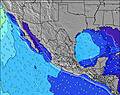 |  |  |  |  |  | ||||||||||||
Swell Altura (m) Direção Período (s) | SSW 19 | SSW 19 | SSW 19 | SSW 19 | SSW 19 | SSW 19 | SW 18 | SSW 18 | SSW 18 | SW 18 | SW 18 | SSW 18 | SSW 18 | SSW 18 | SSE 13 | SSW 17 | S 14 | S 13 | S 13 | SSW 17 |
Onda Gráfico | ||||||||||||||||||||
1719 | 2044 | 2044 | 1719 | 1702 | 1352 | 1292 | 1431 | 1431 | 1536 | 1518 | 1682 | 1702 | 1702 | 1121 | 1274 | 1867 | 1810 | 1838 | 2225 | |
Vento (km/h) | ||||||||||||||||||||
Estado do Vento maral cruzado-maral Cruzado cruzado-terral terral cristalino | cross-off | cross-off | off | cross-off | off | off | glassy | cross-off | cross-off | cross-off | cross-off | cross-off | off | off | glassy | cross | cross | cross-off | off | off |
Maré Alta | 5:53PM1.49m | 8:23AM1.17m | 6:35PM1.57m | 8:39AM1.21m | 7:12PM1.64m | |||||||||||||||
Maré Baixa | 11:58AM1.02m | 1:30AM0.25m | 12:39PM0.95m | 1:57AM0.18m | 1:12PM0.88m | |||||||||||||||
— | — | — | — | — | 5:47 | — | — | — | — | — | — | — | 5:47 | — | — | — | — | — | — | |
— | 7:04 | — | — | — | — | — | — | — | 7:02 | — | — | — | — | — | — | — | 7:02 | — | — | |
mm | — | 1 | — | — | — | — | — | — | — | — | — | — | — | — | — | — | — | — | — | — |
Temp. °C | 32 | 31 | 30 | 28 | 28 | 27 | 29 | 31 | 31 | 30 | 28 | 28 | 27 | 28 | 29 | 30 | 31 | 30 | 28 | 28 |
Ressent. °C | 35 | 33 | 34 | 32 | 32 | 30 | 34 | 34 | 32 | 31 | 29 | 30 | 29 | 32 | 34 | 33 | 33 | 30 | 30 | 30 |
Swell 1 Altura (m) Direção Período (s) | SSW 19 | SSW 19 | SSW 19 | SSW 19 | SSW 19 | SSW 19 | SW 18 | SSW 18 | SSW 18 | SW 18 | SW 18 | SSW 18 | SSW 18 | SSE 13 | SSE 13 | SSE 12 | S 14 | S 13 | S 13 | S 13 |
1719 | 2044 | 2044 | 1719 | 1702 | 1352 | 1292 | 1431 | 1431 | 1536 | 1518 | 1682 | 1702 | 1276 | 1121 | 872 | 1867 | 1810 | 1838 | 1465 | |
Swell 2 Altura (m) Direção Período (s) | S 9 | S 9 | SW 15 | WSW 11 | S 10 | S 10 | W 7 | SSE 8 | SW 13 | SSE 16 | SSE 14 | SSE 13 | SSE 14 | SSW 18 | SSW 16 | SSW 17 | SSW 17 | SSW 18 | SSW 18 | SSW 17 |
40 | 40 | 106 | 82 | 48 | 49 | 24 | 20 | 85 | 215 | 389 | 408 | 752 | 1702 | 886 | 1274 | 1352 | 1399 | 1579 | 2225 | |
Swell 3 Altura (m) Direção Período (s) | SSW 12 | SSW 11 | S 12 | SW 15 | SSW 11 | SW 14 | SSE 10 | SW 11 | SSE 9 | SSE 9 | SSE 10 | SSE 15 | SSE 12 | SW 12 | S 16 | S 15 | W 8 | WSW 8 | W 9 | W 9 |
54 | 51 | 11 | 104 | 49 | 68 | 31 | 30 | 29 | 26 | 102 | 413 | 347 | 37 | 507 | 876 | 10 | 6 | 7 | 2 | |
Ondas de vento Altura (m) Direção Período (s) | W 8 | W 7 | SW 11 | SSW 10 | W 7 | W 7 | W 7 | W 7 | W 7 | W 7 | S 10 | — | — | W 7 | W 7 | — | — | WNW 3 | WNW 4 | WNW 8 |
41 | 69 | 233 | 81 | 35 | 24 | 24 | 25 | 25 | 25 | 123 | — | — | 14 | 14 | — | — | 3 | 4 | 12 | |
Terral ou glassy mais perto | ||||||||||||||||||||
Distância (km) | 0 | 0 | 0 | 0 | 0 | 0 | 0 | 0 | 455 | 48 | 48 | 10 | 0 | 0 | 0 | 58 | 8 | 455 | 0 | 0 |
Melhor previsões de ondas em Baja Sur | ||||||||||||||||||||
Melhor previsões de ondas em Mexico | ||||||||||||||||||||
Buscador de Ondas Global | ||||||||||||||||||||
- Map Icons:
 Break
Break Live Wave Height (m)
 Live Wind Speed (km/h)
 Surf Rating (10 Max)
 Ocean Swells (m)
- Wind Speed (km/h)
widget de graça do Surf-Forecast.com para o seu site
O relatório de surf / widget do tempo abaixo está disponível para incorporar em sites de terceiros gratuitamente e fornece um resumo das nossas The Rock-Costa Azul surf tempo. Simplesmente pegar o trecho de código html que fornecemos e colá-lo em seu próprio site. Você pode escolher seu idioma preferido e unidades métrico/imperial para o surf tempo de alimentação para atender aos usuários do seu site.... Clique aqui para adquirir o código.
 Nearest