
Previsão:

Previsão de curto prazoChuva intensa (total 21mm), mais intensa durante Quarta à Tarde. Warm (máx. 27°C na Segunda de manhã, mín 26°C na Segunda à tarde). Ventos diminuem (ventos frescos de Sul na Segunda à tarde, vento fraco de Su-Sudeste na Quarta à noite). | ||||||||||||||||||||||
Segunda-feira 3 | Terça-feira 4 | Quarta-feira 5 | ||||||||||||||||||||
7 AM | 10 AM | 1 PM | 4 PM | 7 PM | 10 PM | 1 AM | 4 AM | 7 AM | 10 AM | 1 PM | 4 PM | 7 PM | 10 PM | 1 AM | 4 AM | 7 AM | 10 AM | 1 PM | 4 PM | 7 PM | 10 PM | |
Mapa da altura do Swell |  | 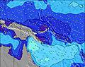 | 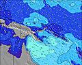 | 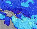 | 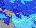 | 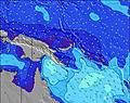 | 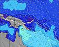 | 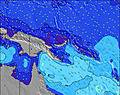 | ||||||||||||||
Swell Altura (m) Direção Período (s) | NNE 13 | NNE 13 | N 14 | NNE 13 | NNE 14 | NNE 14 | NNE 13 | NNE 13 | NNE 13 | NNE 13 | N 12 | N 15 | N 15 | N 14 | N 13 | N 13 | N 13 | N 13 | N 12 | N 12 | N 12 | N 12 |
Onda Gráfico | ||||||||||||||||||||||
114 | 92 | 98 | 92 | 158 | 189 | 187 | 181 | 176 | 168 | 110 | 109 | 106 | 144 | 176 | 173 | 171 | 166 | 151 | 141 | 102 | 103 | |
Vento (km/h) | ||||||||||||||||||||||
Estado do Vento maral cruzado-maral Cruzado cruzado-terral terral cristalino | cross-off | cross-off | cross-off | cross-off | cross-off | cross-off | cross-off | cross-off | cross-off | cross-off | cross-off | cross-off | cross-off | cross-off | cross-off | cross-off | cross-off | cross-off | cross-off | cross-off | cross-off | cross-off |
Maré Alta | 4:14AM0.80m | 5:42PM0.65m | 4:20AM0.69m | 6:07PM0.70m | 3:54AM0.57m | 6:39PM0.74m | ||||||||||||||||
Maré Baixa | 11:10AM0.21m | 10:47PM0.45m | 11:04AM0.23m | 11:49PM0.50m | 10:46AM0.23m | |||||||||||||||||
5:58 | — | — | — | — | — | — | 5:58 | — | — | — | — | — | — | — | 5:58 | — | — | — | — | — | — | |
— | — | — | 5:55 | — | — | — | — | — | — | — | 5:55 | — | — | — | — | — | — | — | 5:55 | — | — | |
mm | — | 1 | 1 | 1 | — | — | — | — | — | 1 | 1 | 2 | 1 | 1 | — | — | — | 1 | 2 | 2 | 4 | 1 |
Temp. °C | 26 | 27 | 27 | 26 | 26 | 26 | 26 | 26 | 26 | 27 | 27 | 27 | 26 | 26 | 26 | 26 | 26 | 27 | 27 | 27 | 26 | 26 |
Ressent. °C | 25 | 26 | 26 | 24 | 24 | 25 | 25 | 26 | 26 | 27 | 27 | 28 | 26 | 26 | 26 | 26 | 26 | 28 | 28 | 28 | 27 | 28 |
Swell 1 Altura (m) Direção Período (s) | NNE 13 | NNE 13 | N 14 | NNE 13 | NNE 14 | NNE 14 | NNE 13 | NNE 13 | NNE 13 | NNE 13 | N 12 | N 12 | N 12 | E 9 | N 13 | N 13 | N 13 | N 13 | N 12 | N 12 | N 12 | N 12 |
114 | 92 | 98 | 92 | 158 | 189 | 187 | 181 | 176 | 168 | 110 | 72 | 76 | 57 | 176 | 173 | 171 | 166 | 151 | 141 | 102 | 103 | |
Swell 2 Altura (m) Direção Período (s) | ENE 14 | ESE 10 | NNE 12 | E 10 | ESE 9 | ENE 14 | E 10 | E 9 | E 9 | E 9 | E 9 | N 15 | ENE 13 | N 14 | E 9 | E 9 | ESE 9 | ESE 9 | ESE 9 | ENE 12 | ESE 9 | ESE 9 |
65 | 32 | 56 | 46 | 46 | 63 | 67 | 64 | 60 | 61 | 60 | 109 | 67 | 144 | 59 | 40 | 26 | 26 | 26 | 27 | 26 | 26 | |
Swell 3 Altura (m) Direção Período (s) | ESE 9 | ENE 14 | ENE 14 | NNE 15 | ENE 14 | ENE 10 | ENE 14 | ENE 13 | ENE 13 | ENE 13 | ENE 13 | ENE 13 | N 15 | ENE 13 | ENE 13 | ENE 13 | ENE 12 | ENE 12 | ENE 12 | ENE 9 | ENE 12 | N 15 |
29 | 62 | 61 | 73 | 74 | 9 | 71 | 70 | 67 | 66 | 66 | 66 | 106 | 67 | 66 | 65 | 59 | 46 | 27 | 17 | 28 | 38 | |
Ondas de vento Altura (m) Direção Período (s) | SSE 5 | S 5 | S 6 | SSE 6 | S 6 | SSE 6 | S 6 | S 6 | SSE 5 | S 5 | S 4 | SE 4 | SSE 5 | SSE 5 | S 5 | S 4 | SSE 4 | SSE 4 | SSE 4 | SE 4 | SSE 4 | S 4 |
117 | 106 | 157 | 173 | 197 | 290 | 235 | 141 | 69 | 40 | 16 | 49 | 98 | 81 | 59 | 40 | 33 | 21 | 14 | 28 | 21 | 7 | |
Terral ou glassy mais perto | ||||||||||||||||||||||
Distância (km) | 98 | 185 | 185 | 994 | 185 | 994 | 994 | 185 | 185 | 185 | 185 | 185 | 185 | 185 | 185 | 185 | 185 | 185 | 185 | 185 | 185 | 184 |
Melhor previsões de ondas em New Ireland | ||||||||||||||||||||||
Melhor previsões de ondas em Papua New Guinea | ||||||||||||||||||||||
Buscador de Ondas Global | ||||||||||||||||||||||
- Map Icons:
 Break
Break Live Wave Height (m)
 Live Wind Speed (km/h)
 Surf Rating (10 Max)
 Ocean Swells (m)
- Wind Speed (km/h)
widget de graça do Surf-Forecast.com para o seu site
O relatório de surf / widget do tempo abaixo está disponível para incorporar em sites de terceiros gratuitamente e fornece um resumo das nossas Rubio surf tempo. Simplesmente pegar o trecho de código html que fornecemos e colá-lo em seu próprio site. Você pode escolher seu idioma preferido e unidades métrico/imperial para o surf tempo de alimentação para atender aos usuários do seu site.... Clique aqui para adquirir o código.
 Nearest