
Previsão:

Previsão de curto prazoprincipalmente seco. Very mild (máx. 15°C no Sábado de manhã, mín 12°C no Sábado à noite). o vento será geralmente fraco. | ||||||||||||||||||||||
Sábado 18 | Domingo 19 | Segunda-feira 20 | ||||||||||||||||||||
7 AM | 10 AM | 1 PM | 4 PM | 7 PM | 10 PM | 1 AM | 4 AM | 7 AM | 10 AM | 1 PM | 4 PM | 7 PM | 10 PM | 1 AM | 4 AM | 7 AM | 10 AM | 1 PM | 4 PM | 7 PM | 10 PM | |
Mapa da altura do Swell |  |  |  | 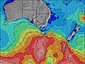 |  |  | 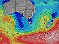 |  | ||||||||||||||
Swell Altura (m) Direção Período (s) | SSW 14 | SSW 13 | SSW 12 | SSW 12 | S 12 | S 12 | S 12 | S 12 | S 11 | S 11 | S 11 | S 11 | S 11 | S 10 | SSW 17 | SSW 16 | SSW 16 | SSW 16 | SSW 15 | SSW 15 | SSW 14 | SSW 14 |
Onda Gráfico | ||||||||||||||||||||||
452 | 378 | 420 | 461 | 432 | 425 | 418 | 333 | 253 | 240 | 191 | 151 | 112 | 108 | 96 | 87 | 85 | 81 | 72 | 121 | 118 | 111 | |
Vento (km/h) | ||||||||||||||||||||||
Estado do Vento maral cruzado-maral Cruzado cruzado-terral terral cristalino | cross-off | cross-off | cross-off | cross-off | cross-off | cross-off | off | cross-off | off | off | off | off | off | off | off | off | cross-off | off | off | cross-off | cross-off | cross-off |
Maré Alta | 11:57AM0.47m | 9:49PM0.56m | 12:18PM0.50m | 10:45PM0.48m | 12:37PM0.53m | |||||||||||||||||
Maré Baixa | 4:45AM0.11m | 4:05PM0.40m | 5:14AM0.17m | 5:36PM0.38m | 5:33AM0.22m | 6:58PM0.34m | ||||||||||||||||
7:35 | — | — | — | — | — | — | — | 7:35 | — | — | — | — | — | — | — | 7:33 | — | — | — | — | — | |
— | — | — | 4:57 | — | — | — | — | — | — | — | 4:57 | — | — | — | — | — | — | — | 4:58 | — | — | |
mm | — | — | — | — | — | — | — | — | — | — | — | — | — | — | — | — | — | — | — | — | — | — |
Temp. °C | 13 | 13 | 15 | 15 | 14 | 13 | 12 | 12 | 12 | 13 | 14 | 15 | 14 | 13 | 13 | 12 | 12 | 12 | 15 | 14 | 13 | 13 |
Ressent. °C | 8 | 9 | 12 | 12 | 11 | 10 | 8 | 9 | 8 | 9 | 11 | 12 | 10 | 9 | 8 | 7 | 6 | 6 | 10 | 11 | 11 | 10 |
Swell 1 Altura (m) Direção Período (s) | SSW 14 | SSW 13 | SSW 12 | SSW 12 | S 12 | S 12 | S 12 | S 12 | S 11 | S 11 | S 11 | S 11 | S 11 | S 10 | S 10 | S 10 | S 10 | S 10 | SSW 15 | SSW 15 | SSW 14 | SSW 14 |
452 | 378 | 420 | 461 | 432 | 425 | 418 | 333 | 253 | 240 | 191 | 151 | 112 | 108 | 77 | 75 | 53 | 54 | 72 | 121 | 118 | 111 | |
Swell 2 Altura (m) Direção Período (s) | S 17 | S 17 | S 16 | SSE 16 | SE 17 | SE 17 | SE 17 | SE 16 | SE 16 | SE 16 | SE 16 | SE 16 | ESE 15 | ESE 15 | ESE 15 | SSW 16 | SSW 16 | SSW 16 | SSW 11 | SE 14 | SE 14 | SE 14 |
149 | 140 | 135 | 86 | 46 | 46 | 74 | 69 | 67 | 65 | 64 | 62 | 92 | 87 | 84 | 87 | 85 | 81 | 37 | 48 | 47 | 29 | |
Swell 3 Altura (m) Direção Período (s) | ESE 17 | ESE 17 | ESE 17 | ESE 17 | S 16 | SE 17 | S 22 | S 16 | S 16 | S 20 | S 15 | SSW 18 | SSW 18 | SSW 18 | SSW 17 | SE 14 | SE 14 | SE 14 | SE 14 | S 10 | S 10 | S 10 |
29 | 29 | 29 | 28 | 20 | 75 | 9 | 5 | 20 | 30 | 18 | 65 | 63 | 63 | 96 | 53 | 51 | 50 | 49 | 19 | 19 | 8 | |
Ondas de vento Altura (m) Direção Período (s) | NW 3 | NW 3 | WNW 3 | — | — | — | — | — | — | — | — | — | — | — | — | NNW 2 | NNW 3 | NNW 3 | NNW 3 | N 2 | — | — |
3 | 2 | 2 | — | — | — | — | — | — | — | — | — | — | — | — | 1 | 1 | 3 | 2 | 1 | — | — | |
Terral ou glassy mais perto | ||||||||||||||||||||||
Distância (km) | 0 | 19 | 0 | 0 | 0 | 0 | 0 | 0 | 0 | 0 | 0 | 0 | 0 | 0 | 0 | 0 | 0 | 0 | 0 | 0 | 0 | 0 |
Melhor previsões de ondas em East Coast of Tasmania | ||||||||||||||||||||||
Melhor previsões de ondas em Australia | ||||||||||||||||||||||
Buscador de Ondas Global | ||||||||||||||||||||||
- Map Icons:
 Break
Break Live Wave Height (m)
 Live Wind Speed (km/h)
 Surf Rating (10 Max)
 Ocean Swells (m)
- Wind Speed (km/h)
widget de graça do Surf-Forecast.com para o seu site
O relatório de surf / widget do tempo abaixo está disponível para incorporar em sites de terceiros gratuitamente e fornece um resumo das nossas Rebounds surf tempo. Simplesmente pegar o trecho de código html que fornecemos e colá-lo em seu próprio site. Você pode escolher seu idioma preferido e unidades métrico/imperial para o surf tempo de alimentação para atender aos usuários do seu site.... Clique aqui para adquirir o código.
 Nearest