
Previsão:

Previsão de curto prazochuva moderada (total 11mm), mais intensa na Segunda à tarde. Warm (máx. 27°C na Quarta de manhã, mín 25°C na Segunda à tarde). Ventos diminuem (ventos frescos de Nordeste na Seg à noite, calmo na Quarta de manhã). | |||||||||||||||||||||
Seg 27 | Terça-feira 28 | Quarta-feira 29 | |||||||||||||||||||
11 AM | 2 PM | 5 PM | 8 PM | 11 PM | 2 AM | 5 AM | 8 AM | 11 AM | 2 PM | 5 PM | 8 PM | 11 PM | 2 AM | 5 AM | 8 AM | 11 AM | 2 PM | 5 PM | 8 PM | 11 PM | |
Mapa da altura do Swell |  |  |  |  |  |  | 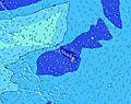 |  | |||||||||||||
Swell Altura (m) Direção Período (s) | E 14 | E 14 | E 13 | E 14 | E 14 | E 13 | E 13 | E 13 | E 13 | E 13 | E 13 | E 12 | ENE 12 | ENE 11 | ENE 11 | ENE 10 | ENE 10 | ENE 9 | ENE 9 | ENE 9 | ENE 8 |
Onda Gráfico | |||||||||||||||||||||
640 | 622 | 690 | 877 | 942 | 1144 | 1370 | 1370 | 1510 | 1667 | 1584 | 1388 | 1230 | 1111 | 1289 | 970 | 821 | 578 | 449 | 397 | 313 | |
Vento (km/h) | |||||||||||||||||||||
Estado do Vento maral cruzado-maral Cruzado cruzado-terral terral cristalino | cross-on | on | on | on | on | on | on | on | on | on | on | on | on | cross-on | cross-on | cross | glassy | cross-off | cross | cross | cross-off |
Maré Alta | 2:38PM0.74m | 00:46AM0.35m | 3:02PM0.75m | 1:29AM0.37m | 3:26PM0.75m | ||||||||||||||||
Maré Baixa | 9:26PM0.29m | 7:24AM-0.09m | 9:39PM0.27m | 7:58AM-0.09m | 9:58PM0.24m | ||||||||||||||||
— | — | — | — | — | — | 6:01 | — | — | — | — | — | — | — | 6:01 | — | — | — | — | — | — | |
— | — | 7:12 | — | — | — | — | — | — | — | 7:12 | — | — | — | — | — | — | — | 7:10 | — | — | |
mm | — | — | 1 | 1 | 1 | 1 | 1 | 1 | 1 | — | — | — | — | 1 | 1 | — | — | — | 1 | — | — |
Temp. °C | 25 | 25 | 25 | 25 | 25 | 25 | 25 | 25 | 25 | 26 | 25 | 25 | 25 | 25 | 25 | 25 | 27 | 26 | 26 | 26 | 26 |
Ressent. °C | 24 | 25 | 24 | 24 | 25 | 25 | 26 | 26 | 26 | 27 | 25 | 25 | 26 | 27 | 26 | 27 | 31 | 28 | 28 | 29 | 29 |
Swell 1 Altura (m) Direção Período (s) | E 14 | E 14 | E 13 | E 14 | E 14 | E 13 | E 13 | E 13 | E 13 | E 13 | E 13 | E 12 | ENE 12 | ENE 11 | ENE 11 | ENE 10 | ENE 10 | ENE 9 | ENE 9 | ENE 9 | ENE 8 |
640 | 622 | 690 | 877 | 942 | 1144 | 1370 | 1370 | 1510 | 1667 | 1584 | 1388 | 1230 | 1111 | 1289 | 970 | 821 | 578 | 449 | 397 | 313 | |
Swell 2 Altura (m) Direção Período (s) | SSW 15 | SSW 15 | SSW 15 | SSW 14 | SSW 14 | NNE 9 | NNE 10 | S 14 | S 14 | S 14 | S 14 | S 13 | S 14 | NNE 6 | SSW 14 | S 14 | S 15 | S 15 | S 14 | S 14 | S 14 |
73 | 42 | 42 | 70 | 41 | 59 | 60 | 33 | 32 | 32 | 33 | 31 | 34 | 103 | 40 | 36 | 67 | 67 | 65 | 62 | 61 | |
Swell 3 Altura (m) Direção Período (s) | S 11 | S 11 | S 11 | S 10 | S 10 | S 14 | S 14 | S 10 | S 10 | — | — | S 16 | S 16 | S 14 | S 10 | S 15 | — | — | S 13 | SW 19 | SW 19 |
2 | 2 | 2 | 8 | 2 | 37 | 35 | 9 | 8 | — | — | 20 | 21 | 36 | 2 | 4 | — | — | 4 | 15 | 15 | |
Ondas de vento Altura (m) Direção Período (s) | NE 7 | NE 7 | NE 7 | NE 7 | NE 6 | NE 7 | NNE 7 | NNE 7 | NNE 8 | NNE 7 | NNE 7 | NNE 7 | NNE 6 | — | — | — | S 2 | SSE 3 | S 3 | — | — |
281 | 255 | 277 | 277 | 265 | 240 | 160 | 193 | 173 | 164 | 158 | 154 | 127 | — | — | — | 1 | 1 | 1 | — | — | |
Terral ou glassy mais perto | |||||||||||||||||||||
Distância (km) | 41 | 41 | 41 | 41 | 41 | 21 | 21 | 21 | 22 | 22 | 23 | 21 | 21 | 20 | 21 | 4 | 0 | 0 | 16 | 21 | 0 |
Melhor previsões de ondas em Oahu | |||||||||||||||||||||
Melhor previsões de ondas em United States | |||||||||||||||||||||
Buscador de Ondas Global | |||||||||||||||||||||
- Map Icons:
 Break
Break Live Wave Height (m)
 Live Wind Speed (km/h)
 Surf Rating (10 Max)
 Ocean Swells (m)
- Wind Speed (km/h)
widget de graça do Surf-Forecast.com para o seu site
O relatório de surf / widget do tempo abaixo está disponível para incorporar em sites de terceiros gratuitamente e fornece um resumo das nossas Pyramid Rock surf tempo. Simplesmente pegar o trecho de código html que fornecemos e colá-lo em seu próprio site. Você pode escolher seu idioma preferido e unidades métrico/imperial para o surf tempo de alimentação para atender aos usuários do seu site.... Clique aqui para adquirir o código.
 Nearest