
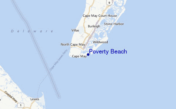
Poverty Beach Surf Guide
Poverty Beach in New Jersey is an exposed beach and reef break Works best in offshore winds from the north northwest. Windswells and groundswells in equal measure and the ideal swell direction is from the south southeast. The beach breaks offer lefts and rights. The quality of the surf isn't affected by the tide. Likely to be crowded if working. Beware of rips, man-made danger (buoys etc..) and locals.
Poverty Beach Spot Info
| Type: | Rating: | Reliability: | Todays Sea Temp*: |
|---|---|---|---|
| rarely breaks | 24.2°C*ocean temperature recorded from satellite |
Surfing Poverty Beach:
The best conditions reported for surf at Poverty Beach occur when a South-southeast swell combines with an offshore wind direction from the North-northwest.
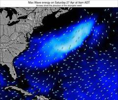
Previsão da Energia de Ondas (Força): 12hrs

Poverty Beach Surf:
Sunday, 19 July 2026, 03:24 Local time| Sáb | Domingo 19 | |||
| 11PM | 2AM | 5AM | 8AM | |
| Wave (m) | ||||
| Período (s) | 5 | 6 | 6 | 6 |
| Vento (km/h) | ||||
| Estado do Vento | cross | cross | cross | cross- off |
- /breaks/Poverty-Beach/forecasts/latest
Poverty Beach Surf Guide
Poverty Beach in New Jersey is an exposed beach and reef break Works best in offshore winds from the north northwest. Windswells and groundswells in equal measure and the ideal swell direction is from the south southeast. The beach breaks offer lefts and rights. The quality of the surf isn't affected by the tide. Likely to be crowded if working. Beware of rips, man-made danger (buoys etc..) and locals.
Poverty Beach Spot Info
Type: Rating: Reliability: Todays Sea Temp*:  Beach and reef
 3
3rarely breaks 24.2°C*ocean temperature recorded from satelliteSurfing Poverty Beach:
The best conditions reported for surf at Poverty Beach occur when a South-southeast swell combines with an offshore wind direction from the North-northwest.
Previsão da Energia de Ondas (Força): 12hrs
Use a aba navegação acima para ver temperatura do mar em Poverty Beach, fotografias de Poverty Beach, previsões detalhadas do swell em Poverty Beach, previsões do vento e do tempo, webcams em Poverty Beach , vento atual em New Jersey com base em dados ao vivo fornecidos por estações de meteorologia e previsões da maré em Poverty Beach. O link para os mapas do swell em United States abrirá uma imagem ampliada monstrando United States e os mares próximos. Estes mapas do swell podem ser animados para mostrar diferentes componentes do swell, energia das ondas, período das ondas, altura das ondas, assim como previsões do vento e do tempo, observações em tempo real do estado do tempo e do mar graças às bóias de United States, navios passantes e estações de meteorologia presentes na costa. Cada uma das páginas de previsão para este surf break apresenta as ferramentas do buscador global e regional para localizar as melores condições de surf na área ao redor de Poverty Beach.
Poverty Beach Surf:
Sunday, 19 July 2026, 03:24 Local timeSáb Domingo 19 11PM 2AM 5AM 8AM Wave (m) Período (s) 5 6 6 6 Vento (km/h) Estado do Vento cross cross cross cross-
off- /breaks/Poverty-Beach/forecasts/latest
- /breaks/Poverty-Beach/forecasts/latest/six_day
Poverty Beach Surf Guide
Poverty Beach in New Jersey is an exposed beach and reef break Works best in offshore winds from the north northwest. Windswells and groundswells in equal measure and the ideal swell direction is from the south southeast. The beach breaks offer lefts and rights. The quality of the surf isn't affected by the tide. Likely to be crowded if working. Beware of rips, man-made danger (buoys etc..) and locals.
Poverty Beach Spot Info
Type: Rating: Reliability: Todays Sea Temp*: Beach and reef3rarely breaks 24.2°C*ocean temperature recorded from satelliteSurfing Poverty Beach:
The best conditions reported for surf at Poverty Beach occur when a South-southeast swell combines with an offshore wind direction from the North-northwest.
Previsão da Energia de Ondas (Força): 12hrs
Use a aba navegação acima para ver temperatura do mar em Poverty Beach, fotografias de Poverty Beach, previsões detalhadas do swell em Poverty Beach, previsões do vento e do tempo, webcams em Poverty Beach , vento atual em New Jersey com base em dados ao vivo fornecidos por estações de meteorologia e previsões da maré em Poverty Beach. O link para os mapas do swell em United States abrirá uma imagem ampliada monstrando United States e os mares próximos. Estes mapas do swell podem ser animados para mostrar diferentes componentes do swell, energia das ondas, período das ondas, altura das ondas, assim como previsões do vento e do tempo, observações em tempo real do estado do tempo e do mar graças às bóias de United States, navios passantes e estações de meteorologia presentes na costa. Cada uma das páginas de previsão para este surf break apresenta as ferramentas do buscador global e regional para localizar as melores condições de surf na área ao redor de Poverty Beach.
Poverty Beach Surf:
Sunday, 19 July 2026, 03:24 Local timeSáb Domingo 19 11PM 2AM 5AM 8AM Wave (m) Período (s) 5 6 6 6 Vento (km/h) Estado do Vento cross cross cross cross-
off- /breaks/Poverty-Beach/forecasts/latest
Poverty Beach Surf Guide
Poverty Beach in New Jersey is an exposed beach and reef break Works best in offshore winds from the north northwest. Windswells and groundswells in equal measure and the ideal swell direction is from the south southeast. The beach breaks offer lefts and rights. The quality of the surf isn't affected by the tide. Likely to be crowded if working. Beware of rips, man-made danger (buoys etc..) and locals.
Poverty Beach Spot Info
Type: Rating: Reliability: Todays Sea Temp*: Beach and reef3rarely breaks 24.2°C*ocean temperature recorded from satelliteSurfing Poverty Beach:
The best conditions reported for surf at Poverty Beach occur when a South-southeast swell combines with an offshore wind direction from the North-northwest.
Previsão da Energia de Ondas (Força): 12hrs
Use a aba navegação acima para ver temperatura do mar em Poverty Beach, fotografias de Poverty Beach, previsões detalhadas do swell em Poverty Beach, previsões do vento e do tempo, webcams em Poverty Beach , vento atual em New Jersey com base em dados ao vivo fornecidos por estações de meteorologia e previsões da maré em Poverty Beach. O link para os mapas do swell em United States abrirá uma imagem ampliada monstrando United States e os mares próximos. Estes mapas do swell podem ser animados para mostrar diferentes componentes do swell, energia das ondas, período das ondas, altura das ondas, assim como previsões do vento e do tempo, observações em tempo real do estado do tempo e do mar graças às bóias de United States, navios passantes e estações de meteorologia presentes na costa. Cada uma das páginas de previsão para este surf break apresenta as ferramentas do buscador global e regional para localizar as melores condições de surf na área ao redor de Poverty Beach.
Poverty Beach Surf:
Sunday, 19 July 2026, 03:24 Local timeSáb Domingo 19 11PM 2AM 5AM 8AM Wave (m) Período (s) 5 6 6 6 Vento (km/h) Estado do Vento cross cross cross cross-
offTide Times:
Para Cape May Harbor, New Jersey %{dist} %{km} de %{location}
A PRÓXIMA É ÀS (hora local) faltam maré alta maré baixa Poverty Beach Tide Times and Tide Chart
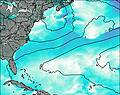
Live Weather:
At BUOY-CMAN4, 7 km from Poverty Beach.
light winds from the SW
(km/h)Air temperature
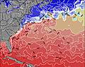
24.1°COverall Poverty Beach Surf Consistency and Wind Distribution in Julho


Wind stats for Poverty Beach: see the variation in direction and stength by month.
fotos da galeria
Contornos: Estradas & Rios: Escolha um spot de surf da lista 


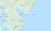
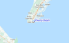
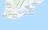
Use este mapa de relevo para navegar até New Jersey surf quebras e estações que estão na área de maré Poverty Beach
Outros Spots de Surf mais próximos de Poverty Beach:
(Clique no nome do local para maiores detalhes)- Closest spot1 mi
- Second closest spot1 mi
- Third closest spot2 mi
- Fourth closest spot2 mi
- Fifth closest spot3 mi
Bóias ondográficas mais próxima de Poverty Beach:
- Closest bóia ondográfica35 mi
- Second closest bóia ondográfica59 mi
- Third closest bóia ondográfica82 mi
- Fourth closest bóia ondográfica83 mi
- Fifth closest bóia ondográfica85 mi
Estações de maré mais próximo de Poverty Beach:
- Closest estação de maréCape May Harbor1 mi
- Second closest estação de maréCape Island Creek, Cape May2 mi
- Third closest estação de maréCape May, Atlantic Ocean3 mi
- Fourth closest estação de maréSwain Channel, Taylor Sound3 mi
- Fifth closest estação de maréWildwood Crest, ocean pier4 mi
Airports
- The closest passenger airport to Poverty Beach is Cape May Co (Wildwood) Airport (WWD) in USA, 8 km (5 miles) away (directly).
- The second nearest airport to Poverty Beach is Millville Muni Airport (MIV), also in USA, 50 km (31 miles) away.
- Third is Dover Afb Airport (DOV) in USA, 55 km (34 miles) away.
- Atlantic City International Airport (ACY) in USA is 63 km (39 miles) away.
- Salisbury Ocean City Wicomico Rgnl Airport (SBY), also in USA is the fifth nearest airport to Poverty Beach and is 86 km (53 miles) away.

- /breaks/Poverty-Beach/forecasts/latest

 Nearest