
Previsão:

Previsão de curto prazochuviscos (total 2mm), principalmente caindo na Qui à tarde. Warm (máx. 23°C na Quarta à noite, mín 18°C na Qui à noite). o vento será geralmente fraco. | ||||||||||||||||||||||||
Quar 15 | Quinta-feira 16 | Sexta-feira 17 | Sáb 18 | |||||||||||||||||||||
5 PM | 8 PM | 11 PM | 2 AM | 5 AM | 8 AM | 11 AM | 2 PM | 5 PM | 8 PM | 11 PM | 2 AM | 5 AM | 8 AM | 11 AM | 2 PM | 5 PM | 8 PM | 11 PM | 2 AM | 5 AM | 8 AM | 11 AM | 2 PM | |
Mapa da altura do Swell |  |  | 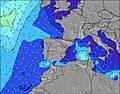 |  |  | 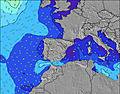 |  |  | 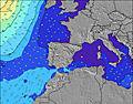 | |||||||||||||||
Swell Altura (m) Direção Período (s) | NNW 7 | NNW 6 | NNW 6 | N 6 | NNE 4 | N 5 | N 5 | N 5 | N 5 | N 5 | N 5 | N 5 | N 5 | N 5 | NNW 5 | N 5 | NNW 5 | N 5 | N 5 | NNW 5 | NNW 5 | NNW 5 | NNW 5 | N 5 |
Onda Gráfico | ||||||||||||||||||||||||
9 | 8 | 8 | 3 | 7 | 11 | 11 | 12 | 13 | 13 | 13 | 12 | 8 | 7 | 7 | 11 | 13 | 12 | 12 | 8 | 8 | 8 | 8 | 7 | |
Vento (km/h) | ||||||||||||||||||||||||
Estado do Vento maral cruzado-maral Cruzado cruzado-terral terral cristalino | cross-on | on | glassy | glassy | cross-off | glassy | cross-on | cross-on | cross-on | on | cross | glassy | cross | cross | on | on | on | on | glassy | cross-off | cross-off | cross-off | cross-off | cross |
Maré Alta | 6:11PM4.01m | 6:41AM3.67m | 6:58PM4.03m | 7:27AM3.61m | 7:44PM3.94m | 8:11AM3.48m | ||||||||||||||||||
Maré Baixa | 00:23AM-0.10m | 12:35PM0.09m | 1:10AM-0.07m | 1:21PM0.13m | 1:56AM0.05m | |||||||||||||||||||
— | — | — | — | 6:50 | — | — | — | — | — | — | — | 6:50 | — | — | — | — | — | — | — | 6:52 | — | — | — | |
— | 9:55 | — | — | — | — | — | — | — | 9:54 | — | — | — | — | — | — | — | 9:53 | — | — | — | — | — | 9:53 | |
mm | — | — | — | — | — | — | — | — | 1 | 1 | — | — | — | — | — | — | — | — | — | — | — | — | — | — |
Temp. °C | 24 | 23 | 21 | 21 | 20 | 20 | 22 | 23 | 23 | 20 | 19 | 19 | 18 | 18 | 21 | 22 | 22 | 21 | 19 | 18 | 18 | 18 | 21 | 23 |
Ressent. °C | 25 | 25 | 24 | 24 | 22 | 22 | 23 | 24 | 24 | 20 | 21 | 20 | 18 | 18 | 21 | 22 | 23 | 22 | 21 | 19 | 19 | 19 | 22 | 23 |
Swell 1 Altura (m) Direção Período (s) | NNW 7 | NNW 6 | NNW 6 | NNW 4 | NNE 4 | N 5 | N 5 | N 5 | N 5 | N 5 | N 5 | N 5 | N 5 | N 5 | NNW 5 | W 8 | NNW 5 | N 5 | N 5 | NNW 5 | NNW 5 | NNW 5 | NNW 5 | N 5 |
9 | 8 | 8 | 3 | 7 | 11 | 11 | 12 | 13 | 13 | 13 | 12 | 8 | 7 | 7 | 1 | 13 | 12 | 12 | 8 | 8 | 8 | 8 | 7 | |
Swell 2 Altura (m) Direção Período (s) | NE 4 | NE 4 | NNE 4 | NNE 4 | N 5 | N 6 | W 10 | W 10 | W 10 | NW 9 | NW 9 | W 9 | W 9 | W 9 | W 9 | — | W 8 | W 8 | W 8 | W 8 | W 8 | W 8 | NW 9 | NW 9 |
1 | 1 | 2 | 2 | 2 | 3 | 2 | 2 | 2 | 3 | 3 | 2 | 2 | 2 | 1 | — | 1 | 1 | 1 | 1 | 1 | 1 | 3 | 3 | |
Swell 3 Altura (m) Direção Período (s) | W 9 | NW 9 | W 9 | N 6 | W 9 | W 10 | NW 8 | W 7 | NW 7 | — | — | — | — | — | — | — | — | — | — | — | — | — | — | — |
2 | 3 | 2 | 3 | 2 | 2 | 2 | 1 | 2 | — | — | — | — | — | — | — | — | — | — | — | — | — | — | — | |
Ondas de vento Altura (m) Direção Período (s) | — | — | — | — | — | — | — | — | — | NNW 2 | — | — | — | — | — | N 5 | — | — | — | — | — | — | — | — |
— | — | — | — | — | — | — | — | — | 1 | — | — | — | — | — | 11 | — | — | — | — | — | — | — | — | |
Terral ou glassy mais perto | ||||||||||||||||||||||||
Distância (km) | 270 | 376 | 303 | 303 | 389 | 565 | 389 | 389 | 752 | 695 | 733 | 466 | 457 | 449 | 970 | 1504 | 1504 | 1052 | 934 | 751 | 755 | 802 | 1310 | |
Melhor previsões de ondas em Spain - Cantabria | ||||||||||||||||||||||||
Melhor previsões de ondas em Spain (Europe) | ||||||||||||||||||||||||
Buscador de Ondas Global | ||||||||||||||||||||||||
- Map Icons:
 Break
Break Live Wave Height (m)
 Live Wind Speed (km/h)
 Surf Rating (10 Max)
 Ocean Swells (m)
- Wind Speed (km/h)
widget de graça do Surf-Forecast.com para o seu site
O relatório de surf / widget do tempo abaixo está disponível para incorporar em sites de terceiros gratuitamente e fornece um resumo das nossas Playa de Meron surf tempo. Simplesmente pegar o trecho de código html que fornecemos e colá-lo em seu próprio site. Você pode escolher seu idioma preferido e unidades métrico/imperial para o surf tempo de alimentação para atender aos usuários do seu site.... Clique aqui para adquirir o código.
 Nearest