
Previsão:

Previsão de curto prazochuviscos (total 5mm), principalmente caindo na Terça à noite. Very mild (máx. 15°C na Sexta à tarde, mín 6°C na Terça à noite). Ventos aumentam (vento fraco de Oeste na Terça à noite, ventos frescos de Nordeste na Quinta de manhã). | ||||||||||||||||||
Ter 28 | Quarta-feira 29 | Quinta-feira 30 | ||||||||||||||||
6 PM | 9 PM | 12 AM | 3 AM | 6 AM | 9 AM | 12 PM | 3 PM | 6 PM | 9 PM | 12 AM | 3 AM | 6 AM | 9 AM | 12 PM | 3 PM | 6 PM | 9 PM | |
Mapa da altura do Swell |  | 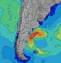 | 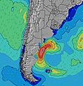 | 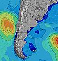 | 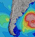 | 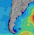 | 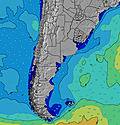 | |||||||||||
Swell Altura (m) Direção Período (s) | S 8 | S 7 | S 7 | S 7 | S 7 | S 7 | S 7 | S 7 | S 12 | S 12 | S 11 | S 11 | S 11 | S 10 | S 10 | NE 6 | ENE 6 | ENE 7 |
Onda Gráfico | ||||||||||||||||||
164 | 156 | 99 | 76 | 57 | 59 | 56 | 69 | 69 | 66 | 198 | 146 | 108 | 98 | 94 | 159 | 164 | 186 | |
Vento (km/h) | ||||||||||||||||||
Estado do Vento maral cruzado-maral Cruzado cruzado-terral terral cristalino | cross | cross-off | cross-off | cross-off | cross-off | cross-off | cross-off | cross | cross-on | on | cross | cross | cross | cross | cross | cross-off | cross-off | cross-off |
Maré Alta | 00:16AM3.16m | 12:13PM3.55m | 00:59AM3.29m | 12:56PM3.58m | ||||||||||||||
Maré Baixa | 6:01PM0.69m | 6:05AM1.15m | 6:42PM0.60m | 6:51AM1.07m | 7:22PM0.52m | |||||||||||||
— | — | — | — | 8:22 | — | — | — | — | — | — | — | 8:21 | — | — | — | — | — | |
6:13 | — | — | — | — | — | — | — | 6:14 | — | — | — | — | — | — | — | 6:15 | — | |
mm | 1 | 1 | — | — | — | — | — | — | — | — | — | — | 1 | 1 | 1 | — | — | — |
Temp. °C | 7 | 7 | 6 | 6 | 6 | 6 | 8 | 9 | 8 | 8 | 7 | 7 | 7 | 7 | 9 | 10 | 11 | 13 |
Ressent. °C | 3 | 4 | 2 | 3 | 2 | 2 | 4 | 5 | 5 | 5 | 4 | 3 | 2 | -1 | 2 | 2 | 4 | 7 |
Swell 1 Altura (m) Direção Período (s) | S 8 | S 7 | S 7 | S 7 | S 7 | S 7 | S 7 | S 7 | S 6 | S 6 | S 11 | S 11 | S 11 | S 10 | S 10 | S 10 | S 10 | S 9 |
164 | 156 | 99 | 76 | 57 | 59 | 56 | 69 | 40 | 29 | 198 | 146 | 108 | 98 | 94 | 66 | 65 | 60 | |
Swell 2 Altura (m) Direção Período (s) | ENE 7 | ENE 6 | S 10 | S 10 | S 9 | S 9 | S 9 | S 12 | S 12 | S 12 | ENE 7 | SE 6 | SE 6 | SE 6 | SE 6 | ESE 6 | SE 6 | SE 7 |
15 | 8 | 30 | 29 | 40 | 25 | 25 | 47 | 69 | 66 | 9 | 9 | 10 | 9 | 5 | 4 | 2 | 2 | |
Swell 3 Altura (m) Direção Período (s) | S 11 | WSW 4 | ENE 6 | ENE 6 | ENE 6 | ENE 7 | ENE 7 | ENE 7 | S 9 | S 9 | SE 7 | SE 7 | E 8 | — | — | — | — | — |
20 | 4 | 8 | 8 | 8 | 10 | 10 | 9 | 24 | 24 | 2 | 2 | 6 | — | — | — | — | — | |
Ondas de vento Altura (m) Direção Período (s) | WSW 5 | — | WSW 4 | WSW 4 | WSW 3 | WSW 3 | — | W 3 | — | — | — | ENE 8 | NE 3 | ENE 4 | ENE 5 | NE 6 | ENE 6 | ENE 7 |
10 | — | 3 | 1 | 1 | 2 | — | 1 | — | — | — | 13 | 4 | 23 | 80 | 159 | 164 | 186 | |
Terral ou glassy mais perto | ||||||||||||||||||
Distância (km) | 993 | 0 | 0 | 0 | 0 | 0 | 0 | 450 | 450 | 450 | 449 | 422 | 449 | 450 | 560 | 1086 | 1086 | 661 |
Melhor previsões de ondas em Provincia Río Negro | ||||||||||||||||||
Melhor previsões de ondas em Argentina | ||||||||||||||||||
Buscador de Ondas Global | ||||||||||||||||||
- Map Icons:
 Break
Break Live Wave Height (m)
 Live Wind Speed (km/h)
 Surf Rating (10 Max)
 Ocean Swells (m)
- Wind Speed (km/h)
widget de graça do Surf-Forecast.com para o seu site
O relatório de surf / widget do tempo abaixo está disponível para incorporar em sites de terceiros gratuitamente e fornece um resumo das nossas Picoto surf tempo. Simplesmente pegar o trecho de código html que fornecemos e colá-lo em seu próprio site. Você pode escolher seu idioma preferido e unidades métrico/imperial para o surf tempo de alimentação para atender aos usuários do seu site.... Clique aqui para adquirir o código.
 Nearest