
Previsão:

Previsão de curto prazochuviscos (total 4mm), principalmente caindo na Terça à tarde. Warm (máx. 27°C na Segunda à tarde, mín 25°C na Terça à noite). o vento será geralmente fraco. | |||||||||||||||||||||
Seg 27 | Terça-feira 28 | Quarta-feira 29 | |||||||||||||||||||
11 AM | 2 PM | 5 PM | 8 PM | 11 PM | 2 AM | 5 AM | 8 AM | 11 AM | 2 PM | 5 PM | 8 PM | 11 PM | 2 AM | 5 AM | 8 AM | 11 AM | 2 PM | 5 PM | 8 PM | 11 PM | |
Mapa da altura do Swell |  |  |  |  |  |  | 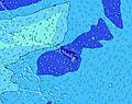 |  | |||||||||||||
Swell Altura (m) Direção Período (s) | E 14 | E 14 | E 14 | E 13 | E 13 | ENE 13 | ENE 13 | ENE 13 | ENE 12 | ENE 12 | NE 11 | NE 10 | ENE 10 | ENE 9 | ENE 9 | ENE 9 | ENE 8 | ENE 8 | ENE 8 | ENE 8 | ENE 8 |
Onda Gráfico | |||||||||||||||||||||
1294 | 1597 | 1632 | 1736 | 1890 | 2085 | 2433 | 2602 | 2228 | 1753 | 1457 | 1081 | 586 | 402 | 294 | 243 | 212 | 270 | 322 | 344 | 280 | |
Vento (km/h) | |||||||||||||||||||||
Estado do Vento maral cruzado-maral Cruzado cruzado-terral terral cristalino | cross-off | cross-off | cross-off | cross-off | cross-off | cross-off | cross-off | cross-off | cross-off | cross-off | cross-off | cross-off | glassy | glassy | cross | cross-on | on | on | on | on | cross-on |
Maré Alta | 2:50PM0.84m | 1:59AM0.41m | 3:19PM0.87m | 2:37AM0.44m | 3:47PM0.87m | ||||||||||||||||
Maré Baixa | 9:32PM0.22m | 8:03AM-0.07m | 9:56PM0.19m | 8:38AM-0.07m | 10:21PM0.17m | ||||||||||||||||
— | — | — | — | — | — | 5:54 | — | — | — | — | — | — | — | 5:54 | — | — | — | — | — | — | |
— | — | 6:59 | — | — | — | — | — | — | — | 6:58 | — | — | — | — | — | — | — | 6:58 | — | — | |
mm | — | — | — | — | — | — | — | — | — | — | 1 | 1 | — | — | — | — | — | — | 1 | 1 | — |
Temp. °C | 26 | 27 | 27 | 27 | 26 | 26 | 26 | 26 | 27 | 27 | 26 | 26 | 26 | 25 | 25 | 26 | 27 | 27 | 26 | 26 | 26 |
Ressent. °C | 27 | 28 | 28 | 29 | 28 | 28 | 27 | 27 | 28 | 29 | 29 | 30 | 31 | 29 | 29 | 29 | 28 | 29 | 28 | 29 | 29 |
Swell 1 Altura (m) Direção Período (s) | E 14 | E 14 | E 14 | E 13 | E 13 | ENE 13 | ENE 13 | ENE 13 | ENE 12 | ENE 12 | NE 11 | NE 10 | ENE 10 | ENE 9 | ENE 9 | ENE 9 | ENE 8 | ENE 8 | ENE 8 | ENE 8 | ENE 8 |
1294 | 1597 | 1632 | 1736 | 1890 | 2085 | 2433 | 2602 | 2228 | 1753 | 1457 | 1081 | 586 | 402 | 294 | 243 | 212 | 270 | 322 | 344 | 280 | |
Swell 2 Altura (m) Direção Período (s) | NNE 8 | SSE 11 | S 14 | NNE 8 | S 14 | NNE 8 | SE 10 | SE 10 | S 14 | N 9 | SE 10 | ESE 9 | NNE 9 | NNE 9 | NNE 9 | NNE 8 | NNE 8 | ESE 9 | S 13 | S 13 | NNE 8 |
158 | 11 | 153 | 179 | 150 | 197 | 15 | 15 | 134 | 246 | 14 | 8 | 180 | 162 | 134 | 85 | 58 | 8 | 3 | 3 | 7 | |
Swell 3 Altura (m) Direção Período (s) | S 15 | S 10 | S 10 | SE 9 | SE 9 | S 10 | S 17 | SE 10 | SE 10 | S 14 | SE 9 | S 10 | SE 9 | SE 9 | SE 9 | SE 9 | ESE 9 | S 13 | S 16 | E 20 | E 20 |
157 | 7 | 8 | 12 | 12 | 8 | 6 | 4 | 4 | 144 | 23 | 2 | 13 | 13 | 13 | 12 | 8 | 3 | 5 | 8 | 8 | |
Ondas de vento Altura (m) Direção Período (s) | NNE 8 | NNE 8 | NNE 8 | — | NNE 8 | — | NNE 9 | NNE 10 | NNE 5 | — | — | — | — | — | SE 3 | SSE 2 | — | — | — | — | — |
163 | 145 | 174 | — | 161 | — | 227 | 328 | 94 | — | — | — | — | — | 2 | 1 | — | — | — | — | — | |
Terral ou glassy mais perto | |||||||||||||||||||||
Distância (km) | 111 | 102 | 59 | 59 | 59 | 0 | 59 | 59 | 167 | 44 | 0 | 0 | 0 | 0 | 2 | 2 | 7 | 7 | 7 | 4 | 2 |
Melhor previsões de ondas em Big Island | |||||||||||||||||||||
Melhor previsões de ondas em United States | |||||||||||||||||||||
Buscador de Ondas Global | |||||||||||||||||||||
- Map Icons:
 Break
Break Live Wave Height (m)
 Live Wind Speed (km/h)
 Surf Rating (10 Max)
 Ocean Swells (m)
- Wind Speed (km/h)
widget de graça do Surf-Forecast.com para o seu site
O relatório de surf / widget do tempo abaixo está disponível para incorporar em sites de terceiros gratuitamente e fornece um resumo das nossas Papaikou Mill surf tempo. Simplesmente pegar o trecho de código html que fornecemos e colá-lo em seu próprio site. Você pode escolher seu idioma preferido e unidades métrico/imperial para o surf tempo de alimentação para atender aos usuários do seu site.... Clique aqui para adquirir o código.
 Nearest