
Previsão:

Previsão de curto prazoprincipalmente seco. Warm (máx. 27°C na Segunda de manhã, mín 19°C no Domingo à noite). Ventos diminuem (ventos frescos de Nor-Noroeste no Domingo à tarde, calmo na Seg de manhã). | |||||||||||||||||||||||
Domingo 26 | Segunda-feira 27 | Terça-feira 28 | |||||||||||||||||||||
4 AM | 7 AM | 10 AM | 1 PM | 4 PM | 7 PM | 10 PM | 1 AM | 4 AM | 7 AM | 10 AM | 1 PM | 4 PM | 7 PM | 10 PM | 1 AM | 4 AM | 7 AM | 10 AM | 1 PM | 4 PM | 7 PM | 10 PM | |
Mapa da altura do Swell | 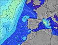 |  | 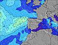 |  | 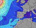 |  |  | 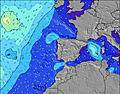 |  | ||||||||||||||
Swell Altura (m) Direção Período (s) | S 11 | S 11 | S 15 | S 15 | S 15 | S 15 | NNW 7 | NNW 7 | NW 7 | NNW 7 | NNW 7 | NNW 7 | NW 11 | NNW 7 | NNW 10 | S 13 | NNW 10 | S 13 | S 13 | S 13 | S 13 | S 13 | S 13 |
Onda Gráfico | |||||||||||||||||||||||
2 | 2 | 4 | 5 | 4 | 4 | 0 | 0 | 0 | 0 | 0 | 0 | 0 | 0 | 0 | 3 | 0 | 3 | 3 | 3 | 3 | 3 | 3 | |
Vento (km/h) | |||||||||||||||||||||||
Estado do Vento maral cruzado-maral Cruzado cruzado-terral terral cristalino | cross-off | off | off | off | off | off | off | cross-off | off | cross-off | glassy | cross | cross-off | cross-off | off | off | glassy | off | glassy | cross-off | cross-off | off | off |
Maré Alta | 1:19AM2.09m | 1:39PM2.30m | 2:05AM2.21m | 2:20PM2.45m | 2:43AM2.32m | 2:58PM2.59m | |||||||||||||||||
Maré Baixa | 7:21AM0.82m | 7:56PM0.69m | 8:04AM0.69m | 8:36PM0.56m | 8:41AM0.56m | 9:12PM0.44m | |||||||||||||||||
6:31 | — | — | — | — | — | — | — | 6:33 | — | — | — | — | — | — | — | 6:33 | — | — | — | — | — | — | |
— | — | — | — | — | 8:53 | — | — | — | — | — | — | — | 8:52 | — | — | — | — | — | — | — | 8:52 | — | |
mm | — | — | — | — | — | — | — | — | — | — | — | — | — | — | — | — | — | — | — | — | — | — | — |
Temp. °C | 18 | 18 | 21 | 24 | 24 | 22 | 20 | 19 | 19 | 20 | 24 | 27 | 25 | 24 | 22 | 22 | 22 | 21 | 24 | 26 | 26 | 23 | 21 |
Ressent. °C | 15 | 16 | 19 | 21 | 19 | 17 | 16 | 18 | 19 | 21 | 25 | 27 | 24 | 24 | 23 | 23 | 23 | 21 | 25 | 26 | 25 | 21 | 21 |
Swell 1 Altura (m) Direção Período (s) | WNW 10 | WNW 10 | WNW 10 | WNW 9 | WNW 9 | WNW 9 | WNW 9 | WNW 9 | NW 7 | NNW 7 | NNW 7 | NNW 7 | N 7 | NNW 7 | NNW 7 | NNW 9 | NNW 10 | NNW 10 | NNW 10 | NNW 10 | NW 10 | NW 10 | NW 10 |
10 | 18 | 18 | 16 | 16 | 16 | 16 | 15 | 85 | 137 | 121 | 124 | 94 | 91 | 99 | 266 | 281 | 333 | 314 | 308 | 286 | 220 | 211 | |
Swell 2 Altura (m) Direção Período (s) | S 11 | S 11 | S 15 | S 15 | S 15 | NW 13 | NW 14 | NNW 14 | WNW 8 | WNW 8 | NW 12 | NNW 11 | NW 11 | NW 10 | NNW 10 | WNW 9 | WNW 4 | WNW 8 | WNW 8 | WNW 8 | WNW 8 | WNW 8 | WNW 8 |
2 | 2 | 4 | 5 | 4 | 7 | 8 | 18 | 24 | 28 | 71 | 87 | 119 | 106 | 122 | 15 | 3 | 14 | 13 | 13 | 6 | 6 | 7 | |
Swell 3 Altura (m) Direção Período (s) | — | — | S 15 | — | — | S 15 | — | — | NW 13 | NW 12 | WNW 9 | WNW 9 | WNW 9 | WNW 9 | WNW 8 | S 13 | WNW 8 | S 13 | S 13 | S 13 | S 13 | S 13 | S 13 |
— | — | 4 | — | — | 4 | — | — | 27 | 40 | 25 | 15 | 15 | 15 | 14 | 3 | 14 | 3 | 3 | 3 | 3 | 3 | 3 | |
Ondas de vento Altura (m) Direção Período (s) | NNW 7 | NNW 7 | NNW 7 | NNW 7 | NNW 7 | NNW 7 | NNW 7 | NNW 7 | N 7 | — | — | — | WNW 5 | — | WNW 4 | WNW 4 | — | WNW 4 | — | — | WNW 8 | NW 3 | — |
277 | 295 | 319 | 286 | 270 | 247 | 240 | 189 | 70 | — | — | — | 5 | — | 6 | 6 | — | 3 | — | — | 39 | 5 | — | |
Terral ou glassy mais perto | |||||||||||||||||||||||
Distância (km) | 15 | 15 | 9 | 621 | 687 | 562 | 168 | 9 | 4 | 4 | 4 | 173 | 75 | 128 | 4 | 4 | 4 | 2 | 2 | 188 | 229 | 160 | 4 |
Melhor previsões de ondas em Lisboa | |||||||||||||||||||||||
Melhor previsões de ondas em Portugal | |||||||||||||||||||||||
Buscador de Ondas Global | |||||||||||||||||||||||
- Map Icons:
 Break
Break Live Wave Height (m)
 Live Wind Speed (km/h)
 Surf Rating (10 Max)
 Ocean Swells (m)
- Wind Speed (km/h)
widget de graça do Surf-Forecast.com para o seu site
O relatório de surf / widget do tempo abaixo está disponível para incorporar em sites de terceiros gratuitamente e fornece um resumo das nossas Paco D 'arcos surf tempo. Simplesmente pegar o trecho de código html que fornecemos e colá-lo em seu próprio site. Você pode escolher seu idioma preferido e unidades métrico/imperial para o surf tempo de alimentação para atender aos usuários do seu site.... Clique aqui para adquirir o código.
 Nearest