
Previsão:

Previsão de curto prazochuviscos (total 4mm), principalmente caindo na Terça à noite. Warm (máx. 23°C na Quarta à noite, mín 21°C na Terça à noite). principalmente ventos fortes. | ||||||||||||||||||
Seg 3 | Terça-feira 4 | Quarta-feira 5 | ||||||||||||||||
8 PM | 11 PM | 2 AM | 5 AM | 8 AM | 11 AM | 2 PM | 5 PM | 8 PM | 11 PM | 2 AM | 5 AM | 8 AM | 11 AM | 2 PM | 5 PM | 8 PM | 11 PM | |
Mapa da altura do Swell |  | 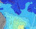 | 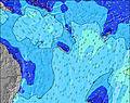 | 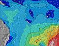 | 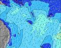 |  |  | |||||||||||
Swell Altura (m) Direção Período (s) | S 13 | S 13 | S 12 | S 12 | S 11 | E 6 | E 6 | S 10 | E 6 | E 6 | ESE 6 | ESE 7 | ESE 7 | E 7 | E 7 | NE 10 | NE 11 | NE 11 |
Onda Gráfico | ||||||||||||||||||
0 | 0 | 0 | 0 | 0 | 0 | 0 | 0 | 115 | 0 | 0 | 0 | 0 | 0 | 0 | 17 | 18 | 18 | |
Vento (km/h) | ||||||||||||||||||
Estado do Vento maral cruzado-maral Cruzado cruzado-terral terral cristalino | cross-off | cross-off | cross-off | cross-off | cross-off | cross-off | cross-off | cross-off | cross-off | cross-off | cross-off | cross-off | cross-off | cross-off | cross-off | cross-off | cross-off | cross-off |
Maré Alta | 8:33PM1.23m | 8:31AM1.07m | 9:15PM1.23m | 9:39AM0.99m | 10:06PM1.22m | |||||||||||||
Maré Baixa | 2:44AM0.50m | 2:39PM0.41m | 3:45AM0.48m | 3:28PM0.50m | ||||||||||||||
— | — | — | 6:11 | — | — | — | — | — | — | — | 6:11 | — | — | — | — | — | — | |
— | — | — | — | — | — | — | 5:32 | — | — | — | — | — | — | — | 5:32 | — | — | |
mm | — | — | — | — | — | — | — | — | — | 2 | 1 | — | — | — | — | — | — | 1 |
Temp. °C | 22 | 22 | 22 | 22 | 22 | 22 | 22 | 22 | 22 | 21 | 21 | 21 | 21 | 22 | 22 | 22 | 22 | 22 |
Ressent. °C | 17 | 17 | 17 | 17 | 17 | 17 | 18 | 18 | 19 | 18 | 16 | 16 | 16 | 18 | 19 | 19 | 18 | 18 |
Swell 1 Altura (m) Direção Período (s) | S 13 | S 13 | S 12 | S 12 | S 11 | S 10 | S 10 | S 10 | S 9 | S 9 | S 9 | S 9 | S 6 | S 6 | S 6 | S 9 | ENE 15 | S 8 |
162 | 160 | 184 | 178 | 157 | 104 | 98 | 121 | 109 | 76 | 57 | 40 | 13 | 12 | 7 | 25 | 47 | 12 | |
Swell 2 Altura (m) Direção Período (s) | S 8 | S 7 | NE 12 | NE 12 | NE 12 | NE 11 | NE 11 | ENE 11 | ENE 11 | NE 11 | NE 11 | NE 11 | NE 12 | NE 10 | ENE 16 | NE 10 | NE 11 | ENE 15 |
41 | 27 | 37 | 36 | 35 | 33 | 32 | 24 | 12 | 31 | 31 | 31 | 34 | 27 | 25 | 17 | 18 | 45 | |
Swell 3 Altura (m) Direção Período (s) | NE 12 | NE 12 | ENE 8 | ESE 12 | ESE 11 | S 12 | S 12 | ENE 18 | ENE 17 | ENE 17 | ENE 17 | ENE 16 | S 9 | S 9 | S 9 | ENE 16 | S 6 | NE 11 |
38 | 37 | 11 | 13 | 13 | 26 | 11 | 30 | 27 | 27 | 55 | 53 | 14 | 15 | 6 | 24 | 3 | 18 | |
Ondas de vento Altura (m) Direção Período (s) | ESE 6 | ESE 6 | ESE 6 | E 6 | E 6 | E 6 | E 6 | E 6 | E 6 | E 6 | ESE 6 | ESE 7 | ESE 7 | E 7 | E 7 | E 7 | E 7 | E 7 |
82 | 80 | 77 | 91 | 94 | 104 | 102 | 105 | 115 | 187 | 289 | 268 | 290 | 236 | 217 | 240 | 258 | 302 | |
Terral ou glassy mais perto | ||||||||||||||||||
Distância (km) | 1143 | 1827 | 1856 | 1827 | 994 | 994 | 932 | 1278 | 1827 | 932 | 548 | 548 | 548 | 548 | 548 | 548 | 548 | 548 |
Melhor previsões de ondas em Efate | ||||||||||||||||||
Melhor previsões de ondas em Vanuatu | ||||||||||||||||||
Buscador de Ondas Global | ||||||||||||||||||
- Map Icons:
 Break
Break Live Wave Height (m)
 Live Wind Speed (km/h)
 Surf Rating (10 Max)
 Ocean Swells (m)
- Wind Speed (km/h)
widget de graça do Surf-Forecast.com para o seu site
O relatório de surf / widget do tempo abaixo está disponível para incorporar em sites de terceiros gratuitamente e fornece um resumo das nossas Nagar surf tempo. Simplesmente pegar o trecho de código html que fornecemos e colá-lo em seu próprio site. Você pode escolher seu idioma preferido e unidades métrico/imperial para o surf tempo de alimentação para atender aos usuários do seu site.... Clique aqui para adquirir o código.
 Nearest