
Previsão:

Previsão de curto prazoAlguns chuviscos, mais intensos durante Domingo à noite. Warm (máx. 27°C no Sábado de manhã, mín 26°C no Sábado de manhã). principalmente ventos fortes. | |||||||||||||||||||||||
Sábado 18 | Domingo 19 | Segunda-feira 20 | |||||||||||||||||||||
5 AM | 8 AM | 11 AM | 2 PM | 5 PM | 8 PM | 11 PM | 2 AM | 5 AM | 8 AM | 11 AM | 2 PM | 5 PM | 8 PM | 11 PM | 2 AM | 5 AM | 8 AM | 11 AM | 2 PM | 5 PM | 8 PM | 11 PM | |
Mapa da altura do Swell |  |  | 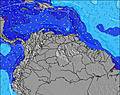 |  | 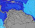 | 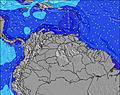 |  | 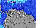 | 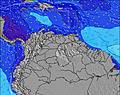 | ||||||||||||||
Swell Altura (m) Direção Período (s) | E 7 | E 7 | E 7 | E 8 | ENE 8 | ENE 8 | ENE 7 | ENE 8 | ENE 8 | ENE 8 | ENE 8 | ENE 8 | ENE 8 | ENE 8 | E 8 | E 8 | E 8 | ENE 8 | E 8 | E 8 | E 8 | ENE 8 | ENE 8 |
Onda Gráfico | |||||||||||||||||||||||
508 | 569 | 636 | 601 | 576 | 561 | 607 | 611 | 681 | 699 | 661 | 661 | 607 | 592 | 566 | 551 | 566 | 627 | 634 | 601 | 601 | 627 | 681 | |
Vento (km/h) | |||||||||||||||||||||||
Estado do Vento maral cruzado-maral Cruzado cruzado-terral terral cristalino | on | on | on | on | on | on | on | on | on | on | on | on | on | on | on | on | on | on | on | on | on | on | on |
Maré Alta | 3:34AM0.30m | 6:24PM0.25m | 4:43AM0.24m | 6:50PM0.29m | 5:58AM0.19m | 7:17PM0.31m | |||||||||||||||||
Maré Baixa | 10:49AM0.09m | 10:36PM0.20m | 11:00AM0.11m | 3:04AM0.18m | 11:00AM0.12m | ||||||||||||||||||
6:22 | — | — | — | — | — | — | — | 6:22 | — | — | — | — | — | — | — | 6:22 | — | — | — | — | — | — | |
— | — | — | — | 7:07 | — | — | — | — | — | — | — | 7:07 | — | — | — | — | — | — | — | 7:07 | — | — | |
mm | — | — | — | — | — | — | — | — | — | — | — | — | — | — | — | — | 1 | — | — | — | — | — | — |
Temp. °C | 27 | 26 | 27 | 27 | 27 | 27 | 27 | 26 | 26 | 26 | 27 | 27 | 27 | 27 | 27 | 27 | 26 | 26 | 26 | 27 | 27 | 27 | 27 |
Ressent. °C | 25 | 24 | 25 | 25 | 26 | 25 | 25 | 23 | 23 | 24 | 25 | 26 | 25 | 25 | 25 | 25 | 24 | 23 | 24 | 25 | 25 | 24 | 25 |
Swell 1 Altura (m) Direção Período (s) | — | — | — | — | — | — | — | — | — | — | — | — | — | — | — | — | — | — | — | — | — | — | — |
— | — | — | — | — | — | — | — | — | — | — | — | — | — | — | — | — | — | — | — | — | — | — | |
Swell 2 Altura (m) Direção Período (s) | — | — | — | — | — | — | — | — | — | — | — | — | — | — | — | — | — | — | — | — | — | — | — |
— | — | — | — | — | — | — | — | — | — | — | — | — | — | — | — | — | — | — | — | — | — | — | |
Swell 3 Altura (m) Direção Período (s) | — | — | — | — | — | — | — | — | — | — | — | — | — | — | — | — | — | — | — | — | — | — | — |
— | — | — | — | — | — | — | — | — | — | — | — | — | — | — | — | — | — | — | — | — | — | — | |
Ondas de vento Altura (m) Direção Período (s) | E 7 | E 7 | E 7 | E 8 | ENE 8 | ENE 8 | ENE 7 | ENE 8 | ENE 8 | ENE 8 | ENE 8 | ENE 8 | ENE 8 | ENE 8 | E 8 | E 8 | E 8 | ENE 8 | E 8 | E 8 | E 8 | ENE 8 | ENE 8 |
508 | 569 | 636 | 601 | 576 | 561 | 607 | 611 | 681 | 699 | 661 | 661 | 607 | 592 | 566 | 551 | 566 | 627 | 634 | 601 | 601 | 627 | 681 | |
Terral ou glassy mais perto | |||||||||||||||||||||||
Distância (km) | 283 | 283 | 375 | 973 | 375 | 375 | 375 | 375 | 375 | 304 | 304 | 375 | 375 | 304 | 304 | 283 | 283 | 283 | 375 | 375 | 375 | 375 | 304 |
Melhor previsões de ondas em Aruba | |||||||||||||||||||||||
Melhor previsões de ondas em Aruba | |||||||||||||||||||||||
Buscador de Ondas Global | |||||||||||||||||||||||
- Map Icons:
 Break
Break Live Wave Height (m)
 Live Wind Speed (km/h)
 Surf Rating (10 Max)
 Ocean Swells (m)
- Wind Speed (km/h)
widget de graça do Surf-Forecast.com para o seu site
O relatório de surf / widget do tempo abaixo está disponível para incorporar em sites de terceiros gratuitamente e fornece um resumo das nossas Muraya surf tempo. Simplesmente pegar o trecho de código html que fornecemos e colá-lo em seu próprio site. Você pode escolher seu idioma preferido e unidades métrico/imperial para o surf tempo de alimentação para atender aos usuários do seu site.... Clique aqui para adquirir o código.
 Nearest