
Previsão:

Previsão de curto prazoprincipalmente seco. Warm (máx. 28°C na Quarta à tarde, mín 26°C na Quarta à noite). principalmente ventos frescos. | ||||||||||||||||||||||||
Quar 15 | Quinta-feira 16 | Sexta-feira 17 | Sáb 18 | |||||||||||||||||||||
11 AM | 2 PM | 5 PM | 8 PM | 11 PM | 2 AM | 5 AM | 8 AM | 11 AM | 2 PM | 5 PM | 8 PM | 11 PM | 2 AM | 5 AM | 8 AM | 11 AM | 2 PM | 5 PM | 8 PM | 11 PM | 2 AM | 5 AM | 8 AM | |
Mapa da altura do Swell |  |  | 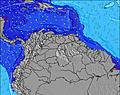 | 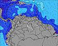 |  | 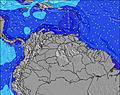 | 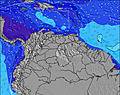 | 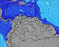 | 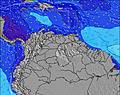 | |||||||||||||||
Swell Altura (m) Direção Período (s) | N 9 | NNW 8 | N 9 | N 9 | N 9 | N 9 | N 9 | N 9 | N 8 | N 8 | N 8 | N 8 | N 7 | N 7 | NNE 8 | N 7 | NNE 8 | NNE 7 | NNE 8 | NNE 8 | NNE 8 | NNE 7 | NNE 7 | NNE 7 |
Onda Gráfico | ||||||||||||||||||||||||
3 | 6 | 2 | 2 | 2 | 2 | 2 | 2 | 5 | 5 | 5 | 10 | 9 | 9 | 7 | 8 | 7 | 9 | 13 | 12 | 11 | 11 | 11 | 10 | |
Vento (km/h) | ||||||||||||||||||||||||
Estado do Vento maral cruzado-maral Cruzado cruzado-terral terral cristalino | cross-off | cross-off | cross-off | cross-off | cross-off | cross-off | cross-off | cross-off | cross-off | cross-off | cross-off | cross-off | cross-off | cross-off | cross-off | cross-off | cross-off | cross-off | cross-off | cross-off | cross-off | cross-off | cross-off | cross-off |
Maré Alta | 9:56PM0.41m | 7:49AM0.24m | 10:35PM0.39m | 9:34AM0.25m | 11:08PM0.36m | |||||||||||||||||||
Maré Baixa | 1:46PM-0.00m | 4:34AM0.22m | 2:43PM0.04m | 4:56AM0.20m | 3:40PM0.09m | 5:24AM0.18m | ||||||||||||||||||
— | — | — | — | — | — | 5:45 | — | — | — | — | — | — | — | 5:45 | — | — | — | — | — | — | — | 5:46 | — | |
— | — | 6:51 | — | — | — | — | — | — | — | 6:51 | — | — | — | — | — | — | — | 6:51 | — | — | — | — | 6:51 | |
mm | — | — | — | — | — | — | — | — | — | — | — | — | — | — | — | — | — | — | — | — | — | — | — | — |
Temp. °C | 27 | 28 | 27 | 26 | 26 | 26 | 26 | 26 | 26 | 27 | 26 | 26 | 26 | 26 | 26 | 26 | 26 | 27 | 26 | 26 | 26 | 26 | 26 | 26 |
Ressent. °C | 26 | 27 | 26 | 25 | 25 | 25 | 25 | 25 | 25 | 27 | 25 | 25 | 25 | 25 | 25 | 25 | 25 | 27 | 25 | 25 | 25 | 24 | 24 | 24 |
Swell 1 Altura (m) Direção Período (s) | N 9 | NNW 8 | NW 8 | NW 7 | NW 7 | NW 7 | NW 7 | N 8 | N 8 | N 8 | N 8 | N 8 | N 7 | N 7 | N 7 | N 7 | NNE 8 | NNE 7 | NNE 8 | NNE 8 | NNE 8 | NNE 7 | NNE 7 | NNE 7 |
2 | 6 | 2 | 2 | 2 | 2 | 2 | 1 | 5 | 5 | 5 | 10 | 9 | 9 | 4 | 8 | 7 | 9 | 13 | 12 | 11 | 11 | 11 | 10 | |
Swell 2 Altura (m) Direção Período (s) | NW 8 | N 9 | N 9 | N 9 | N 9 | N 9 | N 8 | NW 7 | NW 6 | NW 6 | NW 6 | NW 6 | N 6 | N 6 | NNE 8 | NNE 9 | N 7 | — | NE 10 | NE 10 | NE 10 | NNE 10 | NNE 9 | NNE 9 |
3 | 2 | 2 | 2 | 2 | 2 | 1 | 2 | 2 | 2 | 2 | 1 | 1 | 1 | 7 | 7 | 4 | — | 4 | 4 | 4 | 9 | 8 | 8 | |
Swell 3 Altura (m) Direção Período (s) | N 6 | N 9 | N 5 | — | N 9 | N 9 | N 9 | N 9 | N 9 | E 13 | — | — | — | — | N 6 | NE 10 | N 7 | — | — | N 8 | — | N 8 | N 8 | NNE 7 |
1 | 2 | 1 | — | 2 | 2 | 2 | 2 | 2 | 3 | — | — | — | — | 1 | 4 | 1 | — | — | 1 | — | 1 | 1 | 5 | |
Ondas de vento Altura (m) Direção Período (s) | E 7 | E 7 | E 7 | E 7 | E 7 | E 7 | E 7 | E 7 | E 7 | E 7 | E 7 | E 7 | E 7 | E 7 | E 7 | E 7 | E 7 | E 7 | E 7 | E 7 | E 7 | E 6 | E 7 | E 7 |
107 | 107 | 108 | 131 | 127 | 127 | 124 | 127 | 150 | 154 | 131 | 131 | 138 | 138 | 131 | 131 | 131 | 127 | 127 | 128 | 171 | 187 | 173 | 178 | |
Terral ou glassy mais perto | ||||||||||||||||||||||||
Distância (km) | 37 | 246 | 157 | 246 | 246 | 648 | 720 | 720 | 889 | 246 | 803 | 676 | 682 | 246 | 246 | 373 | 300 | 157 | 246 | 433 | 439 | 720 | 648 | 720 |
Melhor previsões de ondas em Netherlands-Antilles - Saint Martin | ||||||||||||||||||||||||
Melhor previsões de ondas em Netherlands Antilles | ||||||||||||||||||||||||
Buscador de Ondas Global | ||||||||||||||||||||||||
- Map Icons:
 Break
Break Live Wave Height (m)
 Live Wind Speed (km/h)
 Surf Rating (10 Max)
 Ocean Swells (m)
- Wind Speed (km/h)
widget de graça do Surf-Forecast.com para o seu site
O relatório de surf / widget do tempo abaixo está disponível para incorporar em sites de terceiros gratuitamente e fornece um resumo das nossas Mullet Bay surf tempo. Simplesmente pegar o trecho de código html que fornecemos e colá-lo em seu próprio site. Você pode escolher seu idioma preferido e unidades métrico/imperial para o surf tempo de alimentação para atender aos usuários do seu site.... Clique aqui para adquirir o código.
 Nearest