
Previsão:

Previsão de curto prazoprincipalmente seco. Warm (máx. 28°C na Qui de manhã, mín 22°C na Seg à noite). principalmente ventos frescos. | ||||||||||||||||||
Seg 3 | Terça-feira 4 | Quarta-feira 5 | ||||||||||||||||
6 PM | 9 PM | 12 AM | 3 AM | 6 AM | 9 AM | 12 PM | 3 PM | 6 PM | 9 PM | 12 AM | 3 AM | 6 AM | 9 AM | 12 PM | 3 PM | 6 PM | 9 PM | |
Mapa da altura do Swell |  |  | 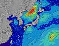 |  |  | 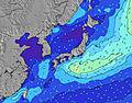 |  | |||||||||||
Swell Altura (m) Direção Período (s) | SE 16 | SE 17 | SE 17 | SE 16 | SE 17 | ESE 16 | ESE 16 | ESE 16 | SE 16 | SE 16 | SE 16 | SE 15 | SE 15 | SE 16 | SE 16 | SE 16 | SSE 15 | SSE 15 |
Onda Gráfico | ||||||||||||||||||
3512 | 4095 | 4420 | 3761 | 5672 | 7039 | 7474 | 7584 | 8478 | 8967 | 9052 | 8654 | 8831 | 9407 | 9324 | 8715 | 7635 | 5939 | |
Vento (km/h) | ||||||||||||||||||
Estado do Vento maral cruzado-maral Cruzado cruzado-terral terral cristalino | off | off | off | off | off | off | off | off | off | off | off | off | off | off | off | off | off | off |
Maré Alta | 7:33PM1.45m | 7:34AM1.34m | 7:55PM1.45m | 8:34AM1.24m | 8:19PM1.44m | |||||||||||||
Maré Baixa | 1:41AM0.57m | 1:38PM0.56m | 2:28AM0.52m | 2:08PM0.74m | ||||||||||||||
— | — | — | 4:50 | — | — | — | — | — | — | — | 4:52 | — | — | — | — | — | — | |
6:42 | — | — | — | — | — | — | — | 6:40 | — | — | — | — | — | — | — | 6:39 | — | |
mm | — | — | — | — | — | — | — | — | — | — | — | — | — | — | — | — | — | — |
Temp. °C | 25 | 24 | 23 | 22 | 23 | 24 | 25 | 26 | 24 | 23 | 23 | 23 | 23 | 24 | 26 | 27 | 27 | 26 |
Ressent. °C | 23 | 21 | 20 | 19 | 19 | 20 | 22 | 23 | 21 | 20 | 20 | 20 | 20 | 21 | 25 | 27 | 28 | 28 |
Swell 1 Altura (m) Direção Período (s) | SE 16 | SE 17 | SE 17 | SE 16 | SE 17 | ESE 16 | ESE 16 | ESE 16 | SE 16 | SE 16 | SE 16 | SE 15 | SE 15 | SE 16 | SE 16 | SE 16 | SSE 15 | SSE 15 |
3512 | 4095 | 4420 | 3761 | 5672 | 7039 | 7474 | 7584 | 8478 | 8967 | 9052 | 8654 | 8831 | 9407 | 9324 | 8715 | 7635 | 5939 | |
Swell 2 Altura (m) Direção Período (s) | E 14 | E 14 | ENE 14 | SE 20 | ENE 14 | ENE 14 | E 13 | ENE 13 | ENE 13 | ENE 13 | ENE 13 | ENE 13 | ENE 13 | — | ENE 18 | — | ENE 18 | ENE 18 |
100 | 98 | 63 | 1233 | 62 | 63 | 92 | 58 | 58 | 57 | 57 | 57 | 55 | — | 31 | — | 30 | 30 | |
Swell 3 Altura (m) Direção Período (s) | — | — | — | ENE 14 | — | — | — | — | — | — | — | — | — | — | — | — | — | — |
— | — | — | 63 | — | — | — | — | — | — | — | — | — | — | — | — | — | — | |
Ondas de vento Altura (m) Direção Período (s) | ENE 6 | ENE 7 | ENE 7 | ENE 7 | ENE 8 | ENE 8 | ENE 8 | ENE 8 | ENE 7 | ENE 7 | ENE 7 | — | — | — | — | — | — | E 11 |
175 | 230 | 314 | 294 | 327 | 532 | 575 | 452 | 456 | 508 | 403 | — | — | — | — | — | — | 599 | |
Terral ou glassy mais perto | ||||||||||||||||||
Distância (km) | 153 | 153 | 501 | 153 | 153 | 504 | 153 | 14 | 504 | 504 | 504 | 501 | 501 | 501 | 501 | 14 | 14 | 0 |
Melhor previsões de ondas em Chiba | ||||||||||||||||||
Melhor previsões de ondas em Japan | ||||||||||||||||||
Buscador de Ondas Global | ||||||||||||||||||
- Map Icons:
 Break
Break Live Wave Height (m)
 Live Wind Speed (km/h)
 Surf Rating (10 Max)
 Ocean Swells (m)
- Wind Speed (km/h)
widget de graça do Surf-Forecast.com para o seu site
O relatório de surf / widget do tempo abaixo está disponível para incorporar em sites de terceiros gratuitamente e fornece um resumo das nossas Mera surf tempo. Simplesmente pegar o trecho de código html que fornecemos e colá-lo em seu próprio site. Você pode escolher seu idioma preferido e unidades métrico/imperial para o surf tempo de alimentação para atender aos usuários do seu site.... Clique aqui para adquirir o código.
 Nearest