
Previsão:

Previsão de curto prazochuviscos (total 7mm), principalmente caindo na Terça à noite. Warm (máx. 29°C na Quarta à tarde, mín 24°C na Terça de manhã). o vento será geralmente fraco. | ||||||||||||||||||||||
Terça-feira 28 | Quarta-feira 29 | Quinta-feira 30 | ||||||||||||||||||||
6 AM | 9 AM | 12 PM | 3 PM | 6 PM | 9 PM | 12 AM | 3 AM | 6 AM | 9 AM | 12 PM | 3 PM | 6 PM | 9 PM | 12 AM | 3 AM | 6 AM | 9 AM | 12 PM | 3 PM | 6 PM | 9 PM | |
Mapa da altura do Swell |  |  |  | 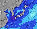 |  |  | 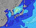 |  | ||||||||||||||
Swell Altura (m) Direção Período (s) | ENE 7 | ENE 8 | ENE 8 | SE 10 | SE 10 | SE 10 | SE 10 | SSW 6 | SW 6 | SW 6 | SSW 7 | SSW 7 | SSW 7 | SW 7 | SSW 7 | SSW 7 | SSW 7 | SSW 7 | SSW 7 | SE 10 | SE 10 | SE 10 |
Onda Gráfico | ||||||||||||||||||||||
86 | 81 | 64 | 63 | 63 | 61 | 48 | 68 | 167 | 239 | 180 | 102 | 138 | 119 | 88 | 62 | 54 | 42 | 41 | 29 | 29 | 28 | |
Vento (km/h) | ||||||||||||||||||||||
Estado do Vento maral cruzado-maral Cruzado cruzado-terral terral cristalino | cross-off | glassy | on | cross-on | cross-on | cross | cross-off | cross-off | off | glassy | cross | cross | cross | cross-off | cross | cross | cross-off | glassy | glassy | cross-on | cross | glassy |
Maré Alta | 5:21PM1.27m | 3:19AM1.38m | 5:42PM1.30m | 4:01AM1.42m | 6:03PM1.32m | |||||||||||||||||
Maré Baixa | 10:04AM0.17m | 10:04PM0.97m | 10:37AM0.13m | 10:38PM0.90m | 11:08AM0.12m | |||||||||||||||||
4:43 | — | — | — | — | — | — | 4:43 | — | — | — | — | — | — | — | 4:45 | — | — | — | — | — | — | |
— | — | — | — | 6:45 | — | — | — | — | — | — | — | 6:45 | — | — | — | — | — | — | — | 6:44 | — | |
mm | — | — | — | — | — | 3 | — | — | — | — | — | — | 1 | 2 | 1 | — | — | — | — | — | — | — |
Temp. °C | 23 | 24 | 26 | 27 | 26 | 27 | 26 | 25 | 25 | 27 | 28 | 29 | 27 | 26 | 26 | 26 | 26 | 26 | 28 | 27 | 27 | 26 |
Ressent. °C | 26 | 28 | 29 | 29 | 28 | 29 | 28 | 28 | 29 | 32 | 31 | 33 | 31 | 30 | 30 | 29 | 29 | 31 | 31 | 30 | 30 | 30 |
Swell 1 Altura (m) Direção Período (s) | ENE 7 | ENE 8 | ENE 8 | ENE 8 | ENE 7 | SE 10 | ENE 7 | SE 10 | SSW 6 | SSW 7 | SSW 7 | SE 10 | SE 10 | SW 7 | SSW 7 | SSW 7 | SSW 7 | SSW 7 | SSW 7 | S 8 | S 8 | S 8 |
86 | 81 | 64 | 58 | 43 | 61 | 31 | 48 | 97 | 107 | 113 | 47 | 47 | 119 | 88 | 62 | 54 | 42 | 41 | 29 | 29 | 28 | |
Swell 2 Altura (m) Direção Período (s) | SE 10 | SE 10 | SE 10 | SE 10 | SE 10 | ENE 7 | SE 10 | ENE 7 | SE 10 | SE 10 | SE 10 | E 9 | ENE 9 | SE 10 | SE 10 | SE 10 | SE 10 | SE 10 | SE 10 | SE 10 | ENE 8 | ENE 8 |
63 | 63 | 49 | 63 | 63 | 19 | 48 | 31 | 48 | 34 | 48 | 26 | 16 | 46 | 33 | 23 | 23 | 23 | 23 | 24 | 14 | 23 | |
Swell 3 Altura (m) Direção Período (s) | SSW 9 | SSW 9 | SSW 9 | SSW 9 | SSW 8 | E 8 | SSW 8 | SE 13 | ENE 7 | ENE 6 | ENE 9 | NE 8 | E 13 | E 9 | E 9 | E 9 | E 9 | E 9 | E 8 | ENE 8 | SE 10 | SE 10 |
25 | 26 | 25 | 25 | 24 | 12 | 14 | 27 | 15 | 8 | 28 | 11 | 14 | 14 | 14 | 14 | 14 | 14 | 13 | 14 | 25 | 24 | |
Ondas de vento Altura (m) Direção Período (s) | — | — | — | — | S 3 | SSW 4 | SW 5 | SSW 6 | SW 6 | SW 6 | SSW 7 | SSW 7 | SSW 7 | — | — | — | NE 6 | — | ENE 2 | — | — | — |
— | — | — | — | 3 | 21 | 37 | 68 | 167 | 239 | 180 | 102 | 138 | — | — | — | 1 | — | 1 | — | — | — | |
Terral ou glassy mais perto | ||||||||||||||||||||||
Distância (km) | 0 | 0 | 15 | 15 | 15 | 15 | 15 | 0 | 0 | 0 | 15 | 3 | 15 | 0 | 6 | 6 | 0 | 0 | 0 | 15 | 15 | 0 |
Melhor previsões de ondas em Chiba | ||||||||||||||||||||||
Melhor previsões de ondas em Japan | ||||||||||||||||||||||
Buscador de Ondas Global | ||||||||||||||||||||||
- Map Icons:
 Break
Break Live Wave Height (m)
 Live Wind Speed (km/h)
 Surf Rating (10 Max)
 Ocean Swells (m)
- Wind Speed (km/h)
widget de graça do Surf-Forecast.com para o seu site
O relatório de surf / widget do tempo abaixo está disponível para incorporar em sites de terceiros gratuitamente e fornece um resumo das nossas Matsube Bay surf tempo. Simplesmente pegar o trecho de código html que fornecemos e colá-lo em seu próprio site. Você pode escolher seu idioma preferido e unidades métrico/imperial para o surf tempo de alimentação para atender aos usuários do seu site.... Clique aqui para adquirir o código.
 Nearest