
Previsão:

Previsão de curto prazochuviscos (total 6mm), principalmente caindo no Sábado à tarde. Warm (máx. 27°C na Sexta à tarde, mín 19°C no Domingo à noite). Ventos diminuem (ventos frescos de Sudoeste no Sábado à tarde, calmo na Seg de manhã). | |||||||||||||||||||||
Sex 17 | Sábado 18 | Domingo 19 | |||||||||||||||||||
11 AM | 2 PM | 5 PM | 8 PM | 11 PM | 2 AM | 5 AM | 8 AM | 11 AM | 2 PM | 5 PM | 8 PM | 11 PM | 2 AM | 5 AM | 8 AM | 11 AM | 2 PM | 5 PM | 8 PM | 11 PM | |
Mapa da altura do Swell |  |  |  | 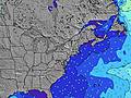 |  |  | 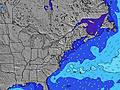 |  | |||||||||||||
Swell Altura (m) Direção Período (s) | S 14 | S 14 | SSW 6 | SSW 6 | SW 4 | SW 4 | SSW 5 | SSW 5 | SSW 4 | SSW 4 | SSW 5 | S 5 | S 5 | SE 13 | SE 13 | SE 13 | SE 13 | SE 13 | SE 13 | SE 12 | SE 12 |
Onda Gráfico | |||||||||||||||||||||
4 | 4 | 22 | 28 | 8 | 8 | 14 | 13 | 11 | 46 | 91 | 71 | 64 | 7 | 7 | 7 | 7 | 7 | 6 | 6 | 6 | |
Vento (km/h) | |||||||||||||||||||||
Estado do Vento maral cruzado-maral Cruzado cruzado-terral terral cristalino | cross | cross-on | cross-on | cross-on | cross-on | cross-on | cross-on | on | on | on | on | on | cross-on | cross-on | cross-on | cross-off | cross-off | cross | cross-off | cross-off | cross-off |
Maré Alta | 10:57AM1.06m | 11:18PM1.06m | 11:47AM1.04m | 00:07AM0.97m | 12:38PM1.00m | ||||||||||||||||
Maré Baixa | 5:12PM-0.06m | 5:38AM-0.07m | 6:06PM0.01m | 6:23AM-0.01m | 7:03PM0.08m | ||||||||||||||||
— | — | — | — | — | — | 5:26 | — | — | — | — | — | — | — | 5:28 | — | — | — | — | — | — | |
— | — | — | 8:16 | — | — | — | — | — | — | — | 8:15 | — | — | — | — | — | — | — | 8:15 | — | |
mm | — | — | — | — | — | — | — | — | — | — | 2 | — | 1 | 1 | 2 | — | — | — | — | — | — |
Temp. °C | 24 | 26 | 27 | 25 | 23 | 22 | 21 | 22 | 24 | 24 | 20 | 22 | 22 | 22 | 22 | 22 | 25 | 27 | 27 | 24 | 22 |
Ressent. °C | 21 | 22 | 23 | 22 | 21 | 21 | 21 | 22 | 22 | 20 | 17 | 20 | 22 | 21 | 22 | 21 | 22 | 24 | 23 | 21 | 19 |
Swell 1 Altura (m) Direção Período (s) | SSW 5 | SSW 6 | SE 8 | SE 8 | SSW 5 | SSW 5 | SE 8 | SE 8 | SE 8 | SE 8 | SE 13 | SE 13 | SE 13 | SE 13 | SSW 7 | SSW 7 | SSW 7 | SSW 7 | SSW 7 | SSW 7 | SSW 7 |
7 | 10 | 3 | 3 | 10 | 15 | 3 | 3 | 3 | 3 | 7 | 7 | 7 | 7 | 281 | 242 | 167 | 143 | 114 | 114 | 86 | |
Swell 2 Altura (m) Direção Período (s) | SE 8 | SE 8 | S 14 | S 14 | SE 8 | SE 8 | SE 14 | SE 14 | SE 14 | SE 13 | SE 13 | SE 13 | SE 13 | S 8 | SE 13 | SE 13 | SE 13 | SE 13 | SE 13 | SE 12 | SE 12 |
3 | 3 | 4 | 4 | 3 | 3 | 8 | 7 | 7 | 7 | 7 | 7 | 7 | 1 | 7 | 7 | 7 | 7 | 6 | 6 | 6 | |
Swell 3 Altura (m) Direção Período (s) | S 14 | S 14 | — | E 9 | SE 14 | SE 14 | — | — | E 8 | — | — | — | — | — | — | — | — | — | — | — | — |
4 | 4 | — | 2 | 8 | 8 | — | — | 1 | — | — | — | — | — | — | — | — | — | — | — | — | |
Ondas de vento Altura (m) Direção Período (s) | — | — | SSW 6 | SSW 6 | SW 4 | SW 4 | SSW 5 | SSW 5 | SSW 4 | SSW 4 | SSW 5 | S 5 | S 5 | SSW 6 | SSW 7 | — | NW 3 | NNW 3 | — | — | — |
— | — | 22 | 28 | 6 | 5 | 14 | 13 | 11 | 46 | 91 | 71 | 64 | 112 | 394 | — | 1 | 1 | — | — | — | |
Terral ou glassy mais perto | |||||||||||||||||||||
Distância (km) | 2508 | 618 | 618 | 618 | 626 | 618 | 751 | 1066 | 1066 | 2617 | 268 | 719 | 439 | 288 | 5 | 10 | 1 | 5 | 5 | 0 | 0 |
Melhor previsões de ondas em Rhode Island | |||||||||||||||||||||
Melhor previsões de ondas em United States | |||||||||||||||||||||
Buscador de Ondas Global | |||||||||||||||||||||
- Map Icons:
 Break
Break Live Wave Height (m)
 Live Wind Speed (km/h)
 Surf Rating (10 Max)
 Ocean Swells (m)
- Wind Speed (km/h)
widget de graça do Surf-Forecast.com para o seu site
O relatório de surf / widget do tempo abaixo está disponível para incorporar em sites de terceiros gratuitamente e fornece um resumo das nossas Matunuck-Trestles surf tempo. Simplesmente pegar o trecho de código html que fornecemos e colá-lo em seu próprio site. Você pode escolher seu idioma preferido e unidades métrico/imperial para o surf tempo de alimentação para atender aos usuários do seu site.... Clique aqui para adquirir o código.
 Nearest