
Previsão:

Previsão de curto prazoprincipalmente seco. Warm (máx. 29°C na Sexta de manhã, mín 25°C na Sexta de noite). principalmente ventos frescos. | |||||||||||||||||||||||
Sexta-feira 17 | Sábado 18 | Domingo 19 | |||||||||||||||||||||
5 AM | 8 AM | 11 AM | 2 PM | 5 PM | 8 PM | 11 PM | 2 AM | 5 AM | 8 AM | 11 AM | 2 PM | 5 PM | 8 PM | 11 PM | 2 AM | 5 AM | 8 AM | 11 AM | 2 PM | 5 PM | 8 PM | 11 PM | |
Mapa da altura do Swell | 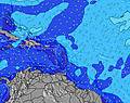 |  |  |  |  |  |  |  |  | ||||||||||||||
Swell Altura (m) Direção Período (s) | E 5 | E 6 | E 6 | E 6 | E 6 | E 6 | E 6 | E 6 | E 6 | E 6 | E 7 | E 7 | E 7 | E 7 | E 7 | E 7 | E 7 | E 7 | E 7 | E 7 | E 7 | E 7 | E 7 |
Onda Gráfico | |||||||||||||||||||||||
45 | 52 | 98 | 120 | 128 | 109 | 106 | 106 | 92 | 95 | 128 | 131 | 131 | 111 | 110 | 130 | 134 | 138 | 139 | 142 | 187 | 171 | 176 | |
Vento (km/h) | |||||||||||||||||||||||
Estado do Vento maral cruzado-maral Cruzado cruzado-terral terral cristalino | cross | cross | cross-on | cross-on | cross-on | cross-on | cross | cross | cross | cross | cross-on | cross-on | cross-on | cross-on | cross | cross | cross | cross | cross-on | cross-on | cross-on | cross-on | cross |
Maré Alta | 11:01AM0.58m | 11:31PM0.71m | 11:59AM0.60m | 00:16AM0.65m | 12:57PM0.62m | ||||||||||||||||||
Maré Baixa | 5:12AM0.11m | 5:01PM0.08m | 5:56AM0.11m | 6:01PM0.13m | 6:40AM0.10m | 7:04PM0.18m | |||||||||||||||||
6:11 | — | — | — | — | — | — | — | 6:11 | — | — | — | — | — | — | — | 6:11 | — | — | — | — | — | — | |
— | — | — | — | 7:22 | — | — | — | — | — | — | — | 7:22 | — | — | — | — | — | — | — | 7:22 | — | — | |
mm | — | — | — | — | — | — | — | — | — | — | — | — | — | — | — | — | — | — | — | — | — | — | — |
Temp. °C | 25 | 26 | 29 | 28 | 28 | 27 | 26 | 26 | 25 | 26 | 29 | 28 | 28 | 27 | 26 | 25 | 25 | 26 | 29 | 28 | 28 | 27 | 26 |
Ressent. °C | 27 | 28 | 29 | 27 | 27 | 28 | 26 | 28 | 27 | 27 | 29 | 27 | 28 | 28 | 28 | 26 | 27 | 27 | 28 | 26 | 27 | 28 | 27 |
Swell 1 Altura (m) Direção Período (s) | E 8 | E 7 | NNE 7 | NNE 7 | NNE 6 | NNE 7 | NNE 7 | NNE 7 | NNE 7 | NNE 8 | NNE 7 | NNE 6 | NE 9 | NE 9 | NE 9 | NE 9 | E 7 | E 7 | NE 8 | NE 8 | NE 8 | NE 8 | NE 8 |
18 | 17 | 5 | 5 | 4 | 5 | 5 | 5 | 4 | 6 | 4 | 4 | 3 | 12 | 12 | 12 | 134 | 138 | 11 | 11 | 11 | 10 | 10 | |
Swell 2 Altura (m) Direção Período (s) | N 6 | NNE 7 | N 6 | N 6 | NE 9 | NE 9 | NE 9 | NE 9 | NE 9 | NE 9 | NE 9 | NNE 9 | NNE 7 | — | — | — | NE 8 | NE 8 | — | — | — | — | — |
3 | 5 | 1 | 1 | 3 | 3 | 3 | 3 | 3 | 3 | 3 | 8 | 5 | — | — | — | 11 | 11 | — | — | — | — | — | |
Swell 3 Altura (m) Direção Período (s) | NE 7 | N 6 | NE 10 | — | — | — | — | — | — | — | — | — | — | — | — | — | — | — | — | — | — | — | — |
2 | 3 | 4 | — | — | — | — | — | — | — | — | — | — | — | — | — | — | — | — | — | — | — | — | |
Ondas de vento Altura (m) Direção Período (s) | E 5 | E 6 | E 6 | E 6 | E 6 | E 6 | E 6 | E 6 | E 6 | E 6 | E 7 | E 7 | E 7 | E 7 | E 7 | E 7 | — | — | E 7 | E 7 | E 7 | E 7 | E 7 |
45 | 52 | 98 | 120 | 128 | 109 | 106 | 106 | 92 | 95 | 128 | 131 | 131 | 111 | 110 | 130 | — | — | 139 | 142 | 187 | 171 | 176 | |
Terral ou glassy mais perto | |||||||||||||||||||||||
Distância (km) | 33 | 33 | 505 | 1078 | 1078 | 1078 | 152 | 33 | 14 | 34 | 1078 | 1078 | 1078 | 1078 | 14 | 14 | 14 | 14 | 505 | 888 | 1002 | 282 | 14 |
Melhor previsões de ondas em Amber Coast | |||||||||||||||||||||||
Melhor previsões de ondas em Dominican Republic | |||||||||||||||||||||||
Buscador de Ondas Global | |||||||||||||||||||||||
- Map Icons:
 Break
Break Live Wave Height (m)
 Live Wind Speed (km/h)
 Surf Rating (10 Max)
 Ocean Swells (m)
- Wind Speed (km/h)
widget de graça do Surf-Forecast.com para o seu site
O relatório de surf / widget do tempo abaixo está disponível para incorporar em sites de terceiros gratuitamente e fornece um resumo das nossas Mañanero surf tempo. Simplesmente pegar o trecho de código html que fornecemos e colá-lo em seu próprio site. Você pode escolher seu idioma preferido e unidades métrico/imperial para o surf tempo de alimentação para atender aos usuários do seu site.... Clique aqui para adquirir o código.
 Nearest