
Previsão:

Previsão de curto prazochuva moderada (total 14mm), mais intensa na Quarta de manhã. Warm (máx. 24°C na Segunda à tarde, mín 23°C na Quarta à noite). o vento será geralmente fraco. | |||||||||||||||||||
Seg 27 | Terça-feira 28 | Quarta-feira 29 | |||||||||||||||||
3 PM | 6 PM | 9 PM | 12 AM | 3 AM | 6 AM | 9 AM | 12 PM | 3 PM | 6 PM | 9 PM | 12 AM | 3 AM | 6 AM | 9 AM | 12 PM | 3 PM | 6 PM | 9 PM | |
Mapa da altura do Swell | 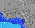 | 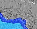 | 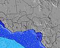 | 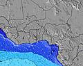 | 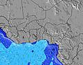 | 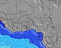 | 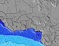 | ||||||||||||
Swell Altura (m) Direção Período (s) | SSW 6 | SSW 6 | SSW 6 | SSW 6 | SSW 6 | S 6 | WSW 6 | SW 6 | SW 6 | SW 6 | SW 6 | SSW 6 | SSW 6 | SSW 6 | SW 6 | SW 6 | SW 6 | SW 6 | SSW 6 |
Onda Gráfico | |||||||||||||||||||
125 | 121 | 117 | 115 | 115 | 78 | 66 | 122 | 122 | 122 | 104 | 108 | 108 | 108 | 104 | 118 | 129 | 133 | 144 | |
Vento (km/h) | |||||||||||||||||||
Estado do Vento maral cruzado-maral Cruzado cruzado-terral terral cristalino | cross-on | cross-on | on | cross-on | cross-on | cross-on | cross-on | cross-on | cross-on | on | on | cross-on | cross-on | cross-on | cross-on | cross-on | cross-on | on | on |
Maré Alta | 3:19PM0.92m | 4:42AM0.94m | 4:01PM0.95m | 5:11AM0.97m | 4:40PM0.97m | ||||||||||||||
Maré Baixa | 9:47PM0.37m | 10:02AM0.57m | 10:21PM0.34m | 10:36AM0.53m | |||||||||||||||
— | — | — | — | — | 6:11 | — | — | — | — | — | — | — | 6:11 | — | — | — | — | — | |
— | 6:32 | — | — | — | — | — | — | — | 6:31 | — | — | — | — | — | — | — | 6:31 | — | |
mm | — | — | — | — | 1 | 1 | 1 | — | — | — | — | — | 1 | 1 | 2 | 2 | — | — | — |
Temp. °C | 24 | 24 | 24 | 24 | 24 | 24 | 24 | 24 | 24 | 24 | 24 | 24 | 24 | 24 | 24 | 24 | 24 | 24 | 24 |
Ressent. °C | 25 | 25 | 25 | 25 | 25 | 25 | 25 | 24 | 24 | 24 | 24 | 25 | 25 | 25 | 24 | 23 | 23 | 24 | 24 |
Swell 1 Altura (m) Direção Período (s) | SSW 11 | SSW 11 | SSW 11 | SSW 14 | S 14 | S 6 | S 6 | SSE 9 | SSE 9 | SSE 9 | SSE 9 | SSE 9 | SSE 8 | SSE 8 | SSE 8 | SSE 8 | SSE 8 | SSE 8 | SSW 11 |
40 | 40 | 40 | 68 | 101 | 78 | 66 | 45 | 61 | 59 | 61 | 58 | 57 | 55 | 57 | 40 | 39 | 38 | 40 | |
Swell 2 Altura (m) Direção Período (s) | SSW 14 | SSW 14 | S 14 | SSW 10 | SSW 10 | SSW 14 | SSW 13 | SSW 10 | S 13 | S 13 | S 13 | SSW 12 | SSW 12 | S 12 | S 12 | S 12 | S 12 | S 12 | SSE 8 |
39 | 40 | 37 | 18 | 18 | 62 | 59 | 33 | 87 | 86 | 85 | 51 | 50 | 73 | 72 | 71 | 70 | 67 | 28 | |
Swell 3 Altura (m) Direção Período (s) | — | S 11 | S 11 | S 11 | SSE 10 | SSW 10 | SSE 9 | SSW 13 | S 10 | S 10 | S 10 | S 15 | S 15 | S 15 | S 15 | S 14 | S 18 | SSW 19 | SSW 16 |
— | 2 | 2 | 9 | 10 | 33 | 32 | 56 | 18 | 18 | 8 | 17 | 17 | 17 | 17 | 16 | 27 | 72 | 51 | |
Ondas de vento Altura (m) Direção Período (s) | SSW 6 | SSW 6 | SSW 6 | SSW 6 | SSW 6 | WSW 6 | WSW 6 | SW 6 | SW 6 | SW 6 | SW 6 | SSW 6 | SSW 6 | SSW 6 | SW 6 | SW 6 | SW 6 | SW 6 | SSW 6 |
125 | 121 | 117 | 115 | 115 | 47 | 65 | 122 | 122 | 122 | 104 | 108 | 108 | 108 | 104 | 118 | 129 | 133 | 144 | |
Terral ou glassy mais perto | |||||||||||||||||||
Distância (km) | 1818 | 2792 | 340 | 190 | 231 | 231 | 231 | 1044 | 2398 | 2399 | 2399 | 2381 | 231 | 231 | 340 | 3358 | 3550 | 2837 | 1097 |
Melhor previsões de ondas em Ivory Coast | |||||||||||||||||||
Melhor previsões de ondas em Côte d'Ivoire | |||||||||||||||||||
Buscador de Ondas Global | |||||||||||||||||||
- Map Icons:
 Break
Break Live Wave Height (m)
 Live Wind Speed (km/h)
 Surf Rating (10 Max)
 Ocean Swells (m)
- Wind Speed (km/h)
widget de graça do Surf-Forecast.com para o seu site
O relatório de surf / widget do tempo abaixo está disponível para incorporar em sites de terceiros gratuitamente e fornece um resumo das nossas La Passe surf tempo. Simplesmente pegar o trecho de código html que fornecemos e colá-lo em seu próprio site. Você pode escolher seu idioma preferido e unidades métrico/imperial para o surf tempo de alimentação para atender aos usuários do seu site.... Clique aqui para adquirir o código.
 Nearest