
Previsão:

Previsão de curto prazoprincipalmente seco. Warm (máx. 27°C na Quarta de manhã, mín 19°C na Quarta à noite). o vento será geralmente fraco. | ||||||||||||||||||||||||
Quarta-feira 29 | Quinta-feira 30 | Sexta-feira 31 | ||||||||||||||||||||||
2 AM | 5 AM | 8 AM | 11 AM | 2 PM | 5 PM | 8 PM | 11 PM | 2 AM | 5 AM | 8 AM | 11 AM | 2 PM | 5 PM | 8 PM | 11 PM | 2 AM | 5 AM | 8 AM | 11 AM | 2 PM | 5 PM | 8 PM | 11 PM | |
Mapa da altura do Swell |  | 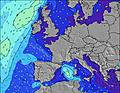 |  |  |  |  |  |  |  | |||||||||||||||
Swell Altura (m) Direção Período (s) | NW 10 | NW 10 | NW 9 | NW 9 | NW 9 | NW 9 | NW 9 | WNW 4 | WNW 4 | WNW 4 | NW 9 | WNW 5 | NW 8 | NW 8 | NW 9 | NW 9 | NW 8 | NW 8 | NW 8 | NW 8 | NW 8 | NW 8 | WNW 8 | NW 8 |
Onda Gráfico | ||||||||||||||||||||||||
0 | 0 | 0 | 0 | 0 | 0 | 0 | 1 | 2 | 2 | 0 | 2 | 0 | 0 | 0 | 0 | 0 | 0 | 0 | 0 | 0 | 0 | 0 | 0 | |
Vento (km/h) | ||||||||||||||||||||||||
Estado do Vento maral cruzado-maral Cruzado cruzado-terral terral cristalino | off | glassy | cross-off | cross-on | cross-on | cross-on | cross-on | cross | cross | cross-on | glassy | cross-on | on | on | on | cross-on | on | glassy | glassy | glassy | on | on | cross-on | cross-on |
Maré Alta | 5:21AM3.79m | 5:34PM4.04m | 5:54AM3.90m | 6:07PM4.14m | 6:26AM3.97m | 6:39PM4.21m | ||||||||||||||||||
Maré Baixa | 11:11PM1.10m | 11:21AM1.13m | 11:45PM0.98m | 11:54AM1.02m | 00:18AM0.88m | 12:27PM0.95m | ||||||||||||||||||
— | 6:52 | — | — | — | — | — | — | — | 6:52 | — | — | — | — | — | — | — | 6:54 | — | — | — | — | — | — | |
— | — | — | — | — | — | 9:32 | — | — | — | — | — | — | — | 9:31 | — | — | — | — | — | — | — | 9:30 | — | |
mm | — | — | — | — | — | — | — | — | — | — | — | — | — | — | — | — | — | — | — | — | — | — | — | — |
Temp. °C | 26 | 25 | 23 | 27 | 27 | 24 | 22 | 19 | 20 | 20 | 19 | 21 | 23 | 23 | 22 | 19 | 19 | 19 | 19 | 20 | 22 | 22 | 22 | 19 |
Ressent. °C | 26 | 24 | 23 | 29 | 28 | 25 | 22 | 19 | 21 | 21 | 21 | 22 | 24 | 24 | 23 | 20 | 21 | 21 | 21 | 23 | 22 | 23 | 23 | 20 |
Swell 1 Altura (m) Direção Período (s) | NW 10 | NW 10 | NW 9 | NW 9 | NW 9 | NW 9 | NW 9 | NW 9 | NW 9 | NW 9 | NW 9 | NW 8 | NW 8 | NW 8 | NW 9 | NW 9 | NW 8 | NW 8 | NW 8 | NW 8 | NW 8 | NW 8 | WNW 8 | NW 8 |
34 | 33 | 31 | 30 | 21 | 21 | 21 | 12 | 12 | 12 | 12 | 11 | 11 | 18 | 12 | 12 | 11 | 11 | 11 | 11 | 10 | 10 | 6 | 9 | |
Swell 2 Altura (m) Direção Período (s) | — | — | — | — | — | — | — | — | — | — | WNW 4 | — | WNW 5 | — | — | — | — | — | — | — | — | — | — | — |
— | — | — | — | — | — | — | — | — | — | 2 | — | 2 | — | — | — | — | — | — | — | — | — | — | — | |
Swell 3 Altura (m) Direção Período (s) | — | — | — | — | — | — | — | — | — | — | — | — | — | — | — | — | — | — | — | — | — | — | — | — |
— | — | — | — | — | — | — | — | — | — | — | — | — | — | — | — | — | — | — | — | — | — | — | — | |
Ondas de vento Altura (m) Direção Período (s) | — | — | — | — | — | — | — | WNW 4 | WNW 4 | WNW 4 | — | WNW 5 | — | — | — | — | — | — | — | — | — | — | — | — |
— | — | — | — | — | — | — | 1 | 2 | 2 | — | 2 | — | — | — | — | — | — | — | — | — | — | — | — | |
Terral ou glassy mais perto | ||||||||||||||||||||||||
Distância (km) | 3 | 3 | 6 | 6 | 527 | 6 | 328 | 131 | 86 | 86 | 3 | 105 | 81 | 81 | 81 | 81 | 25 | 3 | 3 | 6 | 336 | 1132 | 830 | 191 |
Melhor previsões de ondas em La Cote Basque | ||||||||||||||||||||||||
Melhor previsões de ondas em France | ||||||||||||||||||||||||
Buscador de Ondas Global | ||||||||||||||||||||||||
- Map Icons:
 Break
Break Live Wave Height (m)
 Live Wind Speed (km/h)
 Surf Rating (10 Max)
 Ocean Swells (m)
- Wind Speed (km/h)
widget de graça do Surf-Forecast.com para o seu site
O relatório de surf / widget do tempo abaixo está disponível para incorporar em sites de terceiros gratuitamente e fornece um resumo das nossas St Jean de Luz - La Bougie surf tempo. Simplesmente pegar o trecho de código html que fornecemos e colá-lo em seu próprio site. Você pode escolher seu idioma preferido e unidades métrico/imperial para o surf tempo de alimentação para atender aos usuários do seu site.... Clique aqui para adquirir o código.
 Nearest