

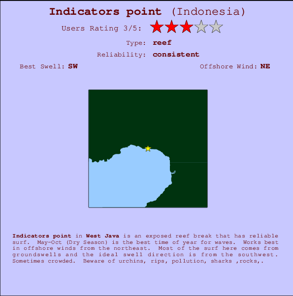
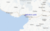
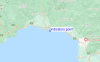
Indicators point Surf Guide
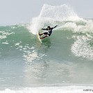
Indicators point in West Java is an exposed reef break that has reliable surf. May-Oct (Dry Season) is the best time of year for waves. Works best in offshore winds from the northeast. Tends to receive distant groundswells and the optimum swell angle is from the southwest. A reef breaks right. Sometimes crowded. Take care of urchins, rips, pollution, sharks ,rocks,.
Indicators point Spot Info
| Type: | Rating: | Reliability: | Todays Sea Temp*: |
|---|---|---|---|
| consistent | 27.8°C*ocean temperature recorded from satellite |
Surfing Indicators point:
The best conditions reported for surf at Indicators point occur when a Southwest swell combines with an offshore wind direction from the Northeast.

Previsão da Energia de Ondas (Força): 12hrs


Indicators point Surf:
Sunday, 19 July 2026, 12:39 Local time| Domingo 19 | ||||
| 10AM | 1PM | 4PM | 7PM | |
| Wave (m) | ||||
| Período (s) | 13 | 13 | 16 | 16 |
| Vento (km/h) | ||||
| Estado do Vento | glass | on | cross | cross- off |
- /breaks/Indicatorspoint/forecasts/latest
Indicators point Surf Guide
Indicators point in West Java is an exposed reef break that has reliable surf. May-Oct (Dry Season) is the best time of year for waves. Works best in offshore winds from the northeast. Tends to receive distant groundswells and the optimum swell angle is from the southwest. A reef breaks right. Sometimes crowded. Take care of urchins, rips, pollution, sharks ,rocks,.
Indicators point Spot Info
Type: Rating: Reliability: Todays Sea Temp*:  Reef
Reef 3
3consistent 27.8°C*ocean temperature recorded from satelliteSurfing Indicators point:
The best conditions reported for surf at Indicators point occur when a Southwest swell combines with an offshore wind direction from the Northeast.
Previsão da Energia de Ondas (Força): 12hrs
Use a aba navegação acima para ver temperatura do mar em Indicators point, fotografias de Indicators point, previsões detalhadas do swell em Indicators point, previsões do vento e do tempo, webcams em Indicators point , vento atual em Java - West com base em dados ao vivo fornecidos por estações de meteorologia e previsões da maré em Indicators point. O link para os mapas do swell em Indonesia abrirá uma imagem ampliada monstrando Indonesia e os mares próximos. Estes mapas do swell podem ser animados para mostrar diferentes componentes do swell, energia das ondas, período das ondas, altura das ondas, assim como previsões do vento e do tempo, observações em tempo real do estado do tempo e do mar graças às bóias de Indonesia, navios passantes e estações de meteorologia presentes na costa. Cada uma das páginas de previsão para este surf break apresenta as ferramentas do buscador global e regional para localizar as melores condições de surf na área ao redor de Indicators point.
Indicators point Surf:
Sunday, 19 July 2026, 12:39 Local timeDomingo 19 10AM 1PM 4PM 7PM Wave (m) Período (s) 13 13 16 16 Vento (km/h) Estado do Vento glass on cross cross-
off- /breaks/Indicatorspoint/forecasts/latest
- /breaks/Indicatorspoint/forecasts/latest/six_day
Indicators point Surf Guide
Indicators point in West Java is an exposed reef break that has reliable surf. May-Oct (Dry Season) is the best time of year for waves. Works best in offshore winds from the northeast. Tends to receive distant groundswells and the optimum swell angle is from the southwest. A reef breaks right. Sometimes crowded. Take care of urchins, rips, pollution, sharks ,rocks,.
Indicators point Spot Info
Type: Rating: Reliability: Todays Sea Temp*: Reef3consistent 27.8°C*ocean temperature recorded from satelliteSurfing Indicators point:
The best conditions reported for surf at Indicators point occur when a Southwest swell combines with an offshore wind direction from the Northeast.
Previsão da Energia de Ondas (Força): 12hrs
Use a aba navegação acima para ver temperatura do mar em Indicators point, fotografias de Indicators point, previsões detalhadas do swell em Indicators point, previsões do vento e do tempo, webcams em Indicators point , vento atual em Java - West com base em dados ao vivo fornecidos por estações de meteorologia e previsões da maré em Indicators point. O link para os mapas do swell em Indonesia abrirá uma imagem ampliada monstrando Indonesia e os mares próximos. Estes mapas do swell podem ser animados para mostrar diferentes componentes do swell, energia das ondas, período das ondas, altura das ondas, assim como previsões do vento e do tempo, observações em tempo real do estado do tempo e do mar graças às bóias de Indonesia, navios passantes e estações de meteorologia presentes na costa. Cada uma das páginas de previsão para este surf break apresenta as ferramentas do buscador global e regional para localizar as melores condições de surf na área ao redor de Indicators point.
Indicators point Surf:
Sunday, 19 July 2026, 12:39 Local timeDomingo 19 10AM 1PM 4PM 7PM Wave (m) Período (s) 13 13 16 16 Vento (km/h) Estado do Vento glass on cross cross-
off- /breaks/Indicatorspoint/forecasts/latest
Indicators point Surf Guide
Indicators point in West Java is an exposed reef break that has reliable surf. May-Oct (Dry Season) is the best time of year for waves. Works best in offshore winds from the northeast. Tends to receive distant groundswells and the optimum swell angle is from the southwest. A reef breaks right. Sometimes crowded. Take care of urchins, rips, pollution, sharks ,rocks,.
Indicators point Spot Info
Type: Rating: Reliability: Todays Sea Temp*: Reef3consistent 27.8°C*ocean temperature recorded from satelliteSurfing Indicators point:
The best conditions reported for surf at Indicators point occur when a Southwest swell combines with an offshore wind direction from the Northeast.
Previsão da Energia de Ondas (Força): 12hrs
Use a aba navegação acima para ver temperatura do mar em Indicators point, fotografias de Indicators point, previsões detalhadas do swell em Indicators point, previsões do vento e do tempo, webcams em Indicators point , vento atual em Java - West com base em dados ao vivo fornecidos por estações de meteorologia e previsões da maré em Indicators point. O link para os mapas do swell em Indonesia abrirá uma imagem ampliada monstrando Indonesia e os mares próximos. Estes mapas do swell podem ser animados para mostrar diferentes componentes do swell, energia das ondas, período das ondas, altura das ondas, assim como previsões do vento e do tempo, observações em tempo real do estado do tempo e do mar graças às bóias de Indonesia, navios passantes e estações de meteorologia presentes na costa. Cada uma das páginas de previsão para este surf break apresenta as ferramentas do buscador global e regional para localizar as melores condições de surf na área ao redor de Indicators point.
Indicators point Surf:
Sunday, 19 July 2026, 12:39 Local timeDomingo 19 10AM 1PM 4PM 7PM Wave (m) Período (s) 13 13 16 16 Vento (km/h) Estado do Vento glass on cross cross-
offTide Times:
Para Karang Haji - Ocean Queen Hotel %{dist} %{km} de %{location}
A PRÓXIMA É ÀS (hora local) faltam maré alta maré baixa Indicators point Tide Times and Tide Chart
Live Weather:
At Genteng wx, 50 km from Indicators point.
calm
(km/h)Air temperature
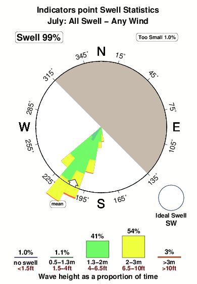
-°COverall Indicators point Surf Consistency and Wind Distribution in Julho
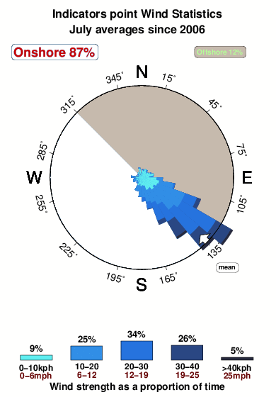


Wind stats for Indicators point: see the variation in direction and stength by month.
fotos da galeria
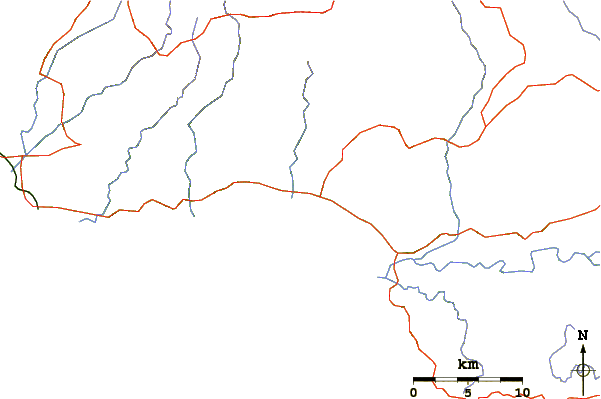
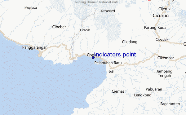
Contornos: Estradas & Rios: Escolha um spot de surf da lista 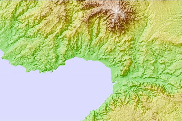
Use este mapa de relevo para navegar até Java - West surf quebras e estações que estão na área de maré Indicators point
Outros Spots de Surf mais próximos de Indicators point:
(Clique no nome do local para maiores detalhes)- Closest spot1 mi
- Second closest spot2 mi
- Third closest spot4 mi
- Fourth closest spot6 mi
- Fifth closest spot17 mi
Bóias ondográficas mais próxima de Indicators point:
- Closest bóia ondográfica2428 mi
- Second closest bóia ondográfica2470 mi
- Third closest bóia ondográfica2536 mi
- Fourth closest bóia ondográfica2700 mi
- Fifth closest bóia ondográfica2711 mi
Estações de maré mais próximo de Indicators point:
- Closest estação de maréPelabuhanratu5 mi
- Second closest estação de maréJakarta60 mi
- Third closest estação de maréLabuhan61 mi
- Fourth closest estação de maréTanjung Priok65 mi
- Fifth closest estação de maréBandar Lampung132 mi
Airports
- The closest passenger airport to Indicators point is Pondok Cabe (Jakarta) Airport (PCB) in Indonesia, 76 km (47 miles) away (directly).
- The second nearest airport to Indicators point is Halim Perdanakusuma International (Jakarta) Airport (HLP), also in Indonesia, 90 km (56 miles) away.
- Third is Soekarno Hatta International (Jakarta) Airport (CGK) in Indonesia, 95 km (59 miles) away.
- Husein Sastranegara (Bandung) Airport (BDO) in Indonesia is 121 km (75 miles) away.
- Penggung (Cirebon) Airport (CBN), also in Indonesia is the fifth nearest airport to Indicators point and is 228 km (142 miles) away.
- /breaks/Indicatorspoint/forecasts/latest

 Nearest