
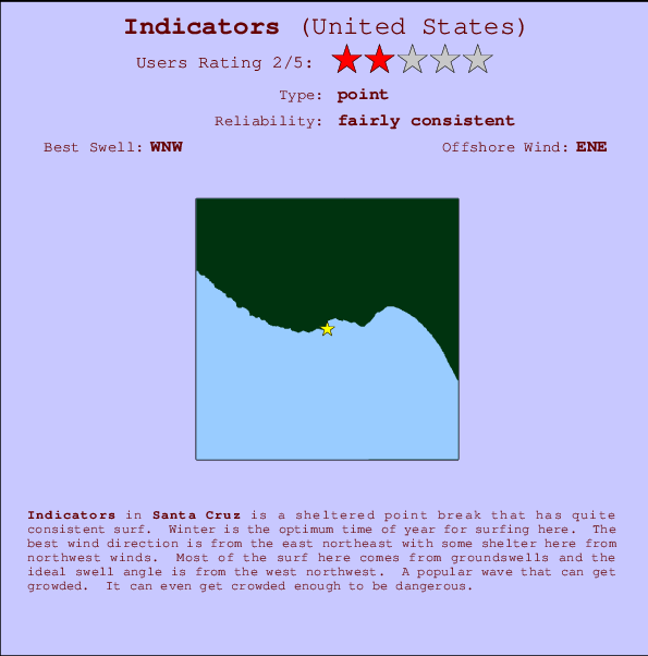
Indicators Surf Guide
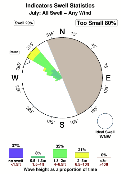
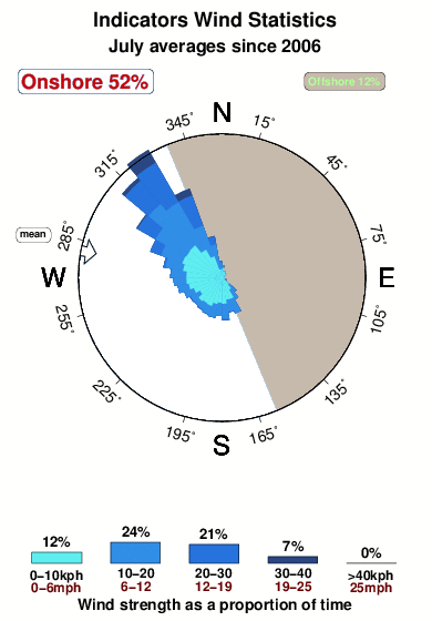
Indicators in Santa Cruz is a sheltered point break that has reasonably consistent surf. Winter is the optimum time of year for surfing here. The best wind direction is from the east northeast with some shelter here from northwest winds. Groundswells more frequent than windswells and the optimum swell angle is from the west northwest. Often Crowded. Overcrowding can even make surfing hazardous.
Indicators Spot Info
| Type: | Rating: | Reliability: | Todays Sea Temp*: |
|---|---|---|---|
| fairly consistent | 15.6°C*ocean temperature recorded from satellite |
Surfing Indicators:
The best conditions reported for surf at Indicators occur when a West-northwest swell combines with an offshore wind direction from the East-northeast.

Previsão da Energia de Ondas (Força): 12hrs


Indicators Surf:
Thursday, 23 July 2026, 20:09 Local time| Quin | Sex | |||
| 8PM | 11PM | 2AM | 5AM | |
| Wave (m) | ||||
| Período (s) | 26 | 26 | 26 | 26 |
| Vento (km/h) | ||||
| Estado do Vento | cross | cross- off |
cross | glass |
- /breaks/Indicators/forecasts/latest
Indicators Surf Guide
Indicators in Santa Cruz is a sheltered point break that has reasonably consistent surf. Winter is the optimum time of year for surfing here. The best wind direction is from the east northeast with some shelter here from northwest winds. Groundswells more frequent than windswells and the optimum swell angle is from the west northwest. Often Crowded. Overcrowding can even make surfing hazardous.
Indicators Spot Info
Type: Rating: Reliability: Todays Sea Temp*:  Point
Point 2
2fairly consistent 15.6°C*ocean temperature recorded from satelliteSurfing Indicators:
The best conditions reported for surf at Indicators occur when a West-northwest swell combines with an offshore wind direction from the East-northeast.
Previsão da Energia de Ondas (Força): 12hrs
Use a aba navegação acima para ver temperatura do mar em Indicators, fotografias de Indicators, previsões detalhadas do swell em Indicators, previsões do vento e do tempo, webcams em Indicators , vento atual em CAL - Santa Cruz com base em dados ao vivo fornecidos por estações de meteorologia e previsões da maré em Indicators. O link para os mapas do swell em United States abrirá uma imagem ampliada monstrando United States e os mares próximos. Estes mapas do swell podem ser animados para mostrar diferentes componentes do swell, energia das ondas, período das ondas, altura das ondas, assim como previsões do vento e do tempo, observações em tempo real do estado do tempo e do mar graças às bóias de United States, navios passantes e estações de meteorologia presentes na costa. Cada uma das páginas de previsão para este surf break apresenta as ferramentas do buscador global e regional para localizar as melores condições de surf na área ao redor de Indicators.
Indicators Surf:
Thursday, 23 July 2026, 20:09 Local timeQuin Sex 8PM 11PM 2AM 5AM Wave (m) Período (s) 26 26 26 26 Vento (km/h) Estado do Vento cross cross-
offcross glass - /breaks/Indicators/forecasts/latest
- /breaks/Indicators/forecasts/latest/six_day
Indicators Surf Guide
Indicators in Santa Cruz is a sheltered point break that has reasonably consistent surf. Winter is the optimum time of year for surfing here. The best wind direction is from the east northeast with some shelter here from northwest winds. Groundswells more frequent than windswells and the optimum swell angle is from the west northwest. Often Crowded. Overcrowding can even make surfing hazardous.
Indicators Spot Info
Type: Rating: Reliability: Todays Sea Temp*: Point2fairly consistent 15.6°C*ocean temperature recorded from satelliteSurfing Indicators:
The best conditions reported for surf at Indicators occur when a West-northwest swell combines with an offshore wind direction from the East-northeast.
Previsão da Energia de Ondas (Força): 12hrs
Use a aba navegação acima para ver temperatura do mar em Indicators, fotografias de Indicators, previsões detalhadas do swell em Indicators, previsões do vento e do tempo, webcams em Indicators , vento atual em CAL - Santa Cruz com base em dados ao vivo fornecidos por estações de meteorologia e previsões da maré em Indicators. O link para os mapas do swell em United States abrirá uma imagem ampliada monstrando United States e os mares próximos. Estes mapas do swell podem ser animados para mostrar diferentes componentes do swell, energia das ondas, período das ondas, altura das ondas, assim como previsões do vento e do tempo, observações em tempo real do estado do tempo e do mar graças às bóias de United States, navios passantes e estações de meteorologia presentes na costa. Cada uma das páginas de previsão para este surf break apresenta as ferramentas do buscador global e regional para localizar as melores condições de surf na área ao redor de Indicators.
Indicators Surf:
Thursday, 23 July 2026, 20:09 Local timeQuin Sex 8PM 11PM 2AM 5AM Wave (m) Período (s) 26 26 26 26 Vento (km/h) Estado do Vento cross cross-
offcross glass - /breaks/Indicators/forecasts/latest
Indicators Surf Guide
Indicators in Santa Cruz is a sheltered point break that has reasonably consistent surf. Winter is the optimum time of year for surfing here. The best wind direction is from the east northeast with some shelter here from northwest winds. Groundswells more frequent than windswells and the optimum swell angle is from the west northwest. Often Crowded. Overcrowding can even make surfing hazardous.
Indicators Spot Info
Type: Rating: Reliability: Todays Sea Temp*: Point2fairly consistent 15.6°C*ocean temperature recorded from satelliteSurfing Indicators:
The best conditions reported for surf at Indicators occur when a West-northwest swell combines with an offshore wind direction from the East-northeast.
Previsão da Energia de Ondas (Força): 12hrs
Use a aba navegação acima para ver temperatura do mar em Indicators, fotografias de Indicators, previsões detalhadas do swell em Indicators, previsões do vento e do tempo, webcams em Indicators , vento atual em CAL - Santa Cruz com base em dados ao vivo fornecidos por estações de meteorologia e previsões da maré em Indicators. O link para os mapas do swell em United States abrirá uma imagem ampliada monstrando United States e os mares próximos. Estes mapas do swell podem ser animados para mostrar diferentes componentes do swell, energia das ondas, período das ondas, altura das ondas, assim como previsões do vento e do tempo, observações em tempo real do estado do tempo e do mar graças às bóias de United States, navios passantes e estações de meteorologia presentes na costa. Cada uma das páginas de previsão para este surf break apresenta as ferramentas do buscador global e regional para localizar as melores condições de surf na área ao redor de Indicators.
Indicators Surf:
Thursday, 23 July 2026, 20:09 Local timeQuin Sex 8PM 11PM 2AM 5AM Wave (m) Período (s) 26 26 26 26 Vento (km/h) Estado do Vento cross cross-
offcross glass Tide Times:
Para Santa Cruz, California %{dist} %{km} de %{location}
A PRÓXIMA É ÀS (hora local) faltam maré alta maré baixa Indicators Tide Times and Tide Chart
Live Weather:
At Santa Cruz, 2 km from Indicators.
calm
(km/h)
dryAir temperature
18°COverall Indicators Surf Consistency and Wind Distribution in Julho
fotos da galeria
Contornos: Estradas & Rios: Escolha um spot de surf da lista 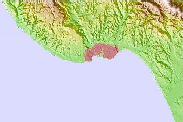
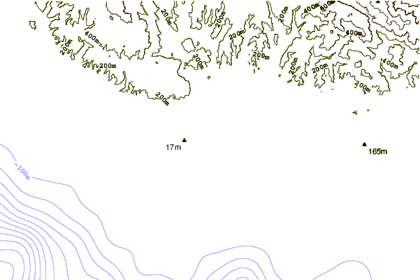
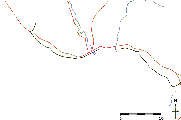
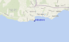
Use este mapa de relevo para navegar até CAL - Santa Cruz surf quebras e estações que estão na área de maré Indicators
Outros Spots de Surf mais próximos de Indicators:
(Clique no nome do local para maiores detalhes)- Closest spot0 mi
- Second closest spot0 mi
- Third closest spot0 mi
- Fourth closest spot1 mi
- Fifth closest spot1 mi
Bóias ondográficas mais próxima de Indicators:
- Closest bóia ondográfica23 mi
- Second closest bóia ondográfica24 mi
- Third closest bóia ondográfica24 mi
- Fourth closest bóia ondográfica42 mi
- Fifth closest bóia ondográfica55 mi
Estações de maré mais próximo de Indicators:
- Closest estação de maréSanta Cruz1 mi
- Second closest estação de maréLive Oak3 mi
- Third closest estação de maréRio Del Mar7 mi
- Fourth closest estação de maréAptos7 mi
- Fifth closest estação de maréElkhorn Slough railroad bridge16 mi
Airports
- The closest passenger airport to Indicators is Norman Y Mineta San Jose International Airport (SJC) in USA, 46 km (29 miles) away (directly).
- The second nearest airport to Indicators is Moffett Federal Afld (Mountain View) Airport (NUQ), also in USA, 52 km (32 miles) away.
- Third is San Francisco International Airport (SFO) in USA, 80 km (50 miles) away.
- Metropolitan Oakland International Airport (OAK) in USA is 87 km (54 miles) away.
- Modesto City Co Harry Sham Airport (MOD), also in USA is the fifth nearest airport to Indicators and is 121 km (75 miles) away.
- /breaks/Indicators/forecasts/latest


 Nearest