

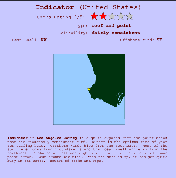
Indicator Surf Guide
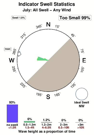
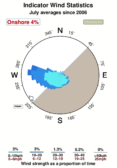
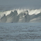
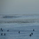
Indicator in LA County is a reasonably exposed reef and point break that has reasonably consistent surf. Winter is the best time of year for surfing here. Offshore winds are from the southeast. Most of the surf here comes from groundswells and the ideal swell direction is from the northwest. Reef breaks provide lefts and rights and there is also a left hand point break. Best around mid tide. A fairly popluar wave that can sometimes get crowded Hazards include rocks and rips.
Indicator Spot Info
| Type: | Rating: | Reliability: | Todays Sea Temp*: |
|---|---|---|---|
| fairly consistent | 22.2°C*ocean temperature recorded from satellite |
Surfing Indicator:
The best conditions reported for surf at Indicator occur when a Northwest swell combines with an offshore wind direction from the Southeast.

Previsão da Energia de Ondas (Força): 12hrs


Indicator Surf:
Thursday, 23 July 2026, 20:09 Local time| Quin | Sex | |||
| 8PM | 11PM | 2AM | 5AM | |
| Wave (m) | ||||
| Período (s) | 7 | 7 | 7 | 25 |
| Vento (km/h) | ||||
| Estado do Vento | cross | cross- off |
off | off |
- /breaks/Indicator/forecasts/latest
Indicator Surf Guide
Indicator in LA County is a reasonably exposed reef and point break that has reasonably consistent surf. Winter is the best time of year for surfing here. Offshore winds are from the southeast. Most of the surf here comes from groundswells and the ideal swell direction is from the northwest. Reef breaks provide lefts and rights and there is also a left hand point break. Best around mid tide. A fairly popluar wave that can sometimes get crowded Hazards include rocks and rips.
Indicator Spot Info
Type: Rating: Reliability: Todays Sea Temp*:  Reef and point
 2
2fairly consistent 22.2°C*ocean temperature recorded from satelliteSurfing Indicator:
The best conditions reported for surf at Indicator occur when a Northwest swell combines with an offshore wind direction from the Southeast.
Previsão da Energia de Ondas (Força): 12hrs
Use a aba navegação acima para ver temperatura do mar em Indicator, fotografias de Indicator, previsões detalhadas do swell em Indicator, previsões do vento e do tempo, webcams em Indicator , vento atual em CAL - LA County com base em dados ao vivo fornecidos por estações de meteorologia e previsões da maré em Indicator. O link para os mapas do swell em United States abrirá uma imagem ampliada monstrando United States e os mares próximos. Estes mapas do swell podem ser animados para mostrar diferentes componentes do swell, energia das ondas, período das ondas, altura das ondas, assim como previsões do vento e do tempo, observações em tempo real do estado do tempo e do mar graças às bóias de United States, navios passantes e estações de meteorologia presentes na costa. Cada uma das páginas de previsão para este surf break apresenta as ferramentas do buscador global e regional para localizar as melores condições de surf na área ao redor de Indicator.
Indicator Surf:
Thursday, 23 July 2026, 20:09 Local timeQuin Sex 8PM 11PM 2AM 5AM Wave (m) Período (s) 7 7 7 25 Vento (km/h) Estado do Vento cross cross-
offoff off - /breaks/Indicator/forecasts/latest
- /breaks/Indicator/forecasts/latest/six_day
Indicator Surf Guide
Indicator in LA County is a reasonably exposed reef and point break that has reasonably consistent surf. Winter is the best time of year for surfing here. Offshore winds are from the southeast. Most of the surf here comes from groundswells and the ideal swell direction is from the northwest. Reef breaks provide lefts and rights and there is also a left hand point break. Best around mid tide. A fairly popluar wave that can sometimes get crowded Hazards include rocks and rips.
Indicator Spot Info
Type: Rating: Reliability: Todays Sea Temp*: Reef and point2fairly consistent 22.2°C*ocean temperature recorded from satelliteSurfing Indicator:
The best conditions reported for surf at Indicator occur when a Northwest swell combines with an offshore wind direction from the Southeast.
Previsão da Energia de Ondas (Força): 12hrs
Use a aba navegação acima para ver temperatura do mar em Indicator, fotografias de Indicator, previsões detalhadas do swell em Indicator, previsões do vento e do tempo, webcams em Indicator , vento atual em CAL - LA County com base em dados ao vivo fornecidos por estações de meteorologia e previsões da maré em Indicator. O link para os mapas do swell em United States abrirá uma imagem ampliada monstrando United States e os mares próximos. Estes mapas do swell podem ser animados para mostrar diferentes componentes do swell, energia das ondas, período das ondas, altura das ondas, assim como previsões do vento e do tempo, observações em tempo real do estado do tempo e do mar graças às bóias de United States, navios passantes e estações de meteorologia presentes na costa. Cada uma das páginas de previsão para este surf break apresenta as ferramentas do buscador global e regional para localizar as melores condições de surf na área ao redor de Indicator.
Indicator Surf:
Thursday, 23 July 2026, 20:09 Local timeQuin Sex 8PM 11PM 2AM 5AM Wave (m) Período (s) 7 7 7 25 Vento (km/h) Estado do Vento cross cross-
offoff off - /breaks/Indicator/forecasts/latest
Indicator Surf Guide
Indicator in LA County is a reasonably exposed reef and point break that has reasonably consistent surf. Winter is the best time of year for surfing here. Offshore winds are from the southeast. Most of the surf here comes from groundswells and the ideal swell direction is from the northwest. Reef breaks provide lefts and rights and there is also a left hand point break. Best around mid tide. A fairly popluar wave that can sometimes get crowded Hazards include rocks and rips.
Indicator Spot Info
Type: Rating: Reliability: Todays Sea Temp*: Reef and point2fairly consistent 22.2°C*ocean temperature recorded from satelliteSurfing Indicator:
The best conditions reported for surf at Indicator occur when a Northwest swell combines with an offshore wind direction from the Southeast.
Previsão da Energia de Ondas (Força): 12hrs
Use a aba navegação acima para ver temperatura do mar em Indicator, fotografias de Indicator, previsões detalhadas do swell em Indicator, previsões do vento e do tempo, webcams em Indicator , vento atual em CAL - LA County com base em dados ao vivo fornecidos por estações de meteorologia e previsões da maré em Indicator. O link para os mapas do swell em United States abrirá uma imagem ampliada monstrando United States e os mares próximos. Estes mapas do swell podem ser animados para mostrar diferentes componentes do swell, energia das ondas, período das ondas, altura das ondas, assim como previsões do vento e do tempo, observações em tempo real do estado do tempo e do mar graças às bóias de United States, navios passantes e estações de meteorologia presentes na costa. Cada uma das páginas de previsão para este surf break apresenta as ferramentas do buscador global e regional para localizar as melores condições de surf na área ao redor de Indicator.
Indicator Surf:
Thursday, 23 July 2026, 20:09 Local timeQuin Sex 8PM 11PM 2AM 5AM Wave (m) Período (s) 7 7 7 25 Vento (km/h) Estado do Vento cross cross-
offoff off Tide Times:
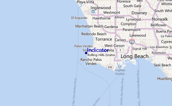
Para Palos Verdes Estates %{dist} %{km} de %{location}
A PRÓXIMA É ÀS (hora local) faltam maré alta maré baixa Indicator Tide Times and Tide Chart
Live Weather:
At Torrance Municipal Airport, 10 km from Indicator.
moderate winds from the WNW
(km/h)
ClearAir temperature
26°CCurrent weather near Indicator
Buoy Data:
At San Pedro, CA, 12 miles from Indicator.
3PM 4PM 5PM 6PM Idade dos dados 4 hr 3 hr 2 hr 1 hr Altura de onda (m) 

Período Dominante (s) 12 8 8 7 Overall Indicator Surf Consistency and Wind Distribution in Julho
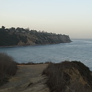
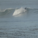
fotos da galeria
Contornos: Estradas & Rios: Escolha um spot de surf da lista 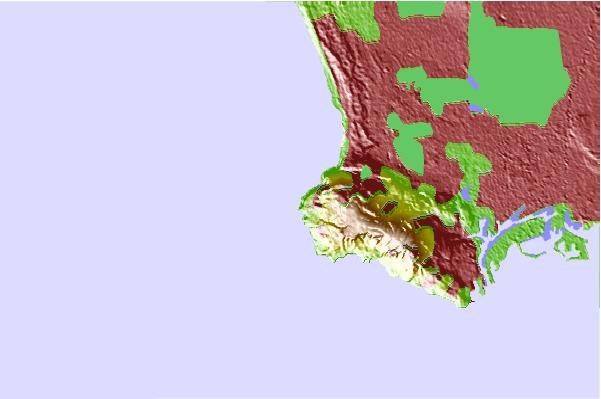
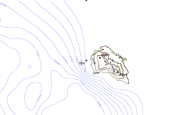
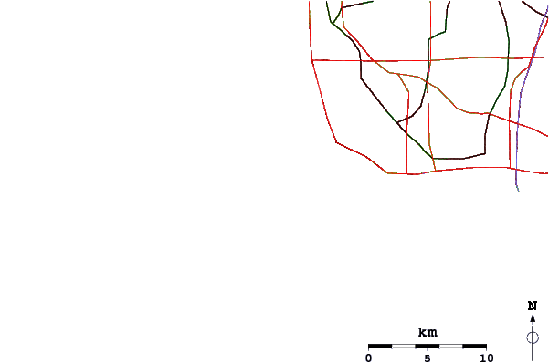
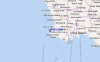
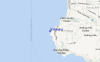
Use este mapa de relevo para navegar até CAL - LA County surf quebras e estações que estão na área de maré Indicator
Outros Spots de Surf mais próximos de Indicator:
(Clique no nome do local para maiores detalhes)- Closest spot0 mi
- Second closest spot1 mi
- Third closest spot1 mi
- Fourth closest spot1 mi
- Fifth closest spot2 mi
Bóias ondográficas mais próxima de Indicator:
- Closest bóia ondográfica12 mi
- Second closest bóia ondográfica13 mi
- Third closest bóia ondográfica14 mi
- Fourth closest bóia ondográfica20 mi
- Fifth closest bóia ondográfica34 mi
Estações de maré mais próximo de Indicator:
- Closest estação de maréPalos Verdes Estates2 mi
- Second closest estação de maréRancho Palos Verdes3 mi
- Third closest estação de maréKing Harbor, Santa Monica Bay5 mi
- Fourth closest estação de maréLomita6 mi
- Fifth closest estação de maréManhattan Beach7 mi
Airports
- The closest passenger airport to Indicator is Jack Northrop Fld Hawthorne Muni Airport (HHR) in USA, 18 km (11 miles) away (directly).
- The second nearest airport to Indicator is Los Angeles International Airport (LAX), also in USA, 18 km (11 miles) away.
- Third is Long Beach Airport (LGB) in USA, 26 km (16 miles) away.
- Burbank Glendale Pasadena Airport (BUR) in USA is 47 km (29 miles) away.
- John Wayne Arpt Orange Co (Santa Ana) Airport (SNA), also in USA is the fifth nearest airport to Indicator and is 53 km (33 miles) away.
- /breaks/Indicator/forecasts/latest


 Nearest