
Previsão:

Previsão de curto prazoprincipalmente seco. Very mild (máx. 19°C na Sexta de manhã, mín 11°C na Terça à noite). o vento será geralmente fraco. | ||||||||||||||||||||
Ter 28 | Quarta-feira 29 | Quinta-feira 30 | ||||||||||||||||||
2 PM | 5 PM | 8 PM | 11 PM | 2 AM | 5 AM | 8 AM | 11 AM | 2 PM | 5 PM | 8 PM | 11 PM | 2 AM | 5 AM | 8 AM | 11 AM | 2 PM | 5 PM | 8 PM | 11 PM | |
Mapa da altura do Swell |  | 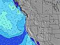 |  | 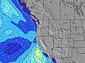 |  |  |  | 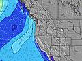 | ||||||||||||
Swell Altura (m) Direção Período (s) | SW 16 | SW 16 | SW 17 | SW 17 | SW 17 | SW 17 | SW 17 | SW 17 | SW 17 | SW 16 | SW 16 | SW 16 | SW 16 | SW 16 | SW 16 | SW 16 | SW 16 | SW 16 | SW 16 | SW 15 |
Onda Gráfico | ||||||||||||||||||||
206 | 322 | 334 | 413 | 423 | 423 | 499 | 418 | 346 | 260 | 310 | 310 | 306 | 306 | 302 | 302 | 295 | 291 | 287 | 233 | |
Vento (km/h) | ||||||||||||||||||||
Estado do Vento maral cruzado-maral Cruzado cruzado-terral terral cristalino | on | cross-on | cross | cross | cross-off | cross-off | cross-off | cross-on | cross-on | cross-on | cross | cross | glassy | glassy | glassy | cross-on | cross-on | cross-on | cross | cross-off |
Maré Alta | 2:15PM1.40m | 00:54AM1.83m | 2:43PM1.45m | 1:31AM1.83m | 3:11PM1.50m | |||||||||||||||
Maré Baixa | 7:33PM0.65m | 8:31AM-0.14m | 8:12PM0.60m | 9:01AM-0.14m | 8:51PM0.55m | |||||||||||||||
— | — | — | — | — | 5:58 | — | — | — | — | — | — | — | 5:58 | — | — | — | — | — | — | |
— | — | 8:46 | — | — | — | — | — | — | — | 8:45 | — | — | — | — | — | — | — | 8:45 | — | |
mm | — | — | — | — | — | — | — | — | — | — | — | — | — | — | — | — | — | — | — | — |
Temp. °C | 17 | 17 | 16 | 14 | 12 | 11 | 13 | 17 | 17 | 16 | 14 | 12 | 12 | 11 | 12 | 16 | 17 | 17 | 15 | 14 |
Ressent. °C | 16 | 16 | 15 | 13 | 11 | 10 | 12 | 15 | 14 | 13 | 12 | 11 | 12 | 11 | 12 | 15 | 14 | 14 | 14 | 13 |
Swell 1 Altura (m) Direção Período (s) | W 8 | W 8 | W 8 | WNW 8 | WNW 8 | WNW 9 | WNW 9 | WNW 9 | WNW 9 | WNW 9 | WNW 8 | WNW 8 | WNW 8 | WNW 8 | WNW 8 | WNW 8 | WNW 8 | SW 16 | SW 16 | WNW 9 |
137 | 161 | 153 | 155 | 187 | 238 | 238 | 243 | 257 | 189 | 202 | 197 | 153 | 128 | 128 | 94 | 75 | 291 | 287 | 88 | |
Swell 2 Altura (m) Direção Período (s) | SW 16 | SW 16 | SW 17 | SW 17 | SW 17 | SW 17 | SW 17 | SW 17 | SW 17 | SW 16 | SW 16 | SW 16 | SW 16 | SW 16 | SW 16 | SW 16 | SW 16 | WNW 8 | WNW 8 | SW 15 |
206 | 322 | 334 | 413 | 423 | 423 | 499 | 418 | 346 | 260 | 310 | 310 | 306 | 306 | 302 | 302 | 295 | 73 | 75 | 233 | |
Swell 3 Altura (m) Direção Período (s) | SW 19 | SW 12 | SW 12 | SW 12 | SW 12 | SSW 11 | — | — | SW 12 | SW 12 | SSW 11 | SSW 11 | SSW 11 | SSW 11 | SSW 11 | SSW 11 | SW 11 | SSW 11 | SSW 11 | SW 11 |
177 | 36 | 35 | 36 | 38 | 11 | — | — | 37 | 35 | 24 | 24 | 12 | 12 | 11 | 11 | 18 | 11 | 11 | 4 | |
Ondas de vento Altura (m) Direção Período (s) | — | — | — | — | — | — | — | — | — | NNW 4 | — | — | — | — | — | — | — | — | — | — |
— | — | — | — | — | — | — | — | — | 12 | — | — | — | — | — | — | — | — | — | — | |
Terral ou glassy mais perto | ||||||||||||||||||||
Distância (km) | 384 | 97 | 350 | 5 | 5 | 5 | 5 | 228 | 898 | 897 | 571 | 97 | 5 | 5 | 5 | 154 | 476 | 489 | 285 | 5 |
Melhor previsões de ondas em North Oregon | ||||||||||||||||||||
Melhor previsões de ondas em United States | ||||||||||||||||||||
Buscador de Ondas Global | ||||||||||||||||||||
- Map Icons:
 Break
Break Live Wave Height (m)
 Live Wind Speed (km/h)
 Surf Rating (10 Max)
 Ocean Swells (m)
- Wind Speed (km/h)
widget de graça do Surf-Forecast.com para o seu site
O relatório de surf / widget do tempo abaixo está disponível para incorporar em sites de terceiros gratuitamente e fornece um resumo das nossas Gleneden Beach surf tempo. Simplesmente pegar o trecho de código html que fornecemos e colá-lo em seu próprio site. Você pode escolher seu idioma preferido e unidades métrico/imperial para o surf tempo de alimentação para atender aos usuários do seu site.... Clique aqui para adquirir o código.
 Nearest