
Previsão:

Previsão de curto prazoprincipalmente seco. Warm (máx. 34°C na Quarta à tarde, mín 24°C na Qui à noite). o vento será geralmente fraco. | ||||||||||||||||||||||||
Ter 14 | Quarta-feira 15 | Quinta-feira 16 | Sex 17 | |||||||||||||||||||||
5 PM | 8 PM | 11 PM | 2 AM | 5 AM | 8 AM | 11 AM | 2 PM | 5 PM | 8 PM | 11 PM | 2 AM | 5 AM | 8 AM | 11 AM | 2 PM | 5 PM | 8 PM | 11 PM | 2 AM | 5 AM | 8 AM | 11 AM | 2 PM | |
Mapa da altura do Swell | 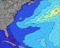 | 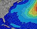 | 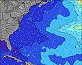 | 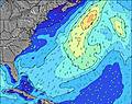 | 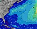 | 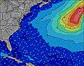 | 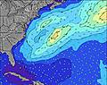 | 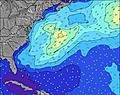 | 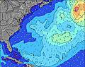 | |||||||||||||||
Swell Altura (m) Direção Período (s) | S 5 | SSW 5 | SSW 6 | SSW 6 | SSW 5 | S 6 | SSW 6 | SSW 6 | S 5 | SE 9 | S 5 | S 6 | S 6 | S 6 | S 6 | S 6 | S 6 | S 6 | S 5 | S 5 | S 5 | S 5 | S 5 | S 5 |
Onda Gráfico | ||||||||||||||||||||||||
43 | 58 | 69 | 74 | 42 | 30 | 39 | 39 | 20 | 14 | 21 | 22 | 15 | 16 | 16 | 16 | 17 | 15 | 14 | 14 | 14 | 13 | 8 | 8 | |
Vento (km/h) | ||||||||||||||||||||||||
Estado do Vento maral cruzado-maral Cruzado cruzado-terral terral cristalino | cross-on | cross | cross | cross | cross-off | cross-off | cross-off | cross-off | cross-off | off | off | cross-off | cross-off | cross-off | cross-off | cross-off | cross | cross-off | off | off | cross-off | cross-off | glassy | cross-on |
Maré Alta | 8:00PM1.69m | 8:39AM1.40m | 8:53PM1.67m | 9:32AM1.42m | 9:44PM1.60m | 10:26AM1.42m | ||||||||||||||||||
Maré Baixa | 2:35AM-0.19m | 2:37PM-0.09m | 3:24AM-0.20m | 3:29PM-0.06m | 4:10AM-0.18m | |||||||||||||||||||
— | — | — | — | 5:35 | — | — | — | — | — | — | — | 5:35 | — | — | — | — | — | — | — | 5:35 | — | — | — | |
— | 8:23 | — | — | — | — | — | — | — | 8:22 | — | — | — | — | — | — | — | 8:22 | — | — | — | — | — | 8:22 | |
mm | — | — | — | — | — | — | — | — | — | — | — | — | — | — | — | — | — | — | — | — | — | — | — | — |
Temp. °C | 29 | 31 | 29 | 27 | 26 | 26 | 30 | 34 | 34 | 34 | 31 | 29 | 27 | 26 | 30 | 32 | 32 | 33 | 29 | 27 | 24 | 24 | 26 | 27 |
Ressent. °C | 26 | 29 | 27 | 26 | 25 | 25 | 29 | 33 | 33 | 32 | 29 | 28 | 25 | 24 | 27 | 28 | 29 | 30 | 27 | 25 | 22 | 22 | 26 | 25 |
Swell 1 Altura (m) Direção Período (s) | SE 9 | SE 9 | SE 9 | SE 9 | SSW 5 | S 6 | SE 9 | SE 9 | S 5 | S 5 | S 5 | S 6 | S 6 | S 6 | S 6 | S 6 | S 6 | S 6 | S 5 | S 5 | S 5 | S 5 | S 5 | S 5 |
13 | 13 | 13 | 13 | 42 | 30 | 12 | 12 | 20 | 14 | 21 | 22 | 15 | 16 | 16 | 16 | 17 | 15 | 14 | 14 | 14 | 13 | 8 | 8 | |
Swell 2 Altura (m) Direção Período (s) | E 8 | — | E 7 | — | SE 9 | SE 9 | — | — | SE 9 | SE 9 | SE 9 | ESE 9 | SE 8 | SE 8 | SE 8 | SE 8 | SE 8 | SE 9 | SE 9 | SE 9 | SE 9 | SE 9 | SE 9 | SE 8 |
1 | — | 1 | — | 12 | 12 | — | — | 12 | 12 | 12 | 7 | 3 | 3 | 3 | 3 | 3 | 3 | 3 | 3 | 3 | 3 | 3 | 3 | |
Swell 3 Altura (m) Direção Período (s) | — | — | — | — | — | — | — | — | — | — | — | — | S 16 | S 16 | S 16 | S 15 | S 15 | S 15 | S 15 | SE 15 | — | SE 15 | SE 15 | SE 14 |
— | — | — | — | — | — | — | — | — | — | — | — | 5 | 5 | 5 | 5 | 4 | 4 | 4 | 9 | — | 9 | 8 | 8 | |
Ondas de vento Altura (m) Direção Período (s) | S 5 | SSW 5 | SSW 6 | SSW 6 | WNW 3 | W 3 | SSW 6 | SSW 6 | W 3 | WNW 3 | NW 3 | — | — | WNW 2 | — | — | W 2 | WNW 3 | NW 3 | NNW 3 | — | — | — | — |
43 | 58 | 69 | 74 | 2 | 3 | 39 | 39 | 2 | 2 | 2 | — | — | 1 | — | — | 1 | 3 | 4 | 1 | — | — | — | — | |
Terral ou glassy mais perto | ||||||||||||||||||||||||
Distância (km) | 1222 | 516 | 516 | 374 | 181 | 59 | 97 | 181 | 139 | 46 | 61 | 78 | 78 | 78 | 82 | 87 | 851 | 78 | 78 | 795 | 927 | 803 | 806 | 2579 |
Melhor previsões de ondas em Long Island New York | ||||||||||||||||||||||||
Melhor previsões de ondas em United States | ||||||||||||||||||||||||
Buscador de Ondas Global | ||||||||||||||||||||||||
- Map Icons:
 Break
Break Live Wave Height (m)
 Live Wind Speed (km/h)
 Surf Rating (10 Max)
 Ocean Swells (m)
- Wind Speed (km/h)
widget de graça do Surf-Forecast.com para o seu site
O relatório de surf / widget do tempo abaixo está disponível para incorporar em sites de terceiros gratuitamente e fornece um resumo das nossas Gilgo surf tempo. Simplesmente pegar o trecho de código html que fornecemos e colá-lo em seu próprio site. Você pode escolher seu idioma preferido e unidades métrico/imperial para o surf tempo de alimentação para atender aos usuários do seu site.... Clique aqui para adquirir o código.
 Nearest