
Previsão:

Previsão de curto prazoChuva intensa (total 24mm), mais intensa durante Domingo à tarde. Warm (máx. 30°C no Domingo à tarde, mín 28°C na Qui à noite). o vento será geralmente fraco. | |||||||||||||||||||
Quin 23 | Sexta-feira 24 | Sábado 25 | |||||||||||||||||
5 PM | 8 PM | 11 PM | 2 AM | 5 AM | 8 AM | 11 AM | 2 PM | 5 PM | 8 PM | 11 PM | 2 AM | 5 AM | 8 AM | 11 AM | 2 PM | 5 PM | 8 PM | 11 PM | |
Mapa da altura do Swell |  | 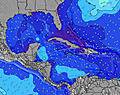 | 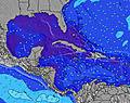 | 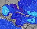 | 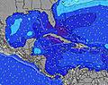 | 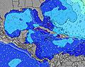 | 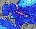 | ||||||||||||
Swell Altura (m) Direção Período (s) | E 8 | E 8 | E 8 | E 8 | E 8 | E 8 | E 8 | E 8 | E 8 | E 8 | E 8 | E 8 | E 8 | E 8 | E 8 | ESE 8 | E 8 | E 8 | E 8 |
Onda Gráfico | |||||||||||||||||||
168 | 172 | 206 | 212 | 181 | 177 | 177 | 149 | 149 | 145 | 145 | 142 | 118 | 118 | 115 | 94 | 90 | 93 | 95 | |
Vento (km/h) | |||||||||||||||||||
Estado do Vento maral cruzado-maral Cruzado cruzado-terral terral cristalino | on | cross-on | cross-on | cross-on | cross-on | cross-on | cross | cross-on | cross-on | cross-on | cross-on | cross | cross | cross | cross-on | cross | cross | cross | cross |
Maré Alta | 4:20PM0.90m | 4:16AM0.62m | 5:11PM0.90m | 5:09AM0.61m | 5:58PM0.92m | ||||||||||||||
Maré Baixa | 10:50PM0.30m | 10:12AM0.18m | 11:42PM0.29m | 11:00AM0.18m | |||||||||||||||
— | — | — | — | 6:28 | — | — | — | — | — | — | — | 6:28 | — | — | — | — | — | — | |
— | 8:00 | — | — | — | — | — | — | 7:59 | — | — | — | — | — | — | — | 7:59 | — | — | |
mm | 1 | 1 | — | — | 1 | 2 | 2 | 1 | — | — | — | 1 | 3 | 1 | — | 1 | 2 | — | — |
Temp. °C | 28 | 28 | 28 | 28 | 28 | 28 | 28 | 28 | 28 | 28 | 28 | 28 | 28 | 28 | 28 | 29 | 29 | 29 | 28 |
Ressent. °C | 29 | 29 | 29 | 29 | 30 | 30 | 30 | 30 | 31 | 30 | 30 | 30 | 31 | 30 | 31 | 31 | 31 | 31 | 30 |
Swell 1 Altura (m) Direção Período (s) | E 8 | E 8 | — | E 8 | E 8 | E 8 | E 8 | E 8 | E 8 | E 8 | E 8 | E 8 | E 8 | E 8 | E 8 | ESE 8 | E 8 | E 8 | E 8 |
168 | 172 | — | 212 | 181 | 177 | 177 | 149 | 149 | 145 | 145 | 142 | 118 | 118 | 115 | 94 | 90 | 93 | 95 | |
Swell 2 Altura (m) Direção Período (s) | NE 9 | — | — | — | — | — | — | — | — | — | — | — | — | — | — | — | — | — | — |
3 | — | — | — | — | — | — | — | — | — | — | — | — | — | — | — | — | — | — | |
Swell 3 Altura (m) Direção Período (s) | — | — | — | — | — | — | — | — | — | — | — | — | — | — | — | — | — | — | — |
— | — | — | — | — | — | — | — | — | — | — | — | — | — | — | — | — | — | — | |
Ondas de vento Altura (m) Direção Período (s) | — | — | E 8 | — | — | — | — | — | — | — | — | — | — | — | — | — | — | — | — |
— | — | 206 | — | — | — | — | — | — | — | — | — | — | — | — | — | — | — | — | |
Terral ou glassy mais perto | |||||||||||||||||||
Distância (km) | 825 | 835 | 837 | 546 | 119 | 119 | 119 | 119 | 1734 | 972 | 546 | 468 | 23 | 345 | 375 | 131 | 131 | 131 | 131 |
Melhor previsões de ondas em Great Abaco - Bahamas | |||||||||||||||||||
Melhor previsões de ondas em Bahamas | |||||||||||||||||||
Buscador de Ondas Global | |||||||||||||||||||
- Map Icons:
 Break
Break Live Wave Height (m)
 Live Wind Speed (km/h)
 Surf Rating (10 Max)
 Ocean Swells (m)
- Wind Speed (km/h)
widget de graça do Surf-Forecast.com para o seu site
O relatório de surf / widget do tempo abaixo está disponível para incorporar em sites de terceiros gratuitamente e fornece um resumo das nossas Four Rocks surf tempo. Simplesmente pegar o trecho de código html que fornecemos e colá-lo em seu próprio site. Você pode escolher seu idioma preferido e unidades métrico/imperial para o surf tempo de alimentação para atender aos usuários do seu site.... Clique aqui para adquirir o código.
 Nearest