
Previsão:

Previsão de curto prazochuva moderada (total 11mm), mais intensa no Domingo à tarde. Warm (máx. 33°C no Domingo à tarde, mín 27°C no Domingo de manhã). o vento será geralmente fraco. | ||||||||||||||||||||||||
Domingo 26 | Segunda-feira 27 | Terça-feira 28 | ||||||||||||||||||||||
2 AM | 5 AM | 8 AM | 11 AM | 2 PM | 5 PM | 8 PM | 11 PM | 2 AM | 5 AM | 8 AM | 11 AM | 2 PM | 5 PM | 8 PM | 11 PM | 2 AM | 5 AM | 8 AM | 11 AM | 2 PM | 5 PM | 8 PM | 11 PM | |
Mapa da altura do Swell | 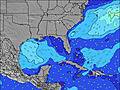 | 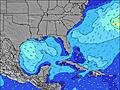 |  | 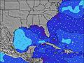 | 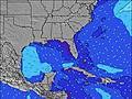 |  | 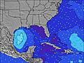 | 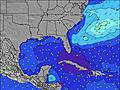 |  | |||||||||||||||
Swell Altura (m) Direção Período (s) | ENE 8 | ENE 8 | ENE 8 | ENE 8 | ENE 8 | ENE 8 | ENE 8 | ENE 8 | ENE 8 | ENE 8 | ENE 8 | ENE 8 | ENE 8 | ENE 8 | SSE 4 | S 4 | ENE 8 | ENE 8 | ENE 8 | ENE 8 | ENE 8 | ENE 8 | S 4 | ENE 8 |
Onda Gráfico | ||||||||||||||||||||||||
11 | 11 | 12 | 12 | 12 | 12 | 12 | 12 | 12 | 12 | 12 | 6 | 6 | 6 | 10 | 14 | 6 | 6 | 6 | 6 | 6 | 6 | 14 | 6 | |
Vento (km/h) | ||||||||||||||||||||||||
Estado do Vento maral cruzado-maral Cruzado cruzado-terral terral cristalino | cross-off | cross-off | cross-off | cross-off | cross | on | cross | cross | off | off | off | glassy | cross-on | cross-on | cross-off | cross-off | glassy | cross-off | cross-off | cross-off | cross-off | cross-on | off | off |
Maré Alta | 6:15AM0.67m | 7:05PM0.83m | 7:02AM0.69m | 7:47PM0.86m | 7:46AM0.71m | 8:28PM0.88m | ||||||||||||||||||
Maré Baixa | 00:30AM0.19m | 12:29PM0.03m | 1:16AM0.17m | 1:15PM0.02m | 1:59AM0.14m | 1:57PM0.00m | ||||||||||||||||||
— | 6:41 | — | — | — | — | — | — | — | 6:41 | — | — | — | — | — | — | — | 6:41 | — | — | — | — | — | — | |
— | — | — | — | — | — | 8:10 | — | — | — | — | — | — | — | 8:09 | — | — | — | — | — | — | — | 8:09 | — | |
mm | 2 | — | — | — | — | 3 | — | 1 | 1 | — | — | — | — | 1 | 1 | 1 | 1 | — | — | — | — | 1 | 1 | — |
Temp. °C | 28 | 27 | 27 | 30 | 33 | 31 | 31 | 30 | 28 | 27 | 27 | 31 | 32 | 32 | 31 | 29 | 27 | 27 | 27 | 30 | 33 | 33 | 33 | 29 |
Ressent. °C | 31 | 30 | 30 | 32 | 36 | 33 | 34 | 34 | 30 | 29 | 30 | 34 | 34 | 34 | 33 | 32 | 31 | 29 | 29 | 31 | 34 | 35 | 33 | 29 |
Swell 1 Altura (m) Direção Período (s) | ENE 8 | ENE 8 | ENE 8 | ENE 8 | ENE 8 | ENE 8 | ENE 8 | ENE 8 | SSE 4 | ENE 8 | ENE 8 | ENE 8 | ENE 8 | ENE 8 | ENE 8 | S 4 | SSE 4 | S 4 | ENE 8 | ENE 8 | ENE 8 | ENE 8 | SSE 4 | SSE 4 |
11 | 11 | 12 | 12 | 12 | 12 | 12 | 12 | 3 | 12 | 12 | 6 | 6 | 6 | 6 | 7 | 3 | 2 | 6 | 6 | 6 | 6 | 5 | 5 | |
Swell 2 Altura (m) Direção Período (s) | S 3 | S 3 | SSE 3 | S 3 | S 3 | E 7 | E 7 | E 8 | ENE 8 | SSE 4 | S 4 | S 3 | E 7 | E 7 | E 7 | ENE 8 | ENE 8 | ENE 8 | S 3 | NNE 6 | NNE 6 | NNE 6 | ENE 8 | ENE 8 |
1 | 1 | 1 | 1 | 1 | 1 | 1 | 1 | 12 | 3 | 1 | 1 | 1 | 1 | 1 | 6 | 6 | 6 | 1 | 4 | 4 | 4 | 6 | 6 | |
Swell 3 Altura (m) Direção Período (s) | ESE 4 | E 7 | E 7 | E 7 | E 7 | — | — | E 8 | E 8 | E 8 | E 7 | — | N 6 | N 6 | N 6 | N 6 | NE 6 | NE 6 | NE 6 | E 8 | E 8 | E 8 | NNE 6 | NNE 6 |
1 | 4 | 4 | 1 | 1 | — | — | 4 | 1 | 1 | 1 | — | 1 | 1 | 1 | 1 | 2 | 2 | 2 | 1 | 1 | 1 | 3 | 3 | |
Ondas de vento Altura (m) Direção Período (s) | — | — | — | WSW 2 | — | S 3 | SSE 3 | SSE 4 | — | W 2 | WNW 2 | — | — | SSE 3 | SSE 4 | S 4 | — | WSW 2 | WSW 2 | WSW 2 | SW 3 | SSE 2 | S 4 | W 2 |
— | — | — | 1 | — | 1 | 2 | 2 | — | 1 | 1 | — | — | 3 | 10 | 14 | — | 1 | 1 | 1 | 1 | 1 | 14 | 1 | |
Terral ou glassy mais perto | ||||||||||||||||||||||||
Distância (km) | 354 | 139 | 139 | 139 | 139 | 140 | 306 | 139 | 304 | 391 | 140 | 354 | 385 | 367 | 367 | 374 | 374 | 139 | 385 | 677 | 944 | 1605 | 367 | 367 |
Melhor previsões de ondas em South Florida | ||||||||||||||||||||||||
Melhor previsões de ondas em United States | ||||||||||||||||||||||||
Buscador de Ondas Global | ||||||||||||||||||||||||
- Map Icons:
 Break
Break Live Wave Height (m)
 Live Wind Speed (km/h)
 Surf Rating (10 Max)
 Ocean Swells (m)
- Wind Speed (km/h)
widget de graça do Surf-Forecast.com para o seu site
O relatório de surf / widget do tempo abaixo está disponível para incorporar em sites de terceiros gratuitamente e fornece um resumo das nossas Flagpoles surf tempo. Simplesmente pegar o trecho de código html que fornecemos e colá-lo em seu próprio site. Você pode escolher seu idioma preferido e unidades métrico/imperial para o surf tempo de alimentação para atender aos usuários do seu site.... Clique aqui para adquirir o código.
 Nearest