
Previsão:

Previsão de curto prazoprincipalmente seco. Warm (máx. 21°C na Segunda à tarde, mín 19°C na Terça à noite). principalmente ventos fortes. | |||||||||||||||||||
Seg 3 | Terça-feira 4 | Quarta-feira 5 | |||||||||||||||||
4 PM | 7 PM | 10 PM | 1 AM | 4 AM | 7 AM | 10 AM | 1 PM | 4 PM | 7 PM | 10 PM | 1 AM | 4 AM | 7 AM | 10 AM | 1 PM | 4 PM | 7 PM | 10 PM | |
Mapa da altura do Swell | 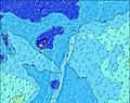 | 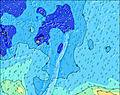 | 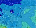 | 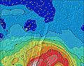 | 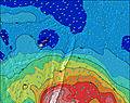 | 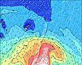 | 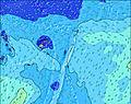 | ||||||||||||
Swell Altura (m) Direção Período (s) | SW 13 | SW 13 | SW 13 | SW 12 | SW 12 | SW 12 | SW 12 | SSW 13 | S 12 | SSW 11 | S 11 | S 10 | S 10 | S 10 | SW 18 | S 11 | SW 17 | SW 17 | SW 16 |
Onda Gráfico | |||||||||||||||||||
663 | 814 | 865 | 1269 | 1229 | 1144 | 1209 | 1211 | 1438 | 1783 | 1532 | 1254 | 1200 | 1009 | 891 | 941 | 1038 | 802 | 966 | |
Vento (km/h) | |||||||||||||||||||
Estado do Vento maral cruzado-maral Cruzado cruzado-terral terral cristalino | cross | cross | cross | cross | cross-off | cross-off | cross-off | cross-off | cross-off | cross-off | off | off | cross-off | cross-off | cross-off | cross-off | cross-off | cross-off | off |
Maré Alta | 11:08PM1.27m | 11:23AM1.20m | 11:50PM1.29m | 12:13PM1.17m | |||||||||||||||
Maré Baixa | 5:19AM0.32m | 5:29PM0.28m | 6:07AM0.30m | 6:15PM0.31m | |||||||||||||||
— | — | — | — | — | 7:11 | — | — | — | — | — | — | — | 7:11 | — | — | — | — | — | |
6:22 | — | — | — | — | — | — | — | 6:22 | — | — | — | — | — | — | — | 6:22 | — | — | |
mm | — | — | — | — | — | — | — | — | — | — | — | — | — | — | — | — | — | — | — |
Temp. °C | 21 | 20 | 20 | 20 | 20 | 20 | 20 | 20 | 20 | 20 | 20 | 19 | 19 | 19 | 19 | 19 | 19 | 19 | 19 |
Ressent. °C | 17 | 15 | 16 | 16 | 15 | 15 | 17 | 16 | 15 | 15 | 16 | 15 | 15 | 14 | 14 | 15 | 14 | 14 | 13 |
Swell 1 Altura (m) Direção Período (s) | SW 13 | SW 13 | SW 13 | SW 12 | SW 12 | SW 12 | SW 12 | SW 12 | S 12 | SSW 11 | S 11 | SW 11 | SW 18 | SW 18 | S 11 | SW 17 | SW 17 | SW 17 | SW 16 |
663 | 814 | 865 | 1269 | 1229 | 1144 | 1209 | 1088 | 1438 | 1783 | 1532 | 209 | 758 | 718 | 303 | 861 | 1038 | 802 | 966 | |
Swell 2 Altura (m) Direção Período (s) | E 6 | E 7 | E 7 | S 15 | S 14 | S 14 | S 13 | SSW 13 | SW 12 | SW 11 | SW 11 | SW 19 | SW 11 | SW 12 | SW 18 | SW 12 | SW 12 | SW 12 | S 14 |
21 | 26 | 26 | 218 | 338 | 400 | 539 | 1211 | 792 | 331 | 357 | 614 | 155 | 197 | 891 | 141 | 112 | 87 | 138 | |
Swell 3 Altura (m) Direção Período (s) | SE 12 | SE 10 | SSW 16 | ENE 7 | ENE 9 | ENE 9 | ENE 9 | E 8 | SW 21 | SW 20 | SW 20 | ENE 9 | ENE 9 | ENE 9 | SW 12 | ENE 8 | ENE 8 | ENE 8 | ENE 8 |
52 | 15 | 87 | 29 | 47 | 45 | 44 | 31 | 269 | 315 | 455 | 31 | 31 | 30 | 114 | 24 | 24 | 24 | 23 | |
Ondas de vento Altura (m) Direção Período (s) | SW 5 | SW 6 | SW 6 | SW 7 | SW 7 | — | — | — | — | SSE 4 | SSE 4 | S 10 | S 10 | S 10 | S 9 | S 11 | S 11 | S 11 | S 11 |
45 | 67 | 116 | 88 | 84 | — | — | — | — | 11 | 17 | 1254 | 1200 | 1009 | 509 | 941 | 866 | 764 | 694 | |
Terral ou glassy mais perto | |||||||||||||||||||
Distância (km) | 803 | 864 | 864 | 864 | 789 | 789 | 861 | 886 | 886 | 861 | 861 | 861 | 886 | 886 | 886 | 1 | 1 | 1617 | 1617 |
Melhor previsões de ondas em Tonga - Tongatapu | |||||||||||||||||||
Melhor previsões de ondas em Tonga | |||||||||||||||||||
Buscador de Ondas Global | |||||||||||||||||||
- Map Icons:
 Break
Break Live Wave Height (m)
 Live Wind Speed (km/h)
 Surf Rating (10 Max)
 Ocean Swells (m)
- Wind Speed (km/h)
widget de graça do Surf-Forecast.com para o seu site
O relatório de surf / widget do tempo abaixo está disponível para incorporar em sites de terceiros gratuitamente e fornece um resumo das nossas Fishtraps surf tempo. Simplesmente pegar o trecho de código html que fornecemos e colá-lo em seu próprio site. Você pode escolher seu idioma preferido e unidades métrico/imperial para o surf tempo de alimentação para atender aos usuários do seu site.... Clique aqui para adquirir o código.
 Nearest