
Previsão:

Previsão de curto prazoprincipalmente seco. Warm (máx. 29°C no Domingo à noite, mín 27°C no Domingo à noite). o vento será geralmente fraco. | ||||||||||||||||||||||||
Segunda-feira 3 | Terça-feira 4 | Quarta-feira 5 | ||||||||||||||||||||||
1 AM | 4 AM | 7 AM | 10 AM | 1 PM | 4 PM | 7 PM | 10 PM | 1 AM | 4 AM | 7 AM | 10 AM | 1 PM | 4 PM | 7 PM | 10 PM | 1 AM | 4 AM | 7 AM | 10 AM | 1 PM | 4 PM | 7 PM | 10 PM | |
Mapa da altura do Swell | 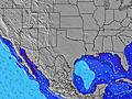 | 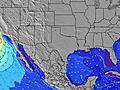 | 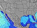 | 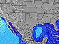 | 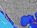 | 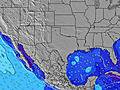 | 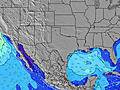 | 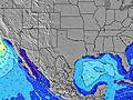 | 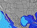 | |||||||||||||||
Swell Altura (m) Direção Período (s) | S 4 | S 4 | SSE 5 | SSE 5 | SE 5 | SE 5 | SSE 5 | SSE 4 | SSE 4 | SSE 5 | SSE 5 | SSE 5 | SSE 5 | SSE 5 | SSE 5 | SSE 5 | SSE 5 | SSE 5 | SE 5 | SE 5 | SE 5 | SE 5 | SE 5 | SE 6 |
Onda Gráfico | ||||||||||||||||||||||||
9 | 12 | 19 | 15 | 11 | 11 | 15 | 15 | 28 | 32 | 33 | 28 | 30 | 33 | 33 | 44 | 44 | 45 | 39 | 41 | 41 | 41 | 35 | 50 | |
Vento (km/h) | ||||||||||||||||||||||||
Estado do Vento maral cruzado-maral Cruzado cruzado-terral terral cristalino | cross-on | cross-on | cross-on | cross-on | on | on | on | cross-on | cross-on | cross-on | cross-on | on | on | on | on | on | on | cross-on | cross-on | cross-on | on | on | on | on |
Maré Alta | 6:41AM0.41m | 8:16PM0.39m | 6:21AM0.44m | 11:02PM0.48m | 5:33AM0.48m | |||||||||||||||||||
Maré Baixa | 00:03AM0.19m | 1:20PM0.18m | 00:49AM0.33m | 2:01PM0.12m | 2:02AM0.47m | 2:51PM0.05m | ||||||||||||||||||
— | 6:52 | — | — | — | — | — | — | — | 6:52 | — | — | — | — | — | — | — | 6:52 | — | — | — | — | — | — | |
— | — | — | — | — | — | 8:15 | — | — | — | — | — | — | — | 8:15 | — | — | — | — | — | — | — | 8:15 | — | |
mm | — | — | — | — | — | — | — | — | — | — | — | — | — | — | — | — | — | — | — | — | — | — | — | — |
Temp. °C | 28 | 28 | 27 | 28 | 28 | 28 | 29 | 28 | 28 | 27 | 27 | 28 | 29 | 29 | 29 | 28 | 28 | 28 | 27 | 28 | 28 | 29 | 29 | 29 |
Ressent. °C | 30 | 30 | 29 | 32 | 31 | 30 | 31 | 29 | 29 | 29 | 30 | 31 | 31 | 30 | 30 | 29 | 29 | 30 | 29 | 31 | 31 | 31 | 31 | 30 |
Swell 1 Altura (m) Direção Período (s) | ESE 6 | SE 6 | SE 10 | ESE 10 | ESE 9 | ESE 9 | ESE 9 | ESE 9 | ESE 9 | ESE 9 | ESE 9 | ESE 9 | ESE 9 | ESE 9 | ESE 9 | ESE 8 | ESE 8 | SE 8 | E 8 | E 8 | E 9 | E 8 | E 8 | — |
4 | 6 | 4 | 9 | 9 | 8 | 8 | 8 | 8 | 8 | 8 | 8 | 8 | 8 | 7 | 7 | 7 | 3 | 1 | 1 | 1 | 1 | 1 | — | |
Swell 2 Altura (m) Direção Período (s) | SE 5 | SE 10 | ESE 10 | ESE 10 | ESE 9 | — | — | — | — | — | — | S 5 | — | — | — | — | — | — | — | — | — | — | — | — |
1 | 4 | 9 | 9 | 8 | — | — | — | — | — | — | 17 | — | — | — | — | — | — | — | — | — | — | — | — | |
Swell 3 Altura (m) Direção Período (s) | SE 8 | — | — | — | — | — | — | — | — | — | — | ESE 9 | — | — | — | — | — | — | — | — | — | — | — | — |
3 | — | — | — | — | — | — | — | — | — | — | 8 | — | — | — | — | — | — | — | — | — | — | — | — | |
Ondas de vento Altura (m) Direção Período (s) | S 4 | S 4 | SSE 5 | SSE 5 | SE 5 | SE 5 | SSE 5 | SSE 4 | SSE 4 | SSE 5 | SSE 5 | SSE 5 | SSE 5 | SSE 5 | SSE 5 | SSE 5 | SSE 5 | SSE 5 | SE 5 | SE 5 | SE 5 | SE 5 | SE 5 | SE 6 |
9 | 12 | 19 | 15 | 11 | 11 | 15 | 15 | 28 | 32 | 33 | 28 | 30 | 33 | 33 | 44 | 44 | 45 | 39 | 41 | 41 | 41 | 35 | 50 | |
Terral ou glassy mais perto | ||||||||||||||||||||||||
Distância (km) | 1033 | 1050 | 1050 | 1050 | 1307 | 1307 | 1172 | 1063 | 1050 | 1050 | 1050 | 1050 | 1157 | 1228 | 1154 | 1076 | 1050 | 1050 | 1050 | 1050 | 1154 | 1155 | 1158 | 1154 |
Melhor previsões de ondas em Texas | ||||||||||||||||||||||||
Melhor previsões de ondas em United States | ||||||||||||||||||||||||
Buscador de Ondas Global | ||||||||||||||||||||||||
- Map Icons:
 Break
Break Live Wave Height (m)
 Live Wind Speed (km/h)
 Surf Rating (10 Max)
 Ocean Swells (m)
- Wind Speed (km/h)
widget de graça do Surf-Forecast.com para o seu site
O relatório de surf / widget do tempo abaixo está disponível para incorporar em sites de terceiros gratuitamente e fornece um resumo das nossas Fish Pass Jetty surf tempo. Simplesmente pegar o trecho de código html que fornecemos e colá-lo em seu próprio site. Você pode escolher seu idioma preferido e unidades métrico/imperial para o surf tempo de alimentação para atender aos usuários do seu site.... Clique aqui para adquirir o código.
 Nearest