
Previsão:

Previsão de curto prazoChuva intensa (total 21mm), mais intensa durante Terça à noite. Warm (máx. 26°C na Quarta à tarde, mín 18°C na Quarta à noite). Ventos diminuem (ventos frescos de Su-Sudoeste na Terça à noite, vento fraco de Sudoeste na Quarta à noite). | |||||||||||||||||||||
Ter 21 | Quarta-feira 22 | Quinta-feira 23 | |||||||||||||||||||
11 AM | 2 PM | 5 PM | 8 PM | 11 PM | 2 AM | 5 AM | 8 AM | 11 AM | 2 PM | 5 PM | 8 PM | 11 PM | 2 AM | 5 AM | 8 AM | 11 AM | 2 PM | 5 PM | 8 PM | 11 PM | |
Mapa da altura do Swell |  |  |  | 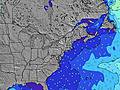 |  |  | 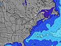 |  | |||||||||||||
Swell Altura (m) Direção Período (s) | S 5 | SSE 6 | S 6 | S 6 | S 7 | S 7 | S 8 | S 8 | S 8 | S 9 | S 9 | S 9 | S 9 | S 9 | S 8 | S 8 | S 8 | S 8 | S 8 | S 8 | S 8 |
Onda Gráfico | |||||||||||||||||||||
64 | 135 | 146 | 161 | 222 | 188 | 323 | 496 | 617 | 493 | 699 | 529 | 335 | 343 | 279 | 230 | 153 | 157 | 161 | 82 | 78 | |
Vento (km/h) | |||||||||||||||||||||
Estado do Vento maral cruzado-maral Cruzado cruzado-terral terral cristalino | cross-on | cross-on | cross-on | cross | cross-on | cross-off | cross-off | cross | cross-off | cross | cross-off | cross-off | cross-off | cross-off | cross-off | cross-off | cross | cross-on | on | cross-on | on |
Maré Alta | 2:15PM0.93m | 2:35AM0.79m | 3:14PM0.92m | 3:38AM0.75m | 4:11PM0.92m | ||||||||||||||||
Maré Baixa | 7:44PM0.23m | 7:51AM0.17m | 8:42PM0.26m | 8:41AM0.20m | 9:40PM0.27m | ||||||||||||||||
— | — | — | — | — | — | 5:37 | — | — | — | — | — | — | — | 5:39 | — | — | — | — | — | — | |
— | — | — | 8:16 | — | — | — | — | — | — | — | 8:15 | — | — | — | — | — | — | — | 8:15 | — | |
mm | 1 | 5 | 3 | 3 | 8 | — | — | — | — | 1 | 1 | — | — | — | — | — | — | — | — | — | — |
Temp. °C | 23 | 24 | 23 | 23 | 23 | 22 | 22 | 22 | 23 | 25 | 26 | 26 | 22 | 20 | 18 | 18 | 21 | 23 | 22 | 21 | 21 |
Ressent. °C | 21 | 23 | 23 | 22 | 24 | 20 | 20 | 20 | 21 | 23 | 27 | 27 | 18 | 17 | 15 | 15 | 18 | 21 | 20 | 19 | 20 |
Swell 1 Altura (m) Direção Período (s) | SE 12 | SE 12 | S 12 | SE 12 | S 7 | — | — | S 8 | S 8 | — | S 9 | S 9 | S 9 | S 9 | S 8 | S 8 | S 8 | S 8 | S 8 | S 8 | S 8 |
5 | 6 | 3 | 5 | 167 | — | — | 355 | 439 | — | 505 | 371 | 335 | 343 | 279 | 230 | 153 | 157 | 161 | 82 | 78 | |
Swell 2 Altura (m) Direção Período (s) | — | — | — | — | SE 11 | — | — | — | — | — | — | — | — | — | — | — | — | — | SE 8 | SE 7 | SE 7 |
— | — | — | — | 5 | — | — | — | — | — | — | — | — | — | — | — | — | — | 46 | 41 | 39 | |
Swell 3 Altura (m) Direção Período (s) | — | — | — | — | — | — | — | — | — | — | — | — | — | — | — | — | — | — | ENE 3 | SE 8 | — |
— | — | — | — | — | — | — | — | — | — | — | — | — | — | — | — | — | — | 1 | 18 | — | |
Ondas de vento Altura (m) Direção Período (s) | S 5 | SSE 6 | S 6 | S 6 | S 7 | S 7 | S 8 | S 8 | S 8 | S 9 | S 9 | S 9 | — | — | N 2 | NNE 2 | NNE 3 | NE 4 | — | — | — |
64 | 135 | 146 | 161 | 222 | 188 | 323 | 496 | 617 | 493 | 699 | 529 | — | — | 1 | 1 | 1 | 3 | — | — | — | |
Terral ou glassy mais perto | |||||||||||||||||||||
Distância (km) | 1176 | 1176 | 1176 | 124 | 230 | 308 | 114 | 503 | 100 | 99 | 0 | 0 | 24 | 24 | 40 | 40 | 24 | 32 | 114 | 91 | 99 |
Melhor previsões de ondas em Long Island New York | |||||||||||||||||||||
Melhor previsões de ondas em United States | |||||||||||||||||||||
Buscador de Ondas Global | |||||||||||||||||||||
- Map Icons:
 Break
Break Live Wave Height (m)
 Live Wind Speed (km/h)
 Surf Rating (10 Max)
 Ocean Swells (m)
- Wind Speed (km/h)
widget de graça do Surf-Forecast.com para o seu site
O relatório de surf / widget do tempo abaixo está disponível para incorporar em sites de terceiros gratuitamente e fornece um resumo das nossas Fire Island surf tempo. Simplesmente pegar o trecho de código html que fornecemos e colá-lo em seu próprio site. Você pode escolher seu idioma preferido e unidades métrico/imperial para o surf tempo de alimentação para atender aos usuários do seu site.... Clique aqui para adquirir o código.
 Nearest