
Previsão:

Previsão de curto prazoChuva intensa (total 25mm), mais intensa durante Domingo à noite. Warm (máx. 29°C na Sexta de manhã, mín 27°C no Domingo à noite). o vento será geralmente fraco. | |||||||||||||||||||||||
Sexta-feira 17 | Sábado 18 | Domingo 19 | |||||||||||||||||||||
5 AM | 8 AM | 11 AM | 2 PM | 5 PM | 8 PM | 11 PM | 2 AM | 5 AM | 8 AM | 11 AM | 2 PM | 5 PM | 8 PM | 11 PM | 2 AM | 5 AM | 8 AM | 11 AM | 2 PM | 5 PM | 8 PM | 11 PM | |
Mapa da altura do Swell | 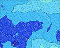 | 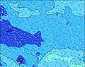 | 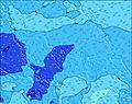 | 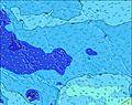 | 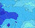 | 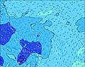 | 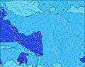 | 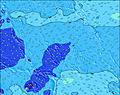 |  | ||||||||||||||
Swell Altura (m) Direção Período (s) | S 12 | S 13 | SSW 11 | S 15 | S 10 | WNW 14 | WNW 14 | S 14 | S 15 | S 15 | S 16 | S 16 | S 16 | S 16 | S 15 | S 15 | S 15 | S 14 | S 10 | S 10 | S 10 | S 14 | S 14 |
Onda Gráfico | |||||||||||||||||||||||
299 | 350 | 202 | 165 | 225 | 152 | 147 | 260 | 362 | 440 | 1009 | 1129 | 1290 | 991 | 1209 | 1229 | 1358 | 1340 | 314 | 374 | 290 | 515 | 508 | |
Vento (km/h) | |||||||||||||||||||||||
Estado do Vento maral cruzado-maral Cruzado cruzado-terral terral cristalino | cross-off | cross-off | cross-off | cross-off | cross-off | cross-off | cross-off | cross-off | cross-off | off | off | off | off | off | glassy | cross-on | cross-on | cross-on | cross-on | cross-on | on | on | on |
Maré Alta | 10:22AM0.46m | 9:49PM0.64m | 11:31AM0.51m | 10:23PM0.55m | 12:42PM0.55m | 10:57PM0.46m | |||||||||||||||||
Maré Baixa | 4:21AM0.13m | 3:25PM0.28m | 4:54AM0.14m | 4:42PM0.34m | 5:27AM0.15m | 6:31PM0.39m | |||||||||||||||||
6:33 | — | — | — | — | — | — | — | 6:33 | — | — | — | — | — | — | — | 6:33 | — | — | — | — | — | — | |
— | — | — | — | 6:52 | — | — | — | — | — | — | — | 6:52 | — | — | — | — | — | — | — | 6:52 | — | — | |
mm | — | — | 1 | — | — | — | 1 | 1 | 1 | 1 | 1 | — | — | — | — | — | 1 | 1 | — | 1 | 1 | 1 | 4 |
Temp. °C | 28 | 29 | 28 | 29 | 29 | 29 | 28 | 29 | 29 | 29 | 29 | 29 | 29 | 29 | 28 | 28 | 28 | 28 | 28 | 28 | 28 | 28 | 27 |
Ressent. °C | 30 | 31 | 29 | 30 | 30 | 30 | 29 | 31 | 31 | 31 | 31 | 32 | 33 | 33 | 32 | 32 | 31 | 31 | 30 | 30 | 30 | 30 | 29 |
Swell 1 Altura (m) Direção Período (s) | S 12 | S 13 | SSW 11 | SSW 10 | S 10 | SSW 10 | SSW 10 | NNE 7 | S 15 | S 15 | S 16 | S 16 | S 16 | S 16 | S 15 | S 15 | S 15 | S 14 | SSE 15 | S 10 | SSE 15 | S 10 | S 10 |
299 | 350 | 202 | 139 | 225 | 125 | 125 | 62 | 362 | 440 | 1009 | 1129 | 1290 | 991 | 1209 | 1229 | 1358 | 1340 | 744 | 374 | 639 | 361 | 302 | |
Swell 2 Altura (m) Direção Período (s) | WNW 14 | WNW 14 | WNW 14 | WNW 14 | WNW 14 | NNE 7 | WNW 14 | SSW 10 | NNE 7 | NNE 7 | NNE 7 | NNE 7 | NNE 7 | NE 7 | NE 7 | NE 7 | NE 7 | NE 7 | S 10 | SSE 15 | S 10 | S 14 | S 14 |
218 | 215 | 163 | 160 | 158 | 66 | 147 | 123 | 62 | 81 | 78 | 78 | 78 | 65 | 65 | 46 | 46 | 37 | 314 | 639 | 290 | 515 | 508 | |
Swell 3 Altura (m) Direção Período (s) | NE 7 | NE 7 | NNE 7 | S 15 | SSW 14 | WNW 14 | S 16 | S 14 | SSW 11 | SSW 12 | WNW 13 | WNW 13 | WNW 13 | SSW 11 | SSW 11 | WNW 13 | WNW 13 | WNW 13 | NE 7 | W 13 | NNE 7 | NE 8 | NNE 9 |
44 | 44 | 36 | 165 | 73 | 152 | 129 | 260 | 107 | 81 | 102 | 101 | 99 | 128 | 79 | 98 | 98 | 98 | 41 | 84 | 34 | 59 | 141 | |
Ondas de vento Altura (m) Direção Período (s) | — | — | N 3 | NNE 3 | NNE 7 | — | NNE 7 | — | — | — | — | — | — | — | — | — | — | — | — | — | W 8 | W 6 | W 6 |
— | — | 1 | 3 | 59 | — | 64 | — | — | — | — | — | — | — | — | — | — | — | — | — | 20 | 13 | 12 | |
Terral ou glassy mais perto | |||||||||||||||||||||||
Distância (km) | 1771 | 1726 | 1809 | 1823 | 1823 | 1789 | 1776 | 1776 | 1776 | 0 | 0 | 0 | 0 | 0 | 0 | 1792 | 1794 | 1776 | 1891 | 1903 | 1891 | 1826 | 1776 |
Melhor previsões de ondas em Line Islands | |||||||||||||||||||||||
Melhor previsões de ondas em Kiribati | |||||||||||||||||||||||
Buscador de Ondas Global | |||||||||||||||||||||||
- Map Icons:
 Break
Break Live Wave Height (m)
 Live Wind Speed (km/h)
 Surf Rating (10 Max)
 Ocean Swells (m)
- Wind Speed (km/h)
widget de graça do Surf-Forecast.com para o seu site
O relatório de surf / widget do tempo abaixo está disponível para incorporar em sites de terceiros gratuitamente e fornece um resumo das nossas English Channel Left (Fanning Island) surf tempo. Simplesmente pegar o trecho de código html que fornecemos e colá-lo em seu próprio site. Você pode escolher seu idioma preferido e unidades métrico/imperial para o surf tempo de alimentação para atender aos usuários do seu site.... Clique aqui para adquirir o código.
 Nearest