

Emma Wood State Beach Surf Guide
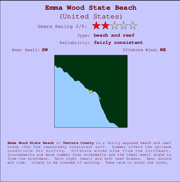
Emma Wood State Beach in Ventura is a fairly exposed beach and reef break that has quite reliable surf. Summer offers the favoured conditions for surfing. The best wind direction is from the northeast. Tends to receive distant groundswells and the best swell direction is from the southwest. Left and better right hand reef breaks.. Best around mid tide. When the surf is up, crowds are likely Take care of rocks in the line up.
Emma Wood State Beach Spot Info
| Type: | Rating: | Reliability: | Todays Sea Temp*: |
|---|---|---|---|
| fairly consistent | 19.9°C*ocean temperature recorded from satellite |
Surfing Emma Wood State Beach:
The best conditions reported for surf at Emma Wood State Beach occur when a Southwest swell combines with an offshore wind direction from the Northeast.

Previsão da Energia de Ondas (Força): 12hrs


Emma Wood State Beach Surf:
Saturday, 18 July 2026, 06:52 Local time| Sábado 18 | ||||
| 8AM | 11AM | 2PM | 5PM | |
| Wave (m) | ||||
| Período (s) | 17 | 18 | 18 | 18 |
| Vento (km/h) | ||||
| Estado do Vento | glass | on | on | cross- on |
- /breaks/Emma-Wood-State-Beach/forecasts/latest
Emma Wood State Beach Surf Guide
Emma Wood State Beach in Ventura is a fairly exposed beach and reef break that has quite reliable surf. Summer offers the favoured conditions for surfing. The best wind direction is from the northeast. Tends to receive distant groundswells and the best swell direction is from the southwest. Left and better right hand reef breaks.. Best around mid tide. When the surf is up, crowds are likely Take care of rocks in the line up.
Emma Wood State Beach Spot Info
Type: Rating: Reliability: Todays Sea Temp*:  Beach and reef
 2
2fairly consistent 19.9°C*ocean temperature recorded from satelliteSurfing Emma Wood State Beach:
The best conditions reported for surf at Emma Wood State Beach occur when a Southwest swell combines with an offshore wind direction from the Northeast.
Previsão da Energia de Ondas (Força): 12hrs
Use a aba navegação acima para ver temperatura do mar em Emma Wood State Beach, fotografias de Emma Wood State Beach, previsões detalhadas do swell em Emma Wood State Beach, previsões do vento e do tempo, webcams em Emma Wood State Beach , vento atual em CAL - Ventura com base em dados ao vivo fornecidos por estações de meteorologia e previsões da maré em Emma Wood State Beach. O link para os mapas do swell em United States abrirá uma imagem ampliada monstrando United States e os mares próximos. Estes mapas do swell podem ser animados para mostrar diferentes componentes do swell, energia das ondas, período das ondas, altura das ondas, assim como previsões do vento e do tempo, observações em tempo real do estado do tempo e do mar graças às bóias de United States, navios passantes e estações de meteorologia presentes na costa. Cada uma das páginas de previsão para este surf break apresenta as ferramentas do buscador global e regional para localizar as melores condições de surf na área ao redor de Emma Wood State Beach.
Emma Wood State Beach Surf:
Saturday, 18 July 2026, 06:52 Local timeSábado 18 8AM 11AM 2PM 5PM Wave (m) Período (s) 17 18 18 18 Vento (km/h) Estado do Vento glass on on cross-
on- /breaks/Emma-Wood-State-Beach/forecasts/latest
- /breaks/Emma-Wood-State-Beach/forecasts/latest/six_day
Emma Wood State Beach Surf Guide
Emma Wood State Beach in Ventura is a fairly exposed beach and reef break that has quite reliable surf. Summer offers the favoured conditions for surfing. The best wind direction is from the northeast. Tends to receive distant groundswells and the best swell direction is from the southwest. Left and better right hand reef breaks.. Best around mid tide. When the surf is up, crowds are likely Take care of rocks in the line up.
Emma Wood State Beach Spot Info
Type: Rating: Reliability: Todays Sea Temp*: Beach and reef2fairly consistent 19.9°C*ocean temperature recorded from satelliteSurfing Emma Wood State Beach:
The best conditions reported for surf at Emma Wood State Beach occur when a Southwest swell combines with an offshore wind direction from the Northeast.
Previsão da Energia de Ondas (Força): 12hrs
Use a aba navegação acima para ver temperatura do mar em Emma Wood State Beach, fotografias de Emma Wood State Beach, previsões detalhadas do swell em Emma Wood State Beach, previsões do vento e do tempo, webcams em Emma Wood State Beach , vento atual em CAL - Ventura com base em dados ao vivo fornecidos por estações de meteorologia e previsões da maré em Emma Wood State Beach. O link para os mapas do swell em United States abrirá uma imagem ampliada monstrando United States e os mares próximos. Estes mapas do swell podem ser animados para mostrar diferentes componentes do swell, energia das ondas, período das ondas, altura das ondas, assim como previsões do vento e do tempo, observações em tempo real do estado do tempo e do mar graças às bóias de United States, navios passantes e estações de meteorologia presentes na costa. Cada uma das páginas de previsão para este surf break apresenta as ferramentas do buscador global e regional para localizar as melores condições de surf na área ao redor de Emma Wood State Beach.
Emma Wood State Beach Surf:
Saturday, 18 July 2026, 06:52 Local timeSábado 18 8AM 11AM 2PM 5PM Wave (m) Período (s) 17 18 18 18 Vento (km/h) Estado do Vento glass on on cross-
on- /breaks/Emma-Wood-State-Beach/forecasts/latest
Emma Wood State Beach Surf Guide
Emma Wood State Beach in Ventura is a fairly exposed beach and reef break that has quite reliable surf. Summer offers the favoured conditions for surfing. The best wind direction is from the northeast. Tends to receive distant groundswells and the best swell direction is from the southwest. Left and better right hand reef breaks.. Best around mid tide. When the surf is up, crowds are likely Take care of rocks in the line up.
Emma Wood State Beach Spot Info
Type: Rating: Reliability: Todays Sea Temp*: Beach and reef2fairly consistent 19.9°C*ocean temperature recorded from satelliteSurfing Emma Wood State Beach:
The best conditions reported for surf at Emma Wood State Beach occur when a Southwest swell combines with an offshore wind direction from the Northeast.
Previsão da Energia de Ondas (Força): 12hrs
Use a aba navegação acima para ver temperatura do mar em Emma Wood State Beach, fotografias de Emma Wood State Beach, previsões detalhadas do swell em Emma Wood State Beach, previsões do vento e do tempo, webcams em Emma Wood State Beach , vento atual em CAL - Ventura com base em dados ao vivo fornecidos por estações de meteorologia e previsões da maré em Emma Wood State Beach. O link para os mapas do swell em United States abrirá uma imagem ampliada monstrando United States e os mares próximos. Estes mapas do swell podem ser animados para mostrar diferentes componentes do swell, energia das ondas, período das ondas, altura das ondas, assim como previsões do vento e do tempo, observações em tempo real do estado do tempo e do mar graças às bóias de United States, navios passantes e estações de meteorologia presentes na costa. Cada uma das páginas de previsão para este surf break apresenta as ferramentas do buscador global e regional para localizar as melores condições de surf na área ao redor de Emma Wood State Beach.
Emma Wood State Beach Surf:
Saturday, 18 July 2026, 06:52 Local timeSábado 18 8AM 11AM 2PM 5PM Wave (m) Período (s) 17 18 18 18 Vento (km/h) Estado do Vento glass on on cross-
onTide Times:
Para Ventura, California %{dist} %{km} de %{location}
A PRÓXIMA É ÀS (hora local) faltam maré alta maré baixa Emma Wood State Beach Tide Times and Tide Chart
Live Weather:
At Oxnard Airport, 13 km from Emma Wood State Beach.
calm
(km/h)
Dry and partly cloudyAir temperature
17.8°COverall Emma Wood State Beach Surf Consistency and Wind Distribution in Julho


Wind stats for Emma Wood State Beach: see the variation in direction and stength by month.
fotos da galeria
Contornos: Estradas & Rios: Escolha um spot de surf da lista 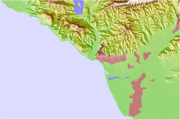
Use este mapa de relevo para navegar até CAL - Ventura surf quebras e estações que estão na área de maré Emma Wood State Beach
Outros Spots de Surf mais próximos de Emma Wood State Beach:
(Clique no nome do local para maiores detalhes)- Closest spot1 mi
- Second closest spot1 mi
- Third closest spot2 mi
- Fourth closest spot3 mi
- Fifth closest spot4 mi
Bóias ondográficas mais próxima de Emma Wood State Beach:
- Closest bóia ondográfica11 mi
- Second closest bóia ondográfica30 mi
- Third closest bóia ondográfica38 mi
- Fourth closest bóia ondográfica40 mi
- Fifth closest bóia ondográfica44 mi
Estações de maré mais próximo de Emma Wood State Beach:
- Closest estação de maréVentura2 mi
- Second closest estação de maréOxnard Shores7 mi
- Third closest estação de maréRincon Island9 mi
- Fourth closest estação de maréRincon Island, Mussel Shoals9 mi
- Fifth closest estação de maréOxnard11 mi
Airports
- The closest passenger airport to Emma Wood State Beach is Point Mugu Nas Airport (NTD) in USA, 25 km (16 miles) away (directly).
- The second nearest airport to Emma Wood State Beach is Burbank Glendale Pasadena Airport (BUR), also in USA, 88 km (55 miles) away.
- Third is Los Angeles International Airport (LAX) in USA, 91 km (57 miles) away.
- Jack Northrop Fld Hawthorne Muni Airport (HHR) in USA is 98 km (61 miles) away.
- Long Beach Airport (LGB), also in USA is the fifth nearest airport to Emma Wood State Beach and is 118 km (73 miles) away.
- /breaks/Emma-Wood-State-Beach/forecasts/latest
 Nearest