
Previsão:

Previsão de curto prazoprincipalmente seco. Warm (máx. 22°C no Sábado de manhã, mín 19°C na Qui à noite). o vento será geralmente fraco. | ||||||||||||||||||||||||
Quinta-feira 16 | Sexta-feira 17 | Sábado 18 | ||||||||||||||||||||||
2 AM | 5 AM | 8 AM | 11 AM | 2 PM | 5 PM | 8 PM | 11 PM | 2 AM | 5 AM | 8 AM | 11 AM | 2 PM | 5 PM | 8 PM | 11 PM | 2 AM | 5 AM | 8 AM | 11 AM | 2 PM | 5 PM | 8 PM | 11 PM | |
Mapa da altura do Swell |  |  |  |  |  |  |  |  | 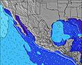 | |||||||||||||||
Swell Altura (m) Direção Período (s) | SW 16 | SW 16 | SW 16 | SW 16 | SW 16 | WNW 8 | SW 15 | WNW 9 | SW 19 | SW 19 | SW 19 | SW 19 | SW 18 | SW 14 | WNW 18 | WNW 17 | WNW 17 | SW 17 | SW 17 | SW 18 | SW 18 | SW 18 | S 15 | S 14 |
Onda Gráfico | ||||||||||||||||||||||||
251 | 251 | 124 | 122 | 157 | 157 | 186 | 172 | 227 | 296 | 231 | 229 | 166 | 132 | 176 | 172 | 168 | 358 | 362 | 510 | 442 | 379 | 422 | 388 | |
Vento (km/h) | ||||||||||||||||||||||||
Estado do Vento maral cruzado-maral Cruzado cruzado-terral terral cristalino | cross | cross | cross-off | cross | cross | cross | cross | cross-off | cross-off | cross | cross | cross | cross | cross | cross | cross-off | cross-off | glassy | cross | cross-on | cross-on | on | glassy | glassy |
Maré Alta | 11:56AM1.70m | 11:07PM2.20m | 12:38PM1.75m | 11:55PM1.96m | 1:20PM1.78m | |||||||||||||||||||
Maré Baixa | 5:26AM-0.01m | 5:03PM0.89m | 6:05AM0.15m | 6:01PM0.90m | 6:42AM0.34m | 7:06PM0.92m | ||||||||||||||||||
— | 5:52 | — | — | — | — | — | — | — | 5:52 | — | — | — | — | — | — | — | 5:52 | — | — | — | — | — | — | |
— | — | — | — | — | 7:53 | — | — | — | — | — | — | — | 7:53 | — | — | — | — | — | — | — | 7:52 | — | — | |
mm | — | — | — | — | — | — | — | — | — | — | — | — | — | — | — | — | — | — | — | — | — | — | — | — |
Temp. °C | 21 | 19 | 21 | 21 | 21 | 21 | 20 | 19 | 19 | 19 | 20 | 21 | 21 | 21 | 20 | 20 | 19 | 19 | 20 | 22 | 22 | 21 | 20 | 19 |
Ressent. °C | 23 | 20 | 22 | 21 | 21 | 21 | 21 | 19 | 19 | 19 | 20 | 21 | 21 | 22 | 21 | 21 | 20 | 21 | 21 | 23 | 23 | 22 | 22 | 21 |
Swell 1 Altura (m) Direção Período (s) | SW 16 | WNW 6 | WNW 7 | WNW 8 | WNW 8 | WNW 8 | WNW 8 | WNW 9 | WNW 9 | WNW 9 | WNW 8 | WNW 8 | WNW 8 | WNW 8 | WNW 8 | WNW 8 | WNW 8 | WNW 8 | SW 17 | SW 18 | S 12 | S 12 | S 15 | S 12 |
251 | 40 | 54 | 85 | 110 | 157 | 164 | 172 | 162 | 131 | 127 | 127 | 137 | 127 | 101 | 101 | 99 | 76 | 362 | 510 | 175 | 220 | 422 | 266 | |
Swell 2 Altura (m) Direção Período (s) | WNW 6 | SW 16 | SW 16 | SW 16 | SW 16 | SW 16 | SW 15 | SW 15 | SW 19 | SW 19 | SW 19 | SW 19 | SW 18 | SW 14 | SW 14 | SW 14 | SW 14 | SW 17 | WNW 8 | S 12 | SW 18 | SW 18 | S 11 | S 14 |
24 | 251 | 124 | 122 | 157 | 119 | 186 | 137 | 227 | 296 | 231 | 229 | 166 | 132 | 132 | 132 | 132 | 358 | 68 | 139 | 442 | 379 | 209 | 388 | |
Swell 3 Altura (m) Direção Período (s) | S 12 | S 12 | SSW 12 | SSW 12 | SSW 12 | SSW 12 | SSW 12 | SSW 12 | SW 15 | SW 15 | SW 14 | SW 14 | SW 14 | WNW 18 | WNW 18 | WNW 17 | WNW 17 | WNW 17 | S 12 | WNW 8 | WNW 8 | WNW 8 | WNW 16 | SSW 17 |
73 | 73 | 47 | 47 | 47 | 46 | 46 | 46 | 104 | 104 | 103 | 102 | 102 | 126 | 176 | 172 | 168 | 168 | 103 | 49 | 47 | 45 | 203 | 313 | |
Ondas de vento Altura (m) Direção Período (s) | — | — | — | — | — | — | — | — | — | SSE 3 | S 3 | S 3 | S 3 | S 3 | S 3 | — | — | — | — | — | — | — | — | — |
— | — | — | — | — | — | — | — | — | 2 | 1 | 1 | 1 | 2 | 1 | — | — | — | — | — | — | — | — | — | |
Terral ou glassy mais perto | ||||||||||||||||||||||||
Distância (km) | 1 | 25 | 0 | 212 | 212 | 212 | 31 | 0 | 0 | 1 | 25 | 243 | 242 | 31 | 31 | 0 | 0 | 0 | 4 | 99 | 243 | 79 | 0 | 0 |
Melhor previsões de ondas em Baja Norte | ||||||||||||||||||||||||
Melhor previsões de ondas em Mexico | ||||||||||||||||||||||||
Buscador de Ondas Global | ||||||||||||||||||||||||
- Map Icons:
 Break
Break Live Wave Height (m)
 Live Wind Speed (km/h)
 Surf Rating (10 Max)
 Ocean Swells (m)
- Wind Speed (km/h)
widget de graça do Surf-Forecast.com para o seu site
O relatório de surf / widget do tempo abaixo está disponível para incorporar em sites de terceiros gratuitamente e fornece um resumo das nossas El Paso surf tempo. Simplesmente pegar o trecho de código html que fornecemos e colá-lo em seu próprio site. Você pode escolher seu idioma preferido e unidades métrico/imperial para o surf tempo de alimentação para atender aos usuários do seu site.... Clique aqui para adquirir o código.
 Nearest