
Previsão:

Previsão de curto prazochuva moderada (total 14mm), mais intensa no Sábado à noite. Very mild (máx. 14°C no Sábado de manhã, mín 10°C na Qui de manhã). Ventos diminuem (ventos frescos de Oeste na Sexta à tarde, vento fraco de Oeste-Noroeste no Sáb à noite). | ||||||||||||||||||||||
Quinta-feira 23 | Sexta-feira 24 | Sábado 25 | ||||||||||||||||||||
7 AM | 10 AM | 1 PM | 4 PM | 7 PM | 10 PM | 1 AM | 4 AM | 7 AM | 10 AM | 1 PM | 4 PM | 7 PM | 10 PM | 1 AM | 4 AM | 7 AM | 10 AM | 1 PM | 4 PM | 7 PM | 10 PM | |
Mapa da altura do Swell |  |  |  | 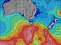 |  |  | 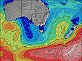 |  | ||||||||||||||
Swell Altura (m) Direção Período (s) | SW 14 | SW 14 | SW 14 | SW 14 | SW 15 | SW 16 | SW 16 | SW 16 | SSW 15 | SSW 15 | SSW 15 | SW 14 | SW 14 | SW 14 | SW 13 | SW 13 | SW 13 | SW 13 | SW 12 | SW 12 | SW 12 | SW 12 |
Onda Gráfico | ||||||||||||||||||||||
7583 | 7478 | 8354 | 8892 | 9516 | 11626 | 14263 | 14566 | 13062 | 11915 | 10420 | 9832 | 9020 | 8398 | 7219 | 6024 | 5381 | 4742 | 4197 | 3482 | 3471 | 3114 | |
Vento (km/h) | ||||||||||||||||||||||
Estado do Vento maral cruzado-maral Cruzado cruzado-terral terral cristalino | cross-on | cross-on | cross-on | cross-on | cross-on | cross-on | cross-on | cross-on | cross | cross | cross | cross | cross | cross-off | cross | cross | cross | cross | cross | cross | cross | cross |
Maré Alta | 5:51AM0.65m | 3:03PM0.72m | 2:20PM0.72m | 1:03PM0.76m | ||||||||||||||||||
Maré Baixa | 9:53AM0.57m | 10:56PM0.15m | 11:26PM0.17m | |||||||||||||||||||
7:39 | — | — | — | — | — | — | — | 7:37 | — | — | — | — | — | — | — | 7:37 | — | — | — | — | — | |
— | — | — | 5:32 | — | — | — | — | — | — | — | 5:34 | — | — | — | — | — | — | — | 5:35 | — | — | |
mm | 1 | — | 1 | 1 | 1 | — | — | — | — | — | — | — | 1 | 1 | 1 | 1 | — | 1 | — | — | 1 | 1 |
Temp. °C | 10 | 11 | 10 | 10 | 10 | 11 | 11 | 11 | 11 | 11 | 12 | 12 | 12 | 12 | 12 | 13 | 13 | 13 | 14 | 13 | 13 | 13 |
Ressent. °C | 3 | 3 | 2 | 2 | 2 | 3 | 3 | 4 | 5 | 4 | 4 | 4 | 5 | 6 | 7 | 7 | 7 | 7 | 7 | 7 | 8 | 8 |
Swell 1 Altura (m) Direção Período (s) | SW 14 | — | SW 14 | SW 14 | — | — | SW 16 | SW 16 | SSW 15 | SSW 15 | SSW 15 | SW 14 | SW 14 | SW 14 | SW 13 | SW 13 | SW 13 | SW 13 | SW 12 | SW 12 | SW 12 | SW 12 |
7583 | — | 7631 | 8129 | — | — | 13003 | 13360 | 13062 | 11915 | 10420 | 8933 | 8054 | 7096 | 6496 | 6024 | 5381 | 4742 | 4197 | 3482 | 3079 | 2719 | |
Swell 2 Altura (m) Direção Período (s) | — | — | — | — | — | — | — | — | — | — | — | — | — | — | — | — | — | — | — | — | — | S 12 |
— | — | — | — | — | — | — | — | — | — | — | — | — | — | — | — | — | — | — | — | — | 44 | |
Swell 3 Altura (m) Direção Período (s) | — | — | — | — | — | — | — | — | — | — | — | — | — | — | — | — | — | — | — | — | — | — |
— | — | — | — | — | — | — | — | — | — | — | — | — | — | — | — | — | — | — | — | — | — | |
Ondas de vento Altura (m) Direção Período (s) | — | SW 14 | SW 14 | SW 14 | SW 15 | SW 16 | SW 16 | SW 16 | — | — | — | SW 14 | SW 14 | SW 14 | SW 13 | — | — | — | — | — | SW 12 | SW 12 |
— | 7478 | 8354 | 8892 | 9516 | 11626 | 14263 | 14566 | — | — | — | 9832 | 9020 | 8398 | 7219 | — | — | — | — | — | 3471 | 3114 | |
Terral ou glassy mais perto | ||||||||||||||||||||||
Distância (km) | 145 | 145 | 623 | 159 | 145 | 159 | 159 | 145 | 108 | 145 | 129 | 670 | 129 | 129 | 129 | 158 | 108 | 145 | 108 | 108 | 108 | 24 |
Melhor previsões de ondas em Far West of Victoria | ||||||||||||||||||||||
Melhor previsões de ondas em Australia | ||||||||||||||||||||||
Buscador de Ondas Global | ||||||||||||||||||||||
- Map Icons:
 Break
Break Live Wave Height (m)
 Live Wind Speed (km/h)
 Surf Rating (10 Max)
 Ocean Swells (m)
- Wind Speed (km/h)
widget de graça do Surf-Forecast.com para o seu site
O relatório de surf / widget do tempo abaixo está disponível para incorporar em sites de terceiros gratuitamente e fornece um resumo das nossas Dredges surf tempo. Simplesmente pegar o trecho de código html que fornecemos e colá-lo em seu próprio site. Você pode escolher seu idioma preferido e unidades métrico/imperial para o surf tempo de alimentação para atender aos usuários do seu site.... Clique aqui para adquirir o código.
 Nearest