
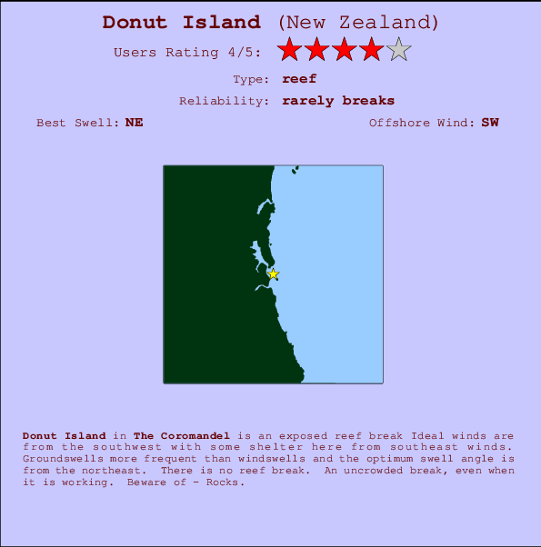
Donut Island Surf Guide
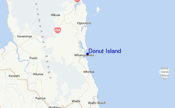
Donut Island in The Coromandel is an exposed reef break Offshore winds blow from the southwest with some shelter here from southeast winds. Most of the surf here comes from groundswells and the ideal swell direction is from the northeast. There is no reef break. The location means that it never gets crowded. Take care of - Rocks.
Donut Island Spot Info
| Type: | Rating: | Reliability: | Todays Sea Temp*: |
|---|---|---|---|
| rarely breaks | 14.6°C*ocean temperature recorded from satellite |
Surfing Donut Island:
The best conditions reported for surf at Donut Island occur when a Northeast swell combines with an offshore wind direction from the Southwest.

Previsão da Energia de Ondas (Força): 12hrs


Donut Island Surf:
Monday, 3 August 2026, 03:10 Local time| Segunda-feira 03 | ||||
| 3AM | 6AM | 9AM | 12PM | |
| Wave (m) | ||||
| Período (s) | 13 | 13 | 13 | 13 |
| Vento (km/h) | ||||
| Estado do Vento | cross- off |
cross- off |
cross- off |
off |
- /breaks/Donut-Island/forecasts/latest
Donut Island Surf Guide
Donut Island in The Coromandel is an exposed reef break Offshore winds blow from the southwest with some shelter here from southeast winds. Most of the surf here comes from groundswells and the ideal swell direction is from the northeast. There is no reef break. The location means that it never gets crowded. Take care of - Rocks.
Donut Island Spot Info
Type: Rating: Reliability: Todays Sea Temp*:  Reef
Reef 4
4rarely breaks 14.6°C*ocean temperature recorded from satelliteSurfing Donut Island:
The best conditions reported for surf at Donut Island occur when a Northeast swell combines with an offshore wind direction from the Southwest.
Previsão da Energia de Ondas (Força): 12hrs
Use a aba navegação acima para ver temperatura do mar em Donut Island, fotografias de Donut Island, previsões detalhadas do swell em Donut Island, previsões do vento e do tempo, webcams em Donut Island , vento atual em Coromandel com base em dados ao vivo fornecidos por estações de meteorologia e previsões da maré em Donut Island. O link para os mapas do swell em New Zealand abrirá uma imagem ampliada monstrando New Zealand e os mares próximos. Estes mapas do swell podem ser animados para mostrar diferentes componentes do swell, energia das ondas, período das ondas, altura das ondas, assim como previsões do vento e do tempo, observações em tempo real do estado do tempo e do mar graças às bóias de New Zealand, navios passantes e estações de meteorologia presentes na costa. Cada uma das páginas de previsão para este surf break apresenta as ferramentas do buscador global e regional para localizar as melores condições de surf na área ao redor de Donut Island.
Donut Island Surf:
Monday, 3 August 2026, 03:10 Local timeSegunda-feira 03 3AM 6AM 9AM 12PM Wave (m) Período (s) 13 13 13 13 Vento (km/h) Estado do Vento cross-
offcross-
offcross-
offoff - /breaks/Donut-Island/forecasts/latest
- /breaks/Donut-Island/forecasts/latest/six_day
Donut Island Surf Guide
Donut Island in The Coromandel is an exposed reef break Offshore winds blow from the southwest with some shelter here from southeast winds. Most of the surf here comes from groundswells and the ideal swell direction is from the northeast. There is no reef break. The location means that it never gets crowded. Take care of - Rocks.
Donut Island Spot Info
Type: Rating: Reliability: Todays Sea Temp*: Reef4rarely breaks 14.6°C*ocean temperature recorded from satelliteSurfing Donut Island:
The best conditions reported for surf at Donut Island occur when a Northeast swell combines with an offshore wind direction from the Southwest.
Previsão da Energia de Ondas (Força): 12hrs
Use a aba navegação acima para ver temperatura do mar em Donut Island, fotografias de Donut Island, previsões detalhadas do swell em Donut Island, previsões do vento e do tempo, webcams em Donut Island , vento atual em Coromandel com base em dados ao vivo fornecidos por estações de meteorologia e previsões da maré em Donut Island. O link para os mapas do swell em New Zealand abrirá uma imagem ampliada monstrando New Zealand e os mares próximos. Estes mapas do swell podem ser animados para mostrar diferentes componentes do swell, energia das ondas, período das ondas, altura das ondas, assim como previsões do vento e do tempo, observações em tempo real do estado do tempo e do mar graças às bóias de New Zealand, navios passantes e estações de meteorologia presentes na costa. Cada uma das páginas de previsão para este surf break apresenta as ferramentas do buscador global e regional para localizar as melores condições de surf na área ao redor de Donut Island.
Donut Island Surf:
Monday, 3 August 2026, 03:10 Local timeSegunda-feira 03 3AM 6AM 9AM 12PM Wave (m) Período (s) 13 13 13 13 Vento (km/h) Estado do Vento cross-
offcross-
offcross-
offoff - /breaks/Donut-Island/forecasts/latest
Donut Island Surf Guide
Donut Island in The Coromandel is an exposed reef break Offshore winds blow from the southwest with some shelter here from southeast winds. Most of the surf here comes from groundswells and the ideal swell direction is from the northeast. There is no reef break. The location means that it never gets crowded. Take care of - Rocks.
Donut Island Spot Info
Type: Rating: Reliability: Todays Sea Temp*: Reef4rarely breaks 14.6°C*ocean temperature recorded from satelliteSurfing Donut Island:
The best conditions reported for surf at Donut Island occur when a Northeast swell combines with an offshore wind direction from the Southwest.
Previsão da Energia de Ondas (Força): 12hrs
Use a aba navegação acima para ver temperatura do mar em Donut Island, fotografias de Donut Island, previsões detalhadas do swell em Donut Island, previsões do vento e do tempo, webcams em Donut Island , vento atual em Coromandel com base em dados ao vivo fornecidos por estações de meteorologia e previsões da maré em Donut Island. O link para os mapas do swell em New Zealand abrirá uma imagem ampliada monstrando New Zealand e os mares próximos. Estes mapas do swell podem ser animados para mostrar diferentes componentes do swell, energia das ondas, período das ondas, altura das ondas, assim como previsões do vento e do tempo, observações em tempo real do estado do tempo e do mar graças às bóias de New Zealand, navios passantes e estações de meteorologia presentes na costa. Cada uma das páginas de previsão para este surf break apresenta as ferramentas do buscador global e regional para localizar as melores condições de surf na área ao redor de Donut Island.
Donut Island Surf:
Monday, 3 August 2026, 03:10 Local timeSegunda-feira 03 3AM 6AM 9AM 12PM Wave (m) Período (s) 13 13 13 13 Vento (km/h) Estado do Vento cross-
offcross-
offcross-
offoff Tide Times:
Para Clark Island %{dist} %{km} de %{location}
A PRÓXIMA É ÀS (hora local) faltam maré alta maré baixa Donut Island Tide Times and Tide Chart
Live Weather:
At Whangamata 2, 10 km from Donut Island.
light winds from the W
(km/h)
DryAir temperature
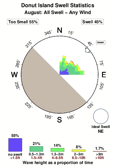
7°COverall Donut Island Surf Consistency and Wind Distribution in Agosto


Wind stats for Donut Island: see the variation in direction and stength by month.
fotos da galeria
Contornos: Estradas & Rios: Escolha um spot de surf da lista 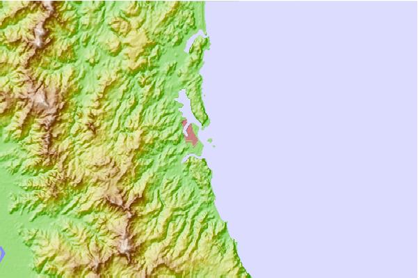
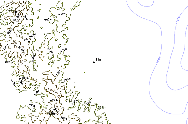
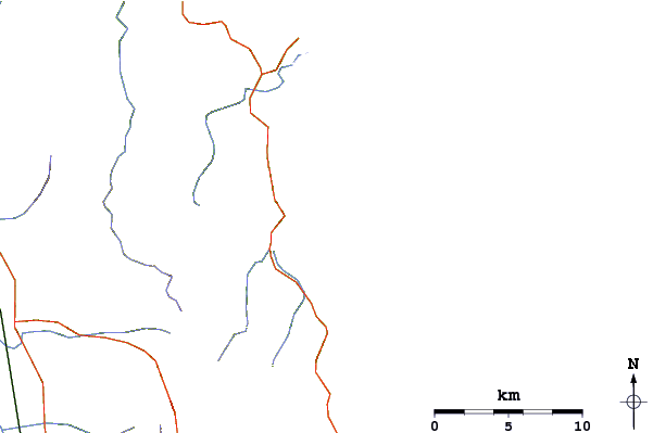
Use este mapa de relevo para navegar até Coromandel surf quebras e estações que estão na área de maré Donut Island
Outros Spots de Surf mais próximos de Donut Island:
(Clique no nome do local para maiores detalhes)- Closest spot1 mi
- Second closest spot1 mi
- Third closest spot1 mi
- Fourth closest spot1 mi
- Fifth closest spot4 mi
Bóias ondográficas mais próxima de Donut Island:
- Closest bóia ondográfica52 mi
- Second closest bóia ondográfica119 mi
- Third closest bóia ondográfica288 mi
- Fourth closest bóia ondográfica289 mi
- Fifth closest bóia ondográfica313 mi
Estações de maré mais próximo de Donut Island:
- Closest estação de maréSlipper Island12 mi
- Second closest estação de maréTairua15 mi
- Third closest estação de maréRocky Point (Thames)22 mi
- Fourth closest estação de maréWhitianga29 mi
- Fifth closest estação de maréTauranga34 mi
Airports
- The closest passenger airport to Donut Island is Tauranga Airport (TRG) in New Zealand, 57 km (35 miles) away (directly).
- The second nearest airport to Donut Island is Hamilton Airport (HLZ), also in New Zealand, 88 km (55 miles) away.
- Third is Auckland International Airport (AKL) in New Zealand, 100 km (62 miles) away.
- Rotorua Airport (ROT) in New Zealand is 106 km (66 miles) away.
- Whakatane Airport (WHK), also in New Zealand is the fifth nearest airport to Donut Island and is 119 km (74 miles) away.
- /breaks/Donut-Island/forecasts/latest
 Nearest