
Previsão:

Previsão de curto prazochuviscos (total 3mm), principalmente caindo na Terça de manhã. Very mild (máx. 17°C na Quarta à tarde, mín 13°C na Terça à noite). o vento será geralmente fraco. | ||||||||||||||||||||||||
Terça-feira 28 | Quarta-feira 29 | Quinta-feira 30 | ||||||||||||||||||||||
2 AM | 5 AM | 8 AM | 11 AM | 2 PM | 5 PM | 8 PM | 11 PM | 2 AM | 5 AM | 8 AM | 11 AM | 2 PM | 5 PM | 8 PM | 11 PM | 2 AM | 5 AM | 8 AM | 11 AM | 2 PM | 5 PM | 8 PM | 11 PM | |
Mapa da altura do Swell |  |  |  |  | 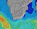 |  |  | 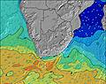 |  | |||||||||||||||
Swell Altura (m) Direção Período (s) | SSW 16 | SSW 15 | SSW 15 | SSW 15 | SSW 15 | SSW 14 | SSW 14 | SSW 14 | SSW 14 | SSW 14 | SSW 14 | SSW 14 | SSW 14 | SSW 14 | SSW 14 | SSW 14 | SSW 14 | SSW 14 | SSW 14 | SSW 14 | SSW 13 | SSW 13 | ESE 7 | ESE 8 |
Onda Gráfico | ||||||||||||||||||||||||
1803 | 1358 | 1288 | 1254 | 1220 | 1187 | 1047 | 904 | 788 | 622 | 613 | 649 | 624 | 606 | 597 | 589 | 589 | 497 | 497 | 415 | 408 | 402 | 487 | 542 | |
Vento (km/h) | ||||||||||||||||||||||||
Estado do Vento maral cruzado-maral Cruzado cruzado-terral terral cristalino | on | on | on | on | on | on | cross-on | cross-on | cross-on | cross-on | cross-on | cross-on | on | on | cross-on | cross-on | cross | cross-on | cross-on | cross-on | on | on | cross-on | cross-on |
Maré Alta | 3:00AM1.73m | 3:30PM1.75m | 3:31AM1.80m | 3:58PM1.83m | 4:01AM1.86m | 4:26PM1.90m | ||||||||||||||||||
Maré Baixa | 9:11AM0.41m | 9:23PM0.53m | 9:40AM0.33m | 9:54PM0.45m | 10:08AM0.28m | 10:25PM0.39m | ||||||||||||||||||
— | 7:26 | — | — | — | — | — | — | — | 7:26 | — | — | — | — | — | — | — | 7:26 | — | — | — | — | — | — | |
— | — | — | — | — | 5:47 | — | — | — | — | — | — | — | 5:49 | — | — | — | — | — | — | — | 5:49 | — | — | |
mm | 1 | — | 1 | 1 | 1 | — | — | — | — | — | — | — | — | — | — | — | — | — | — | — | — | — | — | — |
Temp. °C | 14 | 14 | 14 | 14 | 15 | 15 | 14 | 13 | 13 | 13 | 13 | 15 | 17 | 16 | 15 | 15 | 15 | 14 | 14 | 16 | 17 | 16 | 15 | 15 |
Ressent. °C | 11 | 11 | 10 | 9 | 10 | 11 | 9 | 9 | 9 | 9 | 9 | 12 | 13 | 11 | 11 | 12 | 13 | 11 | 11 | 13 | 13 | 11 | 11 | 12 |
Swell 1 Altura (m) Direção Período (s) | SSW 16 | SSE 8 | SSW 15 | SSW 15 | SSW 15 | SSW 14 | SSW 14 | SSW 14 | ESE 7 | ESE 7 | ESE 7 | ESE 7 | ESE 7 | SSW 14 | ESE 8 | ESE 8 | ESE 8 | ESE 7 | ESE 7 | ESE 7 | ESE 8 | SSW 13 | SSW 13 | ESE 8 |
1803 | 428 | 1288 | 1254 | 1220 | 1187 | 1047 | 904 | 315 | 236 | 222 | 163 | 163 | 606 | 397 | 368 | 322 | 237 | 193 | 167 | 176 | 402 | 336 | 542 | |
Swell 2 Altura (m) Direção Período (s) | SSE 8 | SSW 15 | — | — | — | S 7 | S 12 | S 12 | SSW 14 | SSW 14 | SSW 14 | SSW 14 | SSW 14 | S 11 | SSW 14 | SSW 14 | SSW 14 | SSW 14 | SSW 14 | SSW 14 | SSW 13 | — | — | SSW 14 |
424 | 1358 | — | — | — | 109 | 3 | 3 | 788 | 622 | 613 | 649 | 624 | 2 | 597 | 589 | 589 | 497 | 497 | 415 | 408 | — | — | 347 | |
Swell 3 Altura (m) Direção Período (s) | — | — | — | — | — | — | — | — | S 12 | S 12 | S 11 | S 11 | S 11 | — | — | — | — | — | E 9 | — | — | — | — | — |
— | — | — | — | — | — | — | — | 3 | 3 | 2 | 2 | 2 | — | — | — | — | — | 42 | — | — | — | — | — | |
Ondas de vento Altura (m) Direção Período (s) | — | E 8 | SSE 8 | SE 7 | SE 6 | ESE 6 | ESE 6 | ESE 7 | — | — | E 7 | ESE 7 | — | ESE 7 | — | E 8 | E 7 | E 7 | — | E 7 | E 7 | ESE 8 | ESE 7 | — |
— | 5 | 354 | 331 | 251 | 145 | 277 | 353 | — | — | 293 | 219 | — | 289 | — | 544 | 439 | 298 | — | 198 | 277 | 276 | 487 | — | |
Terral ou glassy mais perto | ||||||||||||||||||||||||
Distância (km) | 62 | 62 | 62 | 62 | 62 | 62 | 62 | 62 | 41 | 41 | 23 | 62 | 62 | 62 | 41 | 23 | 23 | 23 | 23 | 41 | 62 | 62 | 62 | 23 |
Melhor previsões de ondas em Garden Route | ||||||||||||||||||||||||
Melhor previsões de ondas em South Africa | ||||||||||||||||||||||||
Buscador de Ondas Global | ||||||||||||||||||||||||
- Map Icons:
 Break
Break Live Wave Height (m)
 Live Wind Speed (km/h)
 Surf Rating (10 Max)
 Ocean Swells (m)
- Wind Speed (km/h)
widget de graça do Surf-Forecast.com para o seu site
O relatório de surf / widget do tempo abaixo está disponível para incorporar em sites de terceiros gratuitamente e fornece um resumo das nossas Dias Beach surf tempo. Simplesmente pegar o trecho de código html que fornecemos e colá-lo em seu próprio site. Você pode escolher seu idioma preferido e unidades métrico/imperial para o surf tempo de alimentação para atender aos usuários do seu site.... Clique aqui para adquirir o código.
 Nearest