
Previsão:

Previsão de curto prazoprincipalmente seco. Warm (máx. 31°C na Segunda à tarde, mín 27°C na Seg à noite). o vento será geralmente fraco. | |||||||||||||||||||||||
Segunda-feira 20 | Terça-feira 21 | Quarta-feira 22 | |||||||||||||||||||||
3 AM | 6 AM | 9 AM | 12 PM | 3 PM | 6 PM | 9 PM | 12 AM | 3 AM | 6 AM | 9 AM | 12 PM | 3 PM | 6 PM | 9 PM | 12 AM | 3 AM | 6 AM | 9 AM | 12 PM | 3 PM | 6 PM | 9 PM | |
Mapa da altura do Swell |  |  |  |  |  |  |  | 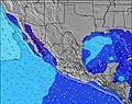 |  | ||||||||||||||
Swell Altura (m) Direção Período (s) | SW 16 | SW 16 | SW 16 | SSW 16 | SW 16 | SW 16 | SW 16 | SW 15 | SW 15 | SW 15 | SW 15 | SW 15 | SW 14 | SW 14 | SW 12 | SW 12 | SW 11 | SSW 14 | SW 11 | SW 12 | WSW 12 | SW 11 | WSW 11 |
Onda Gráfico | |||||||||||||||||||||||
201 | 302 | 302 | 173 | 302 | 299 | 291 | 284 | 276 | 273 | 266 | 255 | 241 | 224 | 114 | 132 | 142 | 121 | 205 | 137 | 243 | 137 | 215 | |
Vento (km/h) | |||||||||||||||||||||||
Estado do Vento maral cruzado-maral Cruzado cruzado-terral terral cristalino | cross-off | cross-off | cross-off | cross-off | cross-off | cross-off | off | cross-off | cross-off | cross-off | cross-off | off | cross-off | cross-off | off | cross-off | cross-off | cross-off | cross-off | cross-off | cross-off | cross | cross |
Maré Alta | 00:54AM0.97m | 1:44PM1.20m | 2:40AM0.83m | 2:27PM1.18m | 3:34PM1.17m | ||||||||||||||||||
Maré Baixa | 6:27AM0.67m | 9:21PM0.72m | 6:06AM0.78m | 11:45PM0.63m | |||||||||||||||||||
— | 6:31 | — | — | — | — | — | — | — | 6:31 | — | — | — | — | — | — | — | 6:31 | — | — | — | — | — | |
— | — | — | — | — | 7:44 | — | — | — | — | — | — | — | 7:44 | — | — | — | — | — | — | — | 7:44 | — | |
mm | — | — | — | — | — | — | — | — | — | — | — | — | — | — | — | — | — | — | — | — | — | — | — |
Temp. °C | 27 | 27 | 28 | 30 | 31 | 30 | 29 | 28 | 27 | 27 | 28 | 30 | 30 | 30 | 29 | 29 | 28 | 28 | 28 | 30 | 30 | 30 | 29 |
Ressent. °C | 30 | 29 | 30 | 33 | 33 | 33 | 33 | 31 | 30 | 30 | 31 | 32 | 31 | 33 | 32 | 33 | 33 | 32 | 32 | 33 | 32 | 34 | 34 |
Swell 1 Altura (m) Direção Período (s) | SW 16 | SW 16 | SW 16 | SSW 16 | SW 16 | SW 16 | SW 16 | SW 15 | SW 15 | SW 15 | SW 15 | SW 15 | SW 14 | SW 14 | SW 12 | SW 12 | SW 11 | SW 11 | SW 11 | SW 12 | WSW 12 | SW 11 | WSW 11 |
201 | 302 | 302 | 173 | 302 | 299 | 291 | 284 | 276 | 273 | 266 | 255 | 241 | 224 | 114 | 132 | 142 | 110 | 205 | 137 | 243 | 137 | 215 | |
Swell 2 Altura (m) Direção Período (s) | WSW 9 | WSW 9 | WSW 9 | SW 13 | WSW 9 | W 8 | W 8 | W 8 | W 8 | W 8 | WSW 8 | WNW 15 | WNW 15 | WNW 15 | SW 14 | SW 14 | SSW 14 | SSW 14 | SW 14 | SW 10 | SW 14 | WSW 12 | SW 14 |
71 | 54 | 45 | 108 | 44 | 37 | 36 | 35 | 35 | 21 | 13 | 44 | 44 | 43 | 99 | 95 | 121 | 121 | 92 | 76 | 96 | 87 | 96 | |
Swell 3 Altura (m) Direção Período (s) | WNW 16 | WNW 16 | WNW 16 | WSW 9 | WNW 16 | WNW 16 | WNW 16 | WNW 16 | WNW 16 | WNW 15 | WNW 15 | WSW 8 | WSW 8 | WSW 8 | NW 3 | NW 3 | WNW 15 | SW 12 | WNW 14 | SW 14 | WNW 14 | SW 14 | WNW 4 |
51 | 51 | 50 | 30 | 50 | 49 | 48 | 48 | 47 | 45 | 45 | 13 | 12 | 12 | 2 | 2 | 42 | 77 | 41 | 95 | 41 | 96 | 4 | |
Ondas de vento Altura (m) Direção Período (s) | — | — | — | — | — | — | — | — | — | — | — | NNW 3 | NNW 3 | NW 3 | — | — | — | — | — | WNW 4 | WNW 4 | — | — |
— | — | — | — | — | — | — | — | — | — | — | 1 | 1 | 2 | — | — | — | — | — | 1 | 3 | — | — | |
Terral ou glassy mais perto | |||||||||||||||||||||||
Distância (km) | 0 | 0 | 0 | 0 | 7 | 0 | 0 | 0 | 0 | 0 | 0 | 0 | 7 | 0 | 0 | 0 | 0 | 0 | 0 | 0 | 491 | 4 | 4 |
Melhor previsões de ondas em Nayarit | |||||||||||||||||||||||
Melhor previsões de ondas em Mexico | |||||||||||||||||||||||
Buscador de Ondas Global | |||||||||||||||||||||||
- Map Icons:
 Break
Break Live Wave Height (m)
 Live Wind Speed (km/h)
 Surf Rating (10 Max)
 Ocean Swells (m)
- Wind Speed (km/h)
widget de graça do Surf-Forecast.com para o seu site
O relatório de surf / widget do tempo abaixo está disponível para incorporar em sites de terceiros gratuitamente e fornece um resumo das nossas Costa Banderas surf tempo. Simplesmente pegar o trecho de código html que fornecemos e colá-lo em seu próprio site. Você pode escolher seu idioma preferido e unidades métrico/imperial para o surf tempo de alimentação para atender aos usuários do seu site.... Clique aqui para adquirir o código.
 Nearest