
Previsão:

Previsão de curto prazoprincipalmente seco. Warm (máx. 22°C na Terça de manhã, mín 12°C na Segunda de manhã). o vento será geralmente fraco. | ||||||||||||||||||||||||
Segunda-feira 3 | Terça-feira 4 | Quarta-feira 5 | ||||||||||||||||||||||
2 AM | 5 AM | 8 AM | 11 AM | 2 PM | 5 PM | 8 PM | 11 PM | 2 AM | 5 AM | 8 AM | 11 AM | 2 PM | 5 PM | 8 PM | 11 PM | 2 AM | 5 AM | 8 AM | 11 AM | 2 PM | 5 PM | 8 PM | 11 PM | |
Mapa da altura do Swell |  |  |  |  | 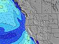 |  |  | 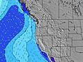 |  | |||||||||||||||
Swell Altura (m) Direção Período (s) | WNW 8 | WNW 8 | WNW 8 | NW 8 | NW 7 | SW 13 | SW 13 | WNW 7 | NW 7 | WSW 16 | NW 7 | NW 7 | NW 7 | NW 7 | SW 15 | SW 15 | NW 8 | NW 8 | NW 8 | NW 8 | NW 8 | NW 8 | NW 8 | NW 8 |
Onda Gráfico | ||||||||||||||||||||||||
294 | 232 | 242 | 270 | 261 | 28 | 27 | 155 | 199 | 51 | 266 | 248 | 266 | 332 | 60 | 57 | 407 | 385 | 344 | 316 | 333 | 371 | 380 | 341 | |
Vento (km/h) | ||||||||||||||||||||||||
Estado do Vento maral cruzado-maral Cruzado cruzado-terral terral cristalino | on | on | cross-on | on | on | on | on | on | on | on | on | on | cross-on | on | on | on | on | on | on | cross-on | cross-on | cross-on | on | on |
Maré Alta | 3:25AM2.06m | 4:08PM2.36m | 4:19AM1.86m | 4:43PM2.41m | 5:26AM1.67m | 5:26PM2.45m | ||||||||||||||||||
Maré Baixa | 9:37AM0.15m | 10:29PM0.40m | 10:12AM0.40m | 11:27PM0.30m | 10:51AM0.66m | |||||||||||||||||||
— | 6:03 | — | — | — | — | — | — | — | 6:05 | — | — | — | — | — | — | — | 6:05 | — | — | — | — | — | — | |
— | — | — | — | — | — | 8:39 | — | — | — | — | — | — | — | 8:37 | — | — | — | — | — | — | — | 8:37 | — | |
mm | — | — | — | — | — | — | — | — | — | — | — | — | — | — | — | — | — | — | — | — | — | — | — | — |
Temp. °C | 13 | 12 | 12 | 18 | 20 | 20 | 17 | 15 | 14 | 15 | 17 | 22 | 21 | 21 | 17 | 15 | 14 | 14 | 15 | 19 | 20 | 19 | 16 | 14 |
Ressent. °C | 10 | 9 | 10 | 15 | 15 | 15 | 14 | 12 | 11 | 12 | 15 | 20 | 18 | 17 | 15 | 13 | 12 | 12 | 14 | 17 | 18 | 17 | 15 | 13 |
Swell 1 Altura (m) Direção Período (s) | WNW 8 | WNW 8 | WNW 8 | SW 13 | SW 13 | SW 13 | SW 13 | WNW 7 | NW 7 | WSW 16 | NW 7 | NW 7 | SW 16 | SW 16 | WNW 9 | WNW 9 | SW 15 | SW 15 | NW 8 | NW 8 | SW 14 | SW 14 | NW 8 | NW 8 |
294 | 232 | 242 | 27 | 27 | 27 | 27 | 155 | 199 | 51 | 266 | 248 | 64 | 63 | 17 | 45 | 56 | 56 | 344 | 316 | 54 | 53 | 380 | 341 | |
Swell 2 Altura (m) Direção Período (s) | SW 13 | SW 13 | SW 13 | WSW 18 | WSW 18 | WSW 17 | WSW 16 | WSW 16 | WSW 16 | SW 13 | WSW 16 | WSW 16 | SSW 12 | SSW 12 | SW 15 | SW 15 | SW 12 | SSW 12 | SW 15 | SW 15 | SW 12 | W 21 | SW 14 | SW 14 |
62 | 45 | 27 | 30 | 30 | 28 | 26 | 25 | 25 | 25 | 25 | 25 | 14 | 14 | 60 | 57 | 6 | 14 | 55 | 54 | 5 | 9 | 71 | 70 | |
Swell 3 Altura (m) Direção Período (s) | WSW 18 | WSW 18 | WSW 18 | — | — | — | — | SW 13 | SW 13 | SW 13 | SW 12 | SW 12 | NW 10 | — | SSW 12 | SW 12 | — | — | SSW 12 | SSW 12 | — | W 21 | W 21 | W 21 |
31 | 31 | 31 | — | — | — | — | 26 | 26 | 26 | 25 | 24 | 4 | — | 14 | 6 | — | — | 14 | 14 | — | 9 | 9 | 9 | |
Ondas de vento Altura (m) Direção Período (s) | N 6 | N 6 | N 6 | NW 8 | NW 7 | NNW 7 | NNW 7 | N 7 | N 6 | NW 7 | — | — | NW 7 | NW 7 | NW 7 | NW 7 | NW 8 | NW 8 | — | — | NW 8 | NW 8 | — | — |
72 | 72 | 31 | 270 | 261 | 350 | 384 | 293 | 184 | 321 | — | — | 266 | 332 | 383 | 405 | 407 | 385 | — | — | 333 | 371 | — | — | |
Terral ou glassy mais perto | ||||||||||||||||||||||||
Distância (km) | 10 | 10 | 10 | 225 | 396 | 396 | 342 | 282 | 10 | 10 | 10 | 225 | 280 | 326 | 326 | 282 | 11 | 10 | 11 | 282 | 282 | 282 | 280 | 103 |
Melhor previsões de ondas em North Oregon | ||||||||||||||||||||||||
Melhor previsões de ondas em United States | ||||||||||||||||||||||||
Buscador de Ondas Global | ||||||||||||||||||||||||
- Map Icons:
 Break
Break Live Wave Height (m)
 Live Wind Speed (km/h)
 Surf Rating (10 Max)
 Ocean Swells (m)
- Wind Speed (km/h)
widget de graça do Surf-Forecast.com para o seu site
O relatório de surf / widget do tempo abaixo está disponível para incorporar em sites de terceiros gratuitamente e fornece um resumo das nossas Boiler Bay surf tempo. Simplesmente pegar o trecho de código html que fornecemos e colá-lo em seu próprio site. Você pode escolher seu idioma preferido e unidades métrico/imperial para o surf tempo de alimentação para atender aos usuários do seu site.... Clique aqui para adquirir o código.
 Nearest