
Previsão:

Previsão de curto prazochuviscos (total 2mm), principalmente caindo na Terça de manhã. Temperatures will be slightly above freezing (máx. 4°C na Terça de manhã, mín 1°C no Domingo à noite). principalmente ventos frescos. | ||||||||||||||||||||||||
Domingo 26 | Segunda-feira 27 | Terça-feira 28 | ||||||||||||||||||||||
12 AM | 3 AM | 6 AM | 9 AM | 12 PM | 3 PM | 6 PM | 9 PM | 12 AM | 3 AM | 6 AM | 9 AM | 12 PM | 3 PM | 6 PM | 9 PM | 12 AM | 3 AM | 6 AM | 9 AM | 12 PM | 3 PM | 6 PM | 9 PM | |
Mapa da altura do Swell | 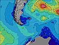 | 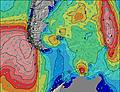 | 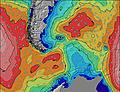 | 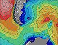 | 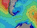 | 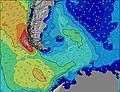 | 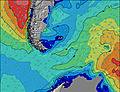 | 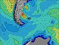 | 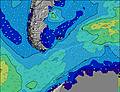 | |||||||||||||||
Swell Altura (m) Direção Período (s) | S 10 | SE 5 | SSE 6 | SSE 6 | SSE 6 | SSE 9 | SSE 12 | S 11 | SSE 11 | S 11 | SSE 10 | S 10 | S 10 | S 10 | S 10 | S 10 | S 10 | S 10 | S 10 | SW 10 | SW 10 | SSW 10 | SSW 10 | SSW 10 |
Onda Gráfico | ||||||||||||||||||||||||
146 | 17 | 21 | 18 | 13 | 28 | 46 | 92 | 24 | 20 | 22 | 17 | 17 | 16 | 16 | 17 | 17 | 17 | 18 | 49 | 45 | 34 | 35 | 35 | |
Vento (km/h) | ||||||||||||||||||||||||
Estado do Vento maral cruzado-maral Cruzado cruzado-terral terral cristalino | on | on | cross-on | cross-on | cross-on | cross | cross | cross-off | cross-off | cross-off | off | off | off | off | off | off | off | off | cross-off | cross-off | cross-off | cross-off | cross-off | cross-off |
Maré Alta | 5:17AM0.92m | 4:24PM1.16m | 5:54AM0.95m | 5:08PM1.21m | 6:26AM0.96m | 5:48PM1.26m | ||||||||||||||||||
Maré Baixa | 10:05AM0.67m | 11:24PM0.28m | 10:50AM0.62m | 00:02AM0.23m | 11:28AM0.55m | |||||||||||||||||||
— | — | 8:41 | — | — | — | — | — | — | — | 8:38 | — | — | — | — | — | — | — | 8:37 | — | — | — | — | — | |
— | — | — | — | — | 5:19 | — | — | — | — | — | — | — | 5:21 | — | — | — | — | — | — | — | 5:22 | — | — | |
mm | 1 | 3 | 1 | — | — | — | — | — | — | — | — | — | — | — | — | — | — | — | — | — | 1 | 1 | — | — |
Temp. °C | 3 | 3 | 3 | 3 | 3 | 3 | 2 | 2 | 1 | 1 | 1 | 1 | 2 | 3 | 1 | 1 | 1 | 1 | 2 | 2 | 4 | 3 | 3 | 2 |
Ressent. °C | -2 | -4 | -5 | -5 | -5 | -4 | -5 | -4 | -5 | -5 | -5 | -5 | -4 | -2 | -5 | -5 | -5 | -6 | -6 | -6 | -5 | -4 | -5 | -4 |
Swell 1 Altura (m) Direção Período (s) | S 10 | NE 8 | NE 8 | NE 8 | NE 9 | SSE 12 | SSE 12 | S 11 | SSE 11 | S 11 | SSE 10 | S 10 | S 10 | S 10 | S 10 | S 10 | S 10 | S 10 | S 10 | E 9 | NE 8 | — | — | — |
146 | 3 | 3 | 3 | 3 | 26 | 46 | 92 | 24 | 20 | 22 | 17 | 17 | 16 | 16 | 17 | 17 | 17 | 18 | 1 | 3 | — | — | — | |
Swell 2 Altura (m) Direção Período (s) | ESE 5 | NE 8 | NE 8 | NE 8 | — | NE 9 | NE 9 | ESE 5 | ESE 5 | E 5 | ESE 5 | ESE 5 | ENE 9 | ENE 9 | ENE 8 | ENE 8 | NE 8 | NE 8 | — | — | — | — | — | — |
31 | 11 | 18 | 18 | — | 3 | 3 | 9 | 9 | 1 | 5 | 2 | 8 | 8 | 7 | 7 | 3 | 3 | — | — | — | — | — | — | |
Swell 3 Altura (m) Direção Período (s) | NE 9 | — | — | — | — | NE 9 | NE 9 | ENE 8 | ENE 8 | ENE 10 | ENE 9 | ENE 9 | E 5 | — | — | — | — | — | — | — | — | — | — | — |
3 | — | — | — | — | 20 | 13 | 7 | 7 | 9 | 8 | 8 | 2 | — | — | — | — | — | — | — | — | — | — | — | |
Ondas de vento Altura (m) Direção Período (s) | SE 10 | SE 5 | SSE 6 | SSE 6 | SSE 6 | SSE 9 | SSE 9 | — | — | — | — | — | — | — | — | — | — | WSW 2 | SW 3 | SW 10 | SW 10 | SSW 10 | SSW 10 | SSW 10 |
24 | 17 | 21 | 18 | 13 | 28 | 29 | — | — | — | — | — | — | — | — | — | — | 1 | 2 | 49 | 45 | 34 | 35 | 35 | |
Terral ou glassy mais perto | ||||||||||||||||||||||||
Distância (km) | 48 | 63 | 658 | 658 | 658 | 658 | 658 | 63 | 63 | 1482 | 63 | 1482 | 63 | 63 | 48 | 63 | 63 | 63 | 63 | 939 | 939 | 2014 | 2010 | 1988 |
Melhor previsões de ondas em Falkland Islands | ||||||||||||||||||||||||
Melhor previsões de ondas em Falkland Islands | ||||||||||||||||||||||||
Buscador de Ondas Global | ||||||||||||||||||||||||
- Map Icons:
 Break
Break Live Wave Height (m)
 Live Wind Speed (km/h)
 Surf Rating (10 Max)
 Ocean Swells (m)
- Wind Speed (km/h)
widget de graça do Surf-Forecast.com para o seu site
O relatório de surf / widget do tempo abaixo está disponível para incorporar em sites de terceiros gratuitamente e fornece um resumo das nossas Bertha's Beach surf tempo. Simplesmente pegar o trecho de código html que fornecemos e colá-lo em seu próprio site. Você pode escolher seu idioma preferido e unidades métrico/imperial para o surf tempo de alimentação para atender aos usuários do seu site.... Clique aqui para adquirir o código.
 Nearest