
Previsão:

Previsão de curto prazoChuva intensa (total 34mm), mais intensa durante Sábado à noite. Warm (máx. 28°C no Domingo à tarde, mín 25°C no Sábado à noite). o vento será geralmente fraco. | |||||||||||||||||||||
Sex 17 | Sábado 18 | Domingo 19 | |||||||||||||||||||
11 AM | 2 PM | 5 PM | 8 PM | 11 PM | 2 AM | 5 AM | 8 AM | 11 AM | 2 PM | 5 PM | 8 PM | 11 PM | 2 AM | 5 AM | 8 AM | 11 AM | 2 PM | 5 PM | 8 PM | 11 PM | |
Mapa da altura do Swell |  | 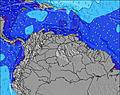 |  | 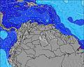 | 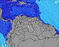 |  | 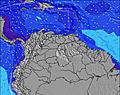 | 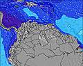 | |||||||||||||
Swell Altura (m) Direção Período (s) | ENE 7 | ENE 7 | ENE 7 | ENE 7 | ENE 7 | ENE 7 | ENE 7 | ENE 8 | ENE 8 | ENE 8 | ENE 8 | ENE 8 | ENE 8 | ENE 8 | ENE 8 | ENE 8 | ENE 8 | ENE 8 | ENE 8 | ENE 8 | ENE 8 |
Onda Gráfico | |||||||||||||||||||||
212 | 254 | 269 | 294 | 365 | 392 | 512 | 481 | 509 | 520 | 563 | 527 | 527 | 498 | 452 | 394 | 452 | 441 | 427 | 427 | 416 | |
Vento (km/h) | |||||||||||||||||||||
Estado do Vento maral cruzado-maral Cruzado cruzado-terral terral cristalino | cross-on | cross-on | cross-on | cross-on | cross-on | cross-on | cross-on | cross-on | cross-on | cross-on | cross-on | cross-on | cross-on | cross-on | cross-on | cross-on | cross-on | cross-on | cross-on | cross-on | cross-on |
Maré Alta | 6:09PM0.78m | 6:01AM0.85m | 6:50PM0.78m | 6:52AM0.76m | 7:30PM0.78m | ||||||||||||||||
Maré Baixa | 11:48AM0.09m | 11:52PM0.29m | 12:28PM0.17m | 00:49AM0.29m | 1:06PM0.24m | ||||||||||||||||
— | — | — | — | — | — | 5:48 | — | — | — | — | — | — | — | 5:50 | — | — | — | — | — | — | |
— | — | 6:30 | — | — | — | — | — | — | — | 6:30 | — | — | — | — | — | — | — | 6:30 | — | — | |
mm | 1 | 2 | 1 | 1 | 1 | 2 | 2 | 2 | 2 | 2 | 2 | 1 | 1 | 1 | 3 | 2 | 1 | 1 | 1 | 1 | 1 |
Temp. °C | 27 | 27 | 27 | 26 | 26 | 26 | 26 | 26 | 27 | 26 | 26 | 26 | 26 | 26 | 25 | 26 | 27 | 28 | 27 | 26 | 26 |
Ressent. °C | 28 | 28 | 29 | 27 | 27 | 27 | 27 | 26 | 28 | 26 | 26 | 27 | 27 | 27 | 26 | 27 | 28 | 28 | 28 | 27 | 27 |
Swell 1 Altura (m) Direção Período (s) | — | — | — | — | N 9 | N 9 | N 9 | N 9 | N 9 | — | N 8 | N 8 | NE 9 | N 9 | — | NNE 9 | — | — | — | — | — |
— | — | — | — | 2 | 2 | 2 | 2 | 2 | — | 1 | 1 | 3 | 1 | — | 8 | — | — | — | — | — | |
Swell 2 Altura (m) Direção Período (s) | — | — | — | — | — | — | — | — | — | — | — | — | — | — | — | — | — | — | — | — | — |
— | — | — | — | — | — | — | — | — | — | — | — | — | — | — | — | — | — | — | — | — | |
Swell 3 Altura (m) Direção Período (s) | — | — | — | — | — | — | — | — | — | — | — | — | — | — | — | — | — | — | — | — | — |
— | — | — | — | — | — | — | — | — | — | — | — | — | — | — | — | — | — | — | — | — | |
Ondas de vento Altura (m) Direção Período (s) | ENE 7 | ENE 7 | ENE 7 | ENE 7 | ENE 7 | ENE 7 | ENE 7 | ENE 8 | ENE 8 | ENE 8 | ENE 8 | ENE 8 | ENE 8 | ENE 8 | ENE 8 | ENE 8 | ENE 8 | ENE 8 | ENE 8 | ENE 8 | ENE 8 |
212 | 254 | 269 | 294 | 365 | 392 | 512 | 481 | 509 | 520 | 563 | 527 | 527 | 498 | 452 | 394 | 452 | 441 | 427 | 427 | 416 | |
Terral ou glassy mais perto | |||||||||||||||||||||
Distância (km) | 651 | 651 | 157 | 651 | 607 | 242 | 242 | 607 | 651 | 651 | 651 | 651 | 651 | 157 | 157 | 157 | 651 | 651 | 651 | 625 | 242 |
Melhor previsões de ondas em Tobago | |||||||||||||||||||||
Melhor previsões de ondas em Trinidad and Tobago | |||||||||||||||||||||
Buscador de Ondas Global | |||||||||||||||||||||
- Map Icons:
 Break
Break Live Wave Height (m)
 Live Wind Speed (km/h)
 Surf Rating (10 Max)
 Ocean Swells (m)
- Wind Speed (km/h)
widget de graça do Surf-Forecast.com para o seu site
O relatório de surf / widget do tempo abaixo está disponível para incorporar em sites de terceiros gratuitamente e fornece um resumo das nossas Beach Break surf tempo. Simplesmente pegar o trecho de código html que fornecemos e colá-lo em seu próprio site. Você pode escolher seu idioma preferido e unidades métrico/imperial para o surf tempo de alimentação para atender aos usuários do seu site.... Clique aqui para adquirir o código.
 Nearest