
Previsão:

Previsão de curto prazochuva moderada (total 14mm), mais intensa na Terça à noite. Very mild (máx. 17°C na Segunda à tarde, mín 11°C na Quarta à noite). o vento será geralmente fraco. | ||||||||||||||||||||||||
Segunda-feira 27 | Terça-feira 28 | Quarta-feira 29 | ||||||||||||||||||||||
12 AM | 3 AM | 6 AM | 9 AM | 12 PM | 3 PM | 6 PM | 9 PM | 12 AM | 3 AM | 6 AM | 9 AM | 12 PM | 3 PM | 6 PM | 9 PM | 12 AM | 3 AM | 6 AM | 9 AM | 12 PM | 3 PM | 6 PM | 9 PM | |
Mapa da altura do Swell |  | 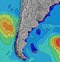 | 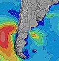 | 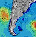 | 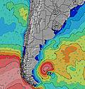 | 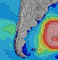 | 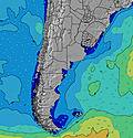 | 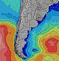 | 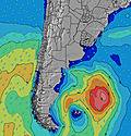 | |||||||||||||||
Swell Altura (m) Direção Período (s) | E 8 | E 8 | E 7 | E 7 | E 8 | E 8 | SSE 13 | ESE 8 | SSE 11 | E 8 | E 8 | E 8 | E 7 | E 7 | E 7 | SSE 10 | SSE 10 | SSE 10 | SSE 9 | E 8 | SSE 9 | SSE 4 | SSE 8 | S 8 |
Onda Gráfico | ||||||||||||||||||||||||
41 | 29 | 28 | 27 | 28 | 18 | 33 | 19 | 25 | 43 | 43 | 42 | 39 | 39 | 40 | 35 | 35 | 32 | 29 | 18 | 94 | 16 | 24 | 50 | |
Vento (km/h) | ||||||||||||||||||||||||
Estado do Vento maral cruzado-maral Cruzado cruzado-terral terral cristalino | on | on | cross | cross | cross | cross-off | cross-off | cross-off | cross-off | glassy | cross-on | cross-on | on | on | on | on | on | on | on | cross-on | cross-on | cross-on | cross-on | cross-on |
Maré Alta | 5:33AM0.29m | 12:25PM0.38m | 5:44PM0.52m | 11:59PM0.28m | 6:22AM0.28m | 1:05PM0.39m | 6:34PM0.52m | 00:41AM0.30m | 7:09AM0.28m | 1:43PM0.39m | 7:22PM0.53m | |||||||||||||
Maré Baixa | 2:19AM0.12m | 8:38AM0.13m | 2:24PM0.33m | 9:39PM0.20m | 3:13AM0.11m | 9:22AM0.12m | 3:16PM0.32m | 10:21PM0.22m | 4:01AM0.09m | 10:06AM0.11m | 4:02PM0.30m | |||||||||||||
— | — | 7:30 | — | — | — | — | — | — | — | 7:28 | — | — | — | — | — | — | — | 7:28 | — | — | — | — | — | |
— | — | — | — | — | 5:50 | — | — | — | — | — | — | — | 5:51 | — | — | — | — | — | — | — | 5:52 | — | — | |
mm | — | — | — | — | — | — | 1 | 1 | 1 | — | — | — | — | — | — | 1 | 1 | 3 | 3 | 2 | 1 | — | — | — |
Temp. °C | 13 | 13 | 13 | 13 | 15 | 17 | 16 | 16 | 16 | 16 | 16 | 15 | 14 | 14 | 12 | 12 | 13 | 13 | 13 | 12 | 12 | 12 | 12 | 11 |
Ressent. °C | 12 | 11 | 11 | 11 | 13 | 15 | 15 | 16 | 17 | 17 | 17 | 14 | 14 | 13 | 10 | 10 | 11 | 11 | 10 | 9 | 9 | 10 | 10 | 9 |
Swell 1 Altura (m) Direção Período (s) | E 8 | E 8 | E 7 | E 7 | E 8 | E 8 | ESE 8 | E 4 | ENE 4 | E 8 | E 8 | E 8 | E 7 | E 7 | E 7 | E 7 | E 8 | SSE 10 | SSE 9 | E 8 | E 8 | SSE 9 | S 4 | S 8 |
41 | 29 | 28 | 27 | 28 | 18 | 19 | 9 | 7 | 43 | 43 | 42 | 39 | 39 | 40 | 27 | 18 | 32 | 29 | 18 | 18 | 16 | 10 | 50 | |
Swell 2 Altura (m) Direção Período (s) | SSE 11 | SSE 11 | SSE 11 | SSE 11 | S 11 | S 11 | SSE 13 | ESE 8 | ESE 8 | SSE 11 | SSE 11 | SSE 11 | SSE 10 | SSE 10 | SSE 10 | SSE 10 | SSE 10 | E 8 | E 8 | SSE 9 | ESE 8 | ESE 8 | SSE 8 | ESE 8 |
24 | 24 | 24 | 11 | 9 | 9 | 33 | 19 | 20 | 24 | 23 | 22 | 35 | 32 | 31 | 35 | 33 | 18 | 18 | 16 | 13 | 13 | 24 | 6 | |
Swell 3 Altura (m) Direção Período (s) | S 15 | S 15 | SE 15 | SSE 14 | SSE 14 | SSE 13 | S 5 | SSE 12 | SSE 11 | — | — | SSE 13 | SE 13 | SSE 12 | SSE 12 | ENE 7 | SSE 10 | SSW 7 | S 12 | SSE 12 | S 11 | ENE 7 | ESE 4 | ENE 7 |
4 | 4 | 8 | 20 | 19 | 17 | 2 | 14 | 25 | — | — | 17 | 7 | 15 | 14 | 19 | 35 | 11 | 12 | 14 | 3 | 5 | 3 | 4 | |
Ondas de vento Altura (m) Direção Período (s) | — | — | — | — | ENE 2 | ENE 3 | ENE 4 | — | — | — | — | S 5 | S 5 | — | — | SE 3 | SE 3 | SE 3 | SE 4 | SSE 4 | SSE 9 | SSE 4 | — | ESE 4 |
— | — | — | — | 1 | 4 | 10 | — | — | — | — | 2 | 1 | — | — | 1 | 2 | 4 | 6 | 10 | 94 | 16 | — | 3 | |
Terral ou glassy mais perto | ||||||||||||||||||||||||
Distância (km) | 31 | 112 | 112 | 29 | 173 | 31 | 0 | 68 | 0 | 0 | 14 | 68 | 77 | 218 | 77 | 30 | 589 | 218 | 502 | 502 | 502 | 427 | 482 | 190 |
Melhor previsões de ondas em Uruguay - North | ||||||||||||||||||||||||
Melhor previsões de ondas em Uruguay | ||||||||||||||||||||||||
Buscador de Ondas Global | ||||||||||||||||||||||||
- Map Icons:
 Break
Break Live Wave Height (m)
 Live Wind Speed (km/h)
 Surf Rating (10 Max)
 Ocean Swells (m)
- Wind Speed (km/h)
widget de graça do Surf-Forecast.com para o seu site
O relatório de surf / widget do tempo abaixo está disponível para incorporar em sites de terceiros gratuitamente e fornece um resumo das nossas Barre del Chuy surf tempo. Simplesmente pegar o trecho de código html que fornecemos e colá-lo em seu próprio site. Você pode escolher seu idioma preferido e unidades métrico/imperial para o surf tempo de alimentação para atender aos usuários do seu site.... Clique aqui para adquirir o código.
 Nearest