
Previsão:

Previsão de curto prazoprincipalmente seco. Warm (máx. 21°C na Sexta de noite, mín 17°C no Sábado à noite). o vento será geralmente fraco. | |||||||||||||||||||
Sex 24 | Sábado 25 | Domingo 26 | |||||||||||||||||
5 PM | 8 PM | 11 PM | 2 AM | 5 AM | 8 AM | 11 AM | 2 PM | 5 PM | 8 PM | 11 PM | 2 AM | 5 AM | 8 AM | 11 AM | 2 PM | 5 PM | 8 PM | 11 PM | |
Mapa da altura do Swell |  |  | 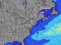 | 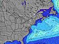 |  | 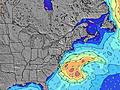 | 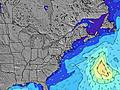 | ||||||||||||
Swell Altura (m) Direção Período (s) | SE 8 | SE 8 | SE 8 | SE 8 | SE 7 | SE 7 | ESE 7 | ESE 7 | ESE 7 | ESE 7 | ESE 7 | ESE 7 | ESE 7 | ESE 7 | ESE 7 | ESE 7 | ESE 7 | ESE 7 | ESE 7 |
Onda Gráfico | |||||||||||||||||||
24 | 53 | 60 | 55 | 64 | 73 | 75 | 102 | 125 | 125 | 113 | 108 | 105 | 108 | 111 | 94 | 76 | 76 | 78 | |
Vento (km/h) | |||||||||||||||||||
Estado do Vento maral cruzado-maral Cruzado cruzado-terral terral cristalino | on | on | on | cross-on | cross | cross | cross-on | cross-on | cross-on | cross-on | cross-on | cross | cross-off | cross | cross | cross-on | on | cross-on | cross |
Maré Alta | 5:25PM0.79m | 5:36AM0.56m | 6:18PM0.81m | 6:33AM0.60m | 7:03PM0.83m | ||||||||||||||
Maré Baixa | 11:38PM0.22m | 10:42AM0.21m | 00:23AM0.19m | 11:36AM0.19m | |||||||||||||||
— | — | — | — | 5:35 | — | — | — | — | — | — | — | 5:37 | — | — | — | — | — | — | |
— | 8:12 | — | — | — | — | — | — | — | 8:10 | — | — | — | — | — | — | — | 8:09 | — | |
mm | — | — | — | — | — | — | — | — | — | — | — | — | — | — | — | — | — | — | — |
Temp. °C | 22 | 21 | 20 | 20 | 19 | 18 | 19 | 20 | 20 | 20 | 19 | 19 | 17 | 17 | 19 | 20 | 21 | 20 | 19 |
Ressent. °C | 19 | 18 | 17 | 18 | 16 | 15 | 16 | 17 | 16 | 16 | 16 | 16 | 13 | 13 | 15 | 17 | 19 | 19 | 18 |
Swell 1 Altura (m) Direção Período (s) | SE 6 | SE 8 | SE 8 | SE 8 | SE 7 | SE 7 | SSW 6 | S 6 | S 6 | S 6 | S 5 | ESE 7 | ESE 7 | ESE 7 | S 6 | ESE 7 | ESE 7 | ESE 7 | ESE 7 |
18 | 53 | 60 | 55 | 64 | 73 | 3 | 1 | 1 | 1 | 1 | 108 | 105 | 108 | 1 | 94 | 76 | 76 | 78 | |
Swell 2 Altura (m) Direção Período (s) | SSW 6 | SSW 6 | SSW 6 | SSW 6 | SSW 6 | SSW 6 | — | — | — | — | — | — | — | S 6 | — | S 6 | S 7 | S 7 | S 6 |
14 | 13 | 8 | 7 | 3 | 3 | — | — | — | — | — | — | — | 1 | — | 3 | 8 | 8 | 7 | |
Swell 3 Altura (m) Direção Período (s) | SE 8 | — | — | — | — | — | — | — | — | — | — | — | — | — | — | — | — | — | — |
24 | — | — | — | — | — | — | — | — | — | — | — | — | — | — | — | — | — | — | |
Ondas de vento Altura (m) Direção Período (s) | — | SE 2 | — | — | — | — | ESE 7 | ESE 7 | ESE 7 | ESE 7 | ESE 7 | — | NE 3 | NNE 3 | ESE 7 | — | — | — | — |
— | 1 | — | — | — | — | 75 | 102 | 125 | 125 | 113 | — | 5 | 3 | 111 | — | — | — | — | |
Terral ou glassy mais perto | |||||||||||||||||||
Distância (km) | 659 | 674 | 275 | 57 | 23 | 57 | 881 | 659 | 720 | 34 | 34 | 34 | 38 | 49 | 34 | 813 | 1378 | 49 | 34 |
Melhor previsões de ondas em Long Island New York | |||||||||||||||||||
Melhor previsões de ondas em United States | |||||||||||||||||||
Buscador de Ondas Global | |||||||||||||||||||
- Map Icons:
 Break
Break Live Wave Height (m)
 Live Wind Speed (km/h)
 Surf Rating (10 Max)
 Ocean Swells (m)
- Wind Speed (km/h)
widget de graça do Surf-Forecast.com para o seu site
O relatório de surf / widget do tempo abaixo está disponível para incorporar em sites de terceiros gratuitamente e fornece um resumo das nossas Atlantic Terrace surf tempo. Simplesmente pegar o trecho de código html que fornecemos e colá-lo em seu próprio site. Você pode escolher seu idioma preferido e unidades métrico/imperial para o surf tempo de alimentação para atender aos usuários do seu site.... Clique aqui para adquirir o código.
 Nearest