
Previsão:

Previsão de curto prazochuviscos (total 2mm), principalmente caindo na Terça à noite. Warm (máx. 24°C na Terça à tarde, mín 15°C no Domingo à noite). Ventos aumentam (calmo na Segunda à tarde, ventos frescos de Sudoeste na Quarta à tarde). | |||||||||||||||||||
Dom 2 | Segunda-feira 3 | Terça-feira 4 | |||||||||||||||||
5 PM | 8 PM | 11 PM | 2 AM | 5 AM | 8 AM | 11 AM | 2 PM | 5 PM | 8 PM | 11 PM | 2 AM | 5 AM | 8 AM | 11 AM | 2 PM | 5 PM | 8 PM | 11 PM | |
Mapa da altura do Swell | 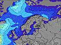 | 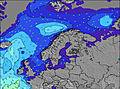 | 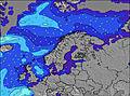 | 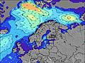 |  |  |  | ||||||||||||
Swell Altura (m) Direção Período (s) | SW 4 | SW 4 | SSW 4 | WNW 4 | WNW 4 | WNW 4 | WNW 5 | NW 5 | NW 5 | NW 4 | NW 4 | NW 4 | NW 4 | W 5 | SSE 3 | SSE 3 | S 4 | SSE 4 | SSE 5 |
Onda Gráfico | |||||||||||||||||||
14 | 12 | 6 | 16 | 12 | 7 | 10 | 6 | 3 | 3 | 1 | 1 | 1 | 1 | 2 | 4 | 9 | 29 | 37 | |
Vento (km/h) | |||||||||||||||||||
Estado do Vento maral cruzado-maral Cruzado cruzado-terral terral cristalino | on | cross-on | cross | cross-on | cross-on | cross-on | cross-on | cross-on | glassy | glassy | cross-off | cross-off | cross-off | cross | cross | cross-on | cross-on | cross-on | cross |
Maré Alta | 00:12AM0.11m | 12:22PM0.07m | 1:15AM0.10m | 1:12PM0.06m | |||||||||||||||
Maré Baixa | 5:16PM0.02m | 6:46AM0.03m | 6:05PM0.01m | 7:56AM0.03m | 7:05PM0.01m | ||||||||||||||
— | — | — | — | 5:11 | — | — | — | — | — | — | — | 5:13 | — | — | — | — | — | — | |
— | 9:22 | — | — | — | — | — | — | — | 9:21 | — | — | — | — | — | — | — | 9:17 | — | |
mm | — | — | — | — | — | — | — | — | — | — | — | — | — | — | — | — | — | — | — |
Temp. °C | 18 | 19 | 17 | 16 | 15 | 15 | 15 | 15 | 16 | 17 | 18 | 17 | 16 | 16 | 21 | 22 | 24 | 24 | 20 |
Ressent. °C | 13 | 16 | 14 | 13 | 13 | 13 | 13 | 13 | 15 | 16 | 16 | 14 | 14 | 14 | 18 | 18 | 22 | 22 | 17 |
Swell 1 Altura (m) Direção Período (s) | WNW 5 | WNW 6 | SSW 4 | SSW 4 | SSW 3 | WNW 6 | WNW 5 | NW 5 | NW 5 | NW 4 | NW 4 | NW 4 | NW 4 | NW 4 | NW 5 | — | — | — | — |
2 | 4 | 6 | 3 | 1 | 4 | 10 | 6 | 3 | 3 | 1 | 1 | 1 | 1 | 1 | — | — | — | — | |
Swell 2 Altura (m) Direção Período (s) | NW 6 | NW 6 | WNW 6 | WNW 7 | WNW 7 | — | WNW 5 | — | — | — | — | — | — | W 5 | — | — | — | — | — |
2 | 2 | 4 | 5 | 5 | — | 3 | — | — | — | — | — | — | 1 | — | — | — | — | — | |
Swell 3 Altura (m) Direção Período (s) | — | — | — | — | WNW 6 | SSW 3 | — | — | — | — | — | — | — | — | — | — | — | — | — |
— | — | — | — | 4 | 1 | — | — | — | — | — | — | — | — | — | — | — | — | — | |
Ondas de vento Altura (m) Direção Período (s) | SW 4 | SW 4 | — | WNW 4 | WNW 4 | WNW 4 | — | W 4 | — | — | — | — | — | SSE 2 | SSE 3 | SSE 3 | S 4 | SSE 4 | SSE 5 |
14 | 12 | — | 16 | 12 | 7 | — | 2 | — | — | — | — | — | 1 | 2 | 4 | 9 | 29 | 37 | |
Terral ou glassy mais perto | |||||||||||||||||||
Distância (km) | 1016 | 899 | 899 | 279 | 279 | 438 | 439 | 854 | 936 | 936 | 386 | 224 | 279 | 694 | 439 | 439 | 850 | 846 | 848 |
Melhor previsões de ondas em Kattegat and Skagerrack | |||||||||||||||||||
Melhor previsões de ondas em Sweden | |||||||||||||||||||
Buscador de Ondas Global | |||||||||||||||||||
- Map Icons:
 Break
Break Live Wave Height (m)
 Live Wind Speed (km/h)
 Surf Rating (10 Max)
 Ocean Swells (m)
- Wind Speed (km/h)
widget de graça do Surf-Forecast.com para o seu site
O relatório de surf / widget do tempo abaixo está disponível para incorporar em sites de terceiros gratuitamente e fornece um resumo das nossas Appelviken surf tempo. Simplesmente pegar o trecho de código html que fornecemos e colá-lo em seu próprio site. Você pode escolher seu idioma preferido e unidades métrico/imperial para o surf tempo de alimentação para atender aos usuários do seu site.... Clique aqui para adquirir o código.
 Nearest