
Previsão:

Previsão de curto prazochuviscos (total 2mm), principalmente caindo na Segunda de manhã. Warm (máx. 23°C na Terça à tarde, mín 17°C na Segunda de manhã). o vento será geralmente fraco. | ||||||||||||||||||||||||
Domingo 19 | Segunda-feira 20 | Terça-feira 21 | ||||||||||||||||||||||
2 AM | 5 AM | 8 AM | 11 AM | 2 PM | 5 PM | 8 PM | 11 PM | 2 AM | 5 AM | 8 AM | 11 AM | 2 PM | 5 PM | 8 PM | 11 PM | 2 AM | 5 AM | 8 AM | 11 AM | 2 PM | 5 PM | 8 PM | 11 PM | |
Mapa da altura do Swell |  |  |  |  | 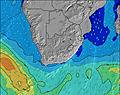 |  |  | 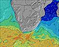 |  | |||||||||||||||
Swell Altura (m) Direção Período (s) | S 12 | S 12 | SSE 14 | SSE 13 | SSE 12 | SSE 12 | SSE 12 | SSE 12 | SSE 12 | SSE 12 | SE 12 | SE 13 | SE 12 | SE 12 | SE 12 | SE 12 | SE 12 | SE 12 | SE 12 | SE 12 | SE 12 | SE 12 | SE 12 | SE 12 |
Onda Gráfico | ||||||||||||||||||||||||
359 | 389 | 529 | 980 | 901 | 902 | 902 | 984 | 967 | 1039 | 964 | 1192 | 1060 | 1100 | 993 | 895 | 822 | 678 | 666 | 603 | 603 | 537 | 486 | 528 | |
Vento (km/h) | ||||||||||||||||||||||||
Estado do Vento maral cruzado-maral Cruzado cruzado-terral terral cristalino | off | off | off | off | cross-off | cross-on | on | glassy | cross-off | off | off | off | cross-off | cross-off | cross | glassy | cross | cross-on | cross-on | cross-on | on | on | on | cross-on |
Maré Alta | 6:43AM1.71m | 7:13PM1.75m | 7:19AM1.58m | 7:51PM1.61m | 7:58AM1.43m | 8:33PM1.46m | ||||||||||||||||||
Maré Baixa | 00:42AM0.29m | 12:52PM0.21m | 1:20AM0.41m | 1:29PM0.35m | 2:00AM0.54m | 2:09PM0.51m | ||||||||||||||||||
— | 6:41 | — | — | — | — | — | — | — | 6:41 | — | — | — | — | — | — | — | 6:41 | — | — | — | — | — | — | |
— | — | — | — | — | 5:13 | — | — | — | — | — | — | — | 5:14 | — | — | — | — | — | — | — | 5:14 | — | — | |
mm | — | — | — | — | — | — | — | — | — | — | — | 1 | 1 | — | — | — | — | — | — | — | — | — | — | — |
Temp. °C | 19 | 19 | 18 | 21 | 21 | 21 | 20 | 19 | 18 | 18 | 17 | 20 | 20 | 21 | 20 | 19 | 18 | 17 | 17 | 21 | 23 | 21 | 20 | 19 |
Ressent. °C | 19 | 19 | 17 | 21 | 21 | 22 | 21 | 20 | 18 | 19 | 15 | 18 | 18 | 20 | 20 | 19 | 18 | 17 | 17 | 20 | 20 | 18 | 19 | 18 |
Swell 1 Altura (m) Direção Período (s) | S 12 | S 12 | SSE 14 | SSE 13 | SSE 12 | SSE 12 | SSE 12 | SSE 12 | SSE 12 | SSE 12 | SE 12 | SE 13 | SE 12 | SE 12 | SE 12 | SE 12 | SE 12 | SE 12 | SE 12 | SE 12 | SE 12 | SE 12 | SE 12 | SE 12 |
359 | 389 | 529 | 980 | 901 | 902 | 902 | 984 | 967 | 1039 | 964 | 1192 | 1060 | 1100 | 993 | 895 | 822 | 678 | 666 | 603 | 603 | 537 | 486 | 528 | |
Swell 2 Altura (m) Direção Período (s) | E 10 | SSE 14 | S 11 | E 10 | E 10 | E 10 | E 10 | E 10 | SSW 11 | SSW 11 | E 10 | S 10 | SSW 10 | E 9 | E 9 | S 10 | SSW 10 | SSW 9 | SSW 9 | SSW 9 | SSW 12 | SSW 12 | SE 15 | S 16 |
116 | 330 | 284 | 94 | 96 | 96 | 94 | 69 | 156 | 150 | 66 | 71 | 100 | 42 | 27 | 47 | 41 | 73 | 46 | 30 | 83 | 56 | 107 | 134 | |
Swell 3 Altura (m) Direção Período (s) | SSE 15 | E 10 | E 10 | S 12 | S 11 | S 11 | S 11 | NE 6 | E 10 | E 10 | SSW 9 | E 10 | E 9 | SSW 10 | S 10 | SSW 14 | E 9 | E 9 | SSW 13 | SSW 12 | E 9 | E 9 | SSW 16 | E 9 |
91 | 90 | 90 | 26 | 21 | 21 | 21 | 6 | 69 | 70 | 8 | 45 | 43 | 33 | 17 | 78 | 26 | 26 | 53 | 50 | 26 | 14 | 91 | 14 | |
Ondas de vento Altura (m) Direção Período (s) | — | — | — | — | — | — | — | — | — | — | SSW 10 | SSW 4 | — | — | — | — | — | — | — | NNE 6 | NE 5 | ENE 3 | ENE 4 | NE 4 |
— | — | — | — | — | — | — | — | — | — | 136 | 12 | — | — | — | — | — | — | — | 3 | 4 | 7 | 9 | 13 | |
Terral ou glassy mais perto | ||||||||||||||||||||||||
Distância (km) | 0 | 0 | 0 | 0 | 0 | 157 | 37 | 0 | 0 | 0 | 0 | 0 | 155 | 0 | 37 | 0 | 0 | 0 | 0 | 0 | 157 | 157 | 117 | 117 |
Melhor previsões de ondas em KwaZulu-Natal North Coast | ||||||||||||||||||||||||
Melhor previsões de ondas em South Africa | ||||||||||||||||||||||||
Buscador de Ondas Global | ||||||||||||||||||||||||
- Map Icons:
 Break
Break Live Wave Height (m)
 Live Wind Speed (km/h)
 Surf Rating (10 Max)
 Ocean Swells (m)
- Wind Speed (km/h)
widget de graça do Surf-Forecast.com para o seu site
O relatório de surf / widget do tempo abaixo está disponível para incorporar em sites de terceiros gratuitamente e fornece um resumo das nossas Alkantstrand surf tempo. Simplesmente pegar o trecho de código html que fornecemos e colá-lo em seu próprio site. Você pode escolher seu idioma preferido e unidades métrico/imperial para o surf tempo de alimentação para atender aos usuários do seu site.... Clique aqui para adquirir o código.
 Nearest