Angola Mapa do Tempo
Outros tipos de mapas estatísticos | Animados mapa
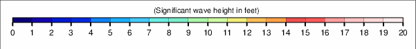
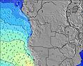
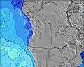
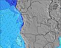
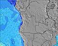
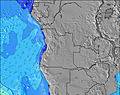
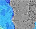
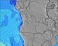
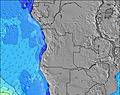
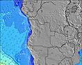
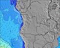
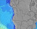
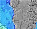
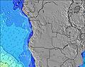
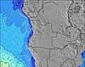
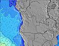
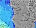
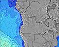
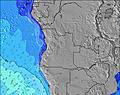
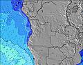
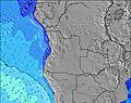
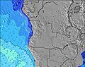
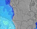
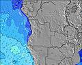
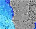
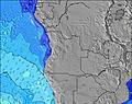
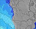
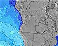
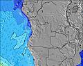
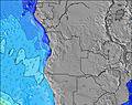
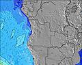
Outros períodos deste Mapa de Altura Significativa das Ondas:
![]() |
![]() |
![]() |
![]() |
![]() |
![]() |
![]() |
![]() |
![]() |
![]() |
![]() |
![]() |
![]() |
![]() |
![]() |
![]() |
![]() |
![]() |
![]() |
![]() |
![]() |
![]() |
![]() |
![]() |
![]() |
![]() |
![]() |
![]() |
![]() |
![]() |
Outros tipos de mapas estatísticos | Animados mapa
![]() |
![]() |
![]() |
![]() |
![]() |
![]() |
![]() |
![]() |
![]() |
![]() |
![]() |
![]() |
![]() |
![]() |
![]() |
![]() |
![]() |
![]() |
![]() |
![]() |
![]() |
![]() |
![]() |
![]() |
![]() |
![]() |
![]() |
![]() |
![]() |
![]() |
© 2025 Snow-Forecast.com | Terms of Service | Privacy | Cookie Policy