

- Forecast
- Maps
- Live
- Weather State
- Spot Information

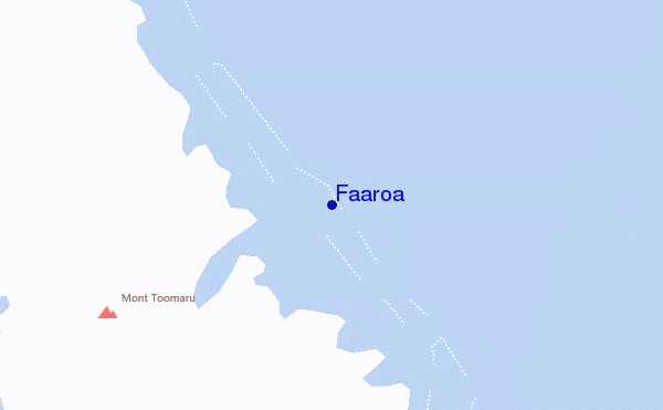
Faaroa surf Forecast / Raiatea / French Polynesia
- Map Icons:
 Break
Break Live Wave Height (m)
 Live Wind Speed (km/h)
 Surf Rating (10 Max)
 Ocean Swells (m)
- Wind Speed (km/h)
How big are the waves at Faaroa today?
The current surf forecast for Faaroa at 5AM is: 1.2m 14s primary swell from a South-southwest direction and 0.6m 9s secondary swell from a Southeast direction, 0.7m 7s secondary swell from a East direction (forecast issued at 01:00am April 19). The wind direction is predicted to be cross-onshore.
| Time (-10) & Date | Wave Height | Wave Period |
|---|---|---|
| Morning (19 Apr) | 3.5ft (1.0m) | 14s |
| Afternoon (19 Apr) | 4ft (1.2m) | 14s |
| Evening (19 Apr) | 4ft (1.2m) | 14s |
Table - waves today at Faaroa. (Swell directed towards the surf break)
Friday 19 | Saturday 20 | Sunday 21 | Monday 22 | Tuesday 23 | Wednesday 24 | Thursday 25 | Friday 26 | |||||||||||||||||||||||||||||||||||||||||||||||||||||
| 11 PM | 2 AM | 5 AM | 8 AM | 11 AM | 2 PM | 5 PM | 8 PM | 11 PM | 2 AM | 5 AM | 8 AM | 11 AM | 2 PM | 5 PM | 8 PM | 11 PM | 2 AM | 5 AM | 8 AM | 11 AM | 2 PM | 5 PM | 8 PM | 11 PM | 2 AM | 5 AM | 8 AM | 11 AM | 2 PM | 5 PM | 8 PM | 11 PM | 2 AM | 5 AM | 8 AM | 11 AM | 2 PM | 5 PM | 8 PM | 11 PM | 2 AM | 5 AM | 8 AM | 11 AM | 2 PM | 5 PM | 8 PM | 11 PM | 2 AM | 5 AM | 8 AM | 11 AM | 2 PM | 5 PM | 8 PM | 11 PM | 2 AM | 5 AM | 8 AM | |
Rating (10 max) | ||||||||||||||||||||||||||||||||||||||||||||||||||||||||||||
Swell Height Map |  |  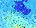  |    |    | 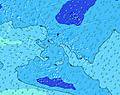 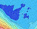 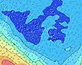 | 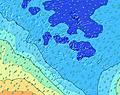 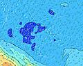 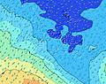 | 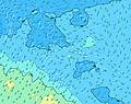 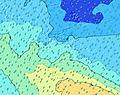 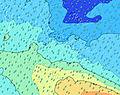 | 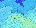 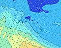 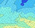 | 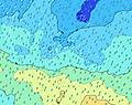 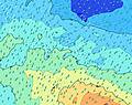  | |||||||||||||||||||||||||||||||||||||||||||||||||||
| Wave Height (m) & direction (?) | ||||||||||||||||||||||||||||||||||||||||||||||||||||||||||||
| Period(s) (?) | 15 | 15 | 14 | 14 | 14 | 14 | 14 | 14 | 14 | 15 | 19 | 16 | 19 | 18 | 18 | 15 | 16 | 16 | 16 | 16 | 16 | 15 | 15 | 15 | 15 | 14 | 14 | 14 | 14 | 14 | 14 | 14 | 14 | 14 | 14 | 14 | 13 | 13 | 13 | 13 | 13 | 13 | 13 | 13 | 13 | 13 | 16 | 15 | 15 | 15 | 14 | 14 | 19 | 18 | 18 | 17 | 16 | 16 | 16 | 15 |
Wave (?)Graph | ||||||||||||||||||||||||||||||||||||||||||||||||||||||||||||
| Energy (?) | 568 | 568 | 561 | 437 | 508 | 553 | 553 | 553 | 553 | 568 | 1352 | 641 | 1352 | 1309 | 768 | 693 | 1321 | 1305 | 1305 | 1199 | 1169 | 1139 | 975 | 936 | 807 | 785 | 785 | 774 | 722 | 630 | 638 | 638 | 630 | 621 | 530 | 508 | 440 | 368 | 368 | 362 | 368 | 357 | 341 | 302 | 206 | 212 | 212 | 474 | 461 | 455 | 437 | 431 | 455 | 514 | 503 | 1361 | 717 | 1261 | 1094 | 962 |
Wind (km/h) | ||||||||||||||||||||||||||||||||||||||||||||||||||||||||||||
| Wind State (?) onshore cross-onshore cross-shore cross-offshore offshore glassy | cross- on | cross- on | cross- on | cross- on | cross- on | cross- on | cross- on | cross- on | cross- on | cross- on | cross- on | cross- on | cross- on | cross- on | cross- on | cross- on | cross- on | cross- on | cross- on | cross- on | cross- on | cross- on | cross- on | cross- on | on | on | on | cross- on | cross- on | cross- on | cross- on | cross- on | cross- on | cross- on | cross- on | on | cross- on | cross- on | cross- on | cross- on | on | on | on | on | on | glass | cross- on | cross | cross | cross- on | cross- on | cross | cross- on | cross | cross | cross | cross | cross | cross | cross |
High Tide / height (m) | 11:02PM 0.20 | 11:16AM 0.19 | 11:16PM 0.22 | 11:24AM 0.20 | 11:32PM 0.24 | 11:35AM 0.21 | 11:48PM 0.24 | 11:47AM 0.22 | 12:05AM 0.24 | 12:00PM 0.23 | 12:21AM 0.23 | 12:13PM 0.23 | 12:37AM 0.22 | 12:26PM 0.23 | 12:51AM 0.20 | |||||||||||||||||||||||||||||||||||||||||||||
Low Tide / height (m) | 5:33AM 0.04 | 5:18PM 0.05 | 5:40AM 0.03 | 5:26PM 0.03 | 5:48AM 0.03 | 5:38PM 0.02 | 5:57AM 0.03 | 5:53PM 0.01 | 6:08AM 0.03 | 6:11PM 0.00 | 6:21AM 0.03 | 6:30PM -0.00 | 6:33AM 0.03 | 6:49PM 0.00 | 6:44AM 0.04 | |||||||||||||||||||||||||||||||||||||||||||||
Friday 19 | Saturday 20 | Sunday 21 | Monday 22 | Tuesday 23 | Wednesday 24 | Thursday 25 | Friday 26 | |||||||||||||||||||||||||||||||||||||||||||||||||||||
| Sunrise | - | - | - | 6:13 | - | - | - | - | - | - | - | 6:15 | - | - | - | - | - | - | - | 6:15 | - | - | - | - | - | - | - | 6:15 | - | - | - | - | - | - | - | 6:15 | - | - | - | - | - | - | - | 6:16 | - | - | - | - | - | - | - | 6:16 | - | - | - | - | - | - | - | 6:16 |
| Sunset | - | - | - | - | - | - | 5:52 | - | - | - | - | - | - | - | 5:52 | - | - | - | - | - | - | - | 5:52 | - | - | - | - | - | - | - | 5:51 | - | - | - | - | - | - | - | 5:51 | - | - | - | - | - | - | - | 5:50 | - | - | - | - | - | - | - | 5:50 | - | - | - | - | - |
Rain (mm) | - | - | - | - | - | - | 1 | 1 | - | - | - | - | - | - | 1 | 1 | 1 | 1 | 7 | 4 | 2 | 1 | 1 | 2 | - | - | 1 | 2 | 1 | 2 | 3 | 3 | 5 | 4 | 2 | 2 | 5 | 4 | 1 | 1 | 2 | 2 | 2 | 2 | 2 | - | - | 1 | 1 | 1 | 1 | - | 1 | 1 | 1 | 2 | 1 | 1 | 2 | 2 |
| Temp. °C | 28 | 28 | 28 | 28 | 28 | 28 | 28 | 28 | 28 | 28 | 28 | 28 | 28 | 28 | 28 | 28 | 28 | 27 | 27 | 28 | 28 | 28 | 27 | 27 | 27 | 27 | 27 | 27 | 27 | 27 | 27 | 27 | 27 | 27 | 27 | 27 | 27 | 27 | 27 | 27 | 27 | 27 | 27 | 27 | 27 | 27 | 27 | 27 | 27 | 26 | 26 | 26 | 26 | 26 | 26 | 26 | 26 | 26 | 26 | 26 |
| Feels °C (?) | 30 | 29 | 29 | 29 | 29 | 28 | 29 | 28 | 28 | 28 | 28 | 28 | 28 | 29 | 29 | 29 | 29 | 28 | 28 | 29 | 29 | 29 | 27 | 26 | 26 | 28 | 29 | 28 | 27 | 28 | 28 | 27 | 29 | 28 | 29 | 28 | 28 | 29 | 28 | 28 | 29 | 29 | 30 | 29 | 30 | 31 | 30 | 30 | 29 | 28 | 28 | 28 | 28 | 28 | 27 | 27 | 26 | 27 | 27 | 27 |
FREE! Surf-Forecast.com widget for your website
The surf report / weather widget below is available to embed on third party websites free of charge and provides a summary of our Faaroa surf forecast. Simply grab the html code snippet that we provide and paste it into your own site. You can choose your preferred language and metric/imperial units for the surf forecast feed to suit users of your site. Click here to get the code.


 Nearest