

- Forecast
- Maps
- Live
- Weather State
- Spot Information
Dunes Surf Forecast
/ Baja Norte (67 surf breaks) /
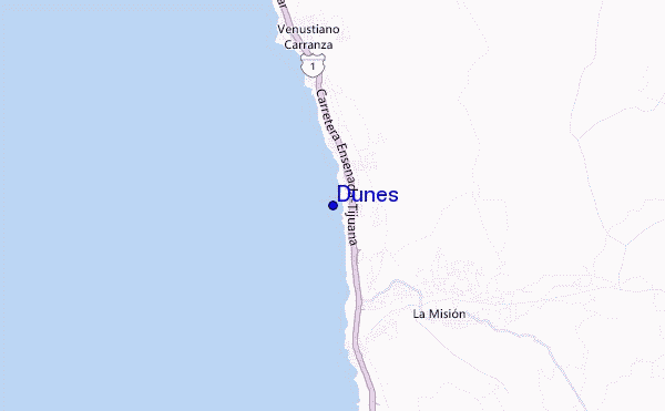
Dunes surf Forecast / Baja Norte / Mexico
- Map Icons:
 Break
Break Live Wave Height (m)
 Live Wind Speed (km/h)
 Surf Rating (10 Max)
 Ocean Swells (m)
- Wind Speed (km/h)
How big are the waves at Dunes today?
The current surf forecast for Dunes at 11PM is: 0.9m 16s primary swell from a South-southwest direction and 0.3m 11s secondary swell from a South-southwest direction, 0.9m 11s secondary swell from a West-northwest direction (forecast issued at 10:00pm April 23). The wind direction is predicted to be cross-shore and the swell rating is 2.
| Time (PDT) & Date | Wave Height | Wave Period |
|---|---|---|
| Morning (23 Apr) | - | - |
| Afternoon (23 Apr) | - | - |
| Evening (23 Apr) | 3ft (0.9m) | 16s |
Table - waves today at Dunes. (Swell directed towards the surf break)
Tue 23 | Wednesday 24 | Thursday 25 | Friday 26 | Saturday 27 | Sunday 28 | Monday 29 | Tuesday 30 | Wed 01 | ||||||||||||||||||||||||||||||||||||||||||||||||||||
| 8 PM | 11 PM | 2 AM | 5 AM | 8 AM | 11 AM | 2 PM | 5 PM | 8 PM | 11 PM | 2 AM | 5 AM | 8 AM | 11 AM | 2 PM | 5 PM | 8 PM | 11 PM | 2 AM | 5 AM | 8 AM | 11 AM | 2 PM | 5 PM | 8 PM | 11 PM | 2 AM | 5 AM | 8 AM | 11 AM | 2 PM | 5 PM | 8 PM | 11 PM | 2 AM | 5 AM | 8 AM | 11 AM | 2 PM | 5 PM | 8 PM | 11 PM | 2 AM | 5 AM | 8 AM | 11 AM | 2 PM | 5 PM | 8 PM | 11 PM | 2 AM | 5 AM | 8 AM | 11 AM | 2 PM | 5 PM | 8 PM | 11 PM | 2 AM | 5 AM | |
Rating (10 max) | ||||||||||||||||||||||||||||||||||||||||||||||||||||||||||||
Swell Height Map |  |    |    |    |  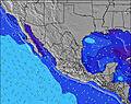 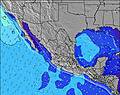 | 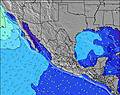 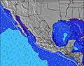 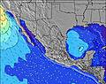 | 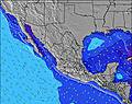 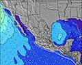 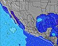 | 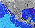 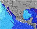 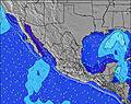 | 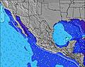   | |||||||||||||||||||||||||||||||||||||||||||||||||||
| Wave Height (m) & direction (?) | ||||||||||||||||||||||||||||||||||||||||||||||||||||||||||||
| Period(s) (?) | 16 | 16 | 16 | 16 | 16 | 16 | 11 | 16 | 15 | 15 | 15 | 15 | 15 | 19 | 15 | 18 | 18 | 18 | 18 | 18 | 18 | 9 | 9 | 8 | 8 | 8 | 9 | 10 | 9 | 9 | 9 | 9 | 9 | 9 | 9 | 9 | 9 | 9 | 9 | 9 | 9 | 9 | 8 | 8 | 8 | 9 | 9 | 9 | 10 | 11 | 10 | 10 | 10 | 10 | 10 | 11 | 11 | 10 | 10 | 10 |
Wave (?)Graph | ||||||||||||||||||||||||||||||||||||||||||||||||||||||||||||
| Energy (?) | 371 | 366 | 251 | 322 | 248 | 245 | 196 | 248 | 183 | 178 | 150 | 181 | 150 | 184 | 171 | 159 | 155 | 112 | 152 | 316 | 449 | 647 | 647 | 589 | 592 | 662 | 1067 | 1601 | 1256 | 1090 | 796 | 631 | 572 | 446 | 436 | 446 | 464 | 454 | 427 | 427 | 380 | 363 | 313 | 299 | 346 | 378 | 397 | 415 | 399 | 487 | 530 | 543 | 596 | 703 | 806 | 822 | 822 | 778 | 778 | 886 |
Wind (km/h) | ||||||||||||||||||||||||||||||||||||||||||||||||||||||||||||
| Wind State (?) onshore cross-onshore cross-shore cross-offshore offshore glassy | cross | cross | cross | cross- off | cross- off | cross | cross | cross | cross | cross | cross | cross | cross | cross | cross | cross | cross | cross | cross- on | glass | on | cross- on | cross- on | cross- on | cross- on | cross- on | cross- on | glass | cross- on | on | on | cross- on | cross- on | glass | glass | glass | glass | on | cross- on | cross- on | cross | cross | glass | cross- on | glass | on | on | cross- on | glass | cross- on | glass | cross | cross- on | cross- on | on | on | cross- on | cross | glass | glass |
High Tide / height (m) | 9:15PM 2.09 | 10:19AM 1.58 | 9:38PM 2.11 | 11:00AM 1.48 | 10:03PM 2.11 | 11:47AM 1.38 | 10:32PM 2.08 | 12:49PM 1.29 | 11:06PM 2.03 | 2:35PM 1.24 | 11:51PM 1.95 | 12:57AM 1.85 | 5:55PM 1.43 | 2:34AM 1.77 | ||||||||||||||||||||||||||||||||||||||||||||||
Low Tide / height (m) | 4:05AM 0.33 | 3:25PM 0.89 | 4:41AM 0.32 | 3:44PM 0.99 | 5:20AM 0.34 | 4:02PM 1.07 | 6:07AM 0.38 | 4:18PM 1.15 | 7:05AM 0.43 | 4:24PM 1.23 | 8:17AM 0.46 | 9:35AM 0.45 | 8:25PM 1.39 | |||||||||||||||||||||||||||||||||||||||||||||||
Tue 23 | Wednesday 24 | Thursday 25 | Friday 26 | Saturday 27 | Sunday 28 | Monday 29 | Tuesday 30 | Wed 01 | ||||||||||||||||||||||||||||||||||||||||||||||||||||
| Sunrise | - | - | - | - | 6:07 | - | - | - | - | - | - | - | 6:05 | - | - | - | - | - | - | - | 6:05 | - | - | - | - | - | - | - | 6:03 | - | - | - | - | - | - | - | 6:03 | - | - | - | - | - | - | - | 6:01 | - | - | - | - | - | - | - | 6:01 | - | - | - | - | - | - | - |
| Sunset | - | - | - | - | - | - | - | 7:22 | - | - | - | - | - | - | - | 7:23 | - | - | - | - | - | - | - | 7:24 | - | - | - | - | - | - | - | 7:24 | - | - | - | - | - | - | - | 7:25 | - | - | - | - | - | - | - | 7:27 | - | - | - | - | - | - | - | 7:28 | - | - | - | - |
Rain (mm) | - | - | - | - | - | - | - | - | - | - | - | - | - | - | - | - | - | - | - | - | - | - | - | - | - | - | - | - | - | - | - | - | - | - | - | - | - | - | - | - | - | - | - | - | - | - | - | - | - | - | - | - | - | - | - | - | - | - | - | - |
| Temp. °C | 14 | 14 | 13 | 14 | 14 | 16 | 16 | 16 | 15 | 15 | 15 | 15 | 15 | 16 | 16 | 15 | 14 | 14 | 14 | 13 | 14 | 14 | 15 | 15 | 14 | 14 | 14 | 14 | 14 | 16 | 16 | 16 | 15 | 14 | 14 | 13 | 14 | 17 | 18 | 17 | 16 | 15 | 15 | 14 | 15 | 17 | 18 | 17 | 16 | 15 | 15 | 15 | 16 | 17 | 18 | 17 | 15 | 15 | 14 | 14 |
| Feels °C (?) | 12 | 12 | 11 | 12 | 12 | 12 | 12 | 12 | 12 | 13 | 13 | 14 | 14 | 13 | 12 | 11 | 10 | 12 | 12 | 12 | 13 | 11 | 11 | 10 | 10 | 9 | 12 | 14 | 12 | 14 | 14 | 14 | 15 | 15 | 14 | 13 | 14 | 16 | 16 | 16 | 15 | 15 | 15 | 14 | 15 | 16 | 17 | 16 | 16 | 15 | 15 | 15 | 15 | 16 | 17 | 16 | 15 | 15 | 14 | 14 |
FREE! Surf-Forecast.com widget for your website
The surf report / weather widget below is available to embed on third party websites free of charge and provides a summary of our Dunes surf forecast. Simply grab the html code snippet that we provide and paste it into your own site. You can choose your preferred language and metric/imperial units for the surf forecast feed to suit users of your site. Click here to get the code.


 Nearest